Chobham Common is a 655.7-hectare (1,620-acre) biological Site of Special Scientific Interest north of Chobham in Surrey. It is a Nature Conservation Review site, Grade I and a national nature reserve. It is part of the Thames Basin Heaths Special Protection Area and the Thursley, Ash, Pirbright and Chobham Special Area of Conservation. It contains three scheduled monuments. Most of the site is managed by the Surrey Wildlife Trust as the Chobham Common nature reserve, but the SSSI also includes a small private reserve managed by the Trust, Gracious Pond.
Staffordshire Moorlands is a local government district in Staffordshire, England. Its council is based in Leek, the district's largest town. The district also contains the towns of Biddulph and Cheadle, along with a large rural area containing many villages. North-eastern parts of the district lie within the Peak District National Park.

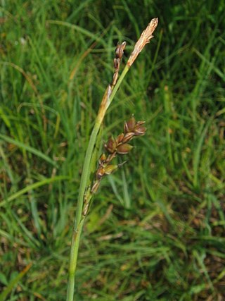
A heath is a shrubland habitat found mainly on free-draining infertile, acidic soils and characterised by open, low-growing woody vegetation. Moorland is generally related to high-ground heaths with—especially in Great Britain—a cooler and damper climate.

Scotstown Moor is in the north of Aberdeen, Scotland.
Hothfield Common is a 56.5-hectare (140-acre) biological Site of Special Scientific Interest north-east of Ashford in Kent. It is also a Local Nature Reserve, and is part of the 86-hectare (210-acre) Hothfield Heathlands nature reserve owned by Ashford Borough Council and managed by Kent Wildlife Trust.
Gentleshaw Common is an area of common land situated in Gentleshaw on the northern side of Burntwood in Staffordshire, England. The area is a Site of Special Scientific Interest as it is an area of globally rare lowland heathland. The common plays host to a series of fun public events throughout the year, including scrub bashing and countryside walks.
Thursley Common is a national nature reserve in Surrey, England, and has also been designated as a Ramsar wetland. It is also part of a Site of Special Scientific Interest called Thursley, Hankley and Frensham Commons.
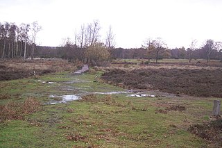
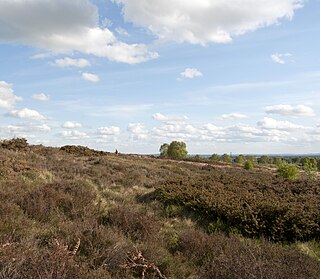
Lowland heath is a Biodiversity Action Plan habitat as it is a type of ancient wild landscape. Natural England's Environmental Stewardship scheme describes lowland heath as containing dry heath, wet heath and valley mire communities, usually below 250 metres (820 ft) in altitude, on acidic soils and shallow peat, typically comprising heathers, gorses, fine grasses, wild flowers and lichens in a complex mosaic. Heathers and other dwarf shrubs usually account for at least 25% of the ground cover. By contrast, upland heath, which is above 300 metres (980 ft) in altitude, is called moorland, Dartmoor being an example.

Fire Beacon Hill is a Local Nature Reserve in East Devon, England. It is registered as Common land and known as Harpford Common. Sidmouth Town Council are the current owners, and are responsible for the management of the site.

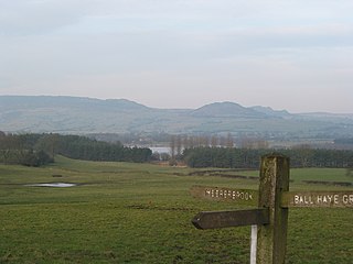
Werrington is a village in the Staffordshire Moorlands district of Staffordshire, England, about 5 miles (8 km) east of Stoke-on-Trent city centre. The village has a population of just over 3,000 people, sits at 875 feet (270 m) above sea level and is known for its windmill standing at the summit. It is surrounded by Wetley Moor, a Site of Special Scientific Interest, and has the A52 road running through the middle of the village.

Highgate Common is a Staffordshire Wildlife Trust reserve containing a mix of heathland and woodland. It is about 116 hectares or 286 acres in size. The common is a popular leisure destination and a Site of Special Scientific Interest, located in Southern Staffordshire, England.

Rosenannon Downs is a nature reserve in mid Cornwall, England, UK, being designated Rosenannon Bog and Downs Site of Special Scientific Interest (SSSI), noted for its biological characteristics. The site supports a wide variety of flora and fauna and includes Bronze Age barrows. Conservation work is carried out on the site by the owners, the Cornwall Wildlife Trust.

Wangford Warren and Carr is a 67.8-hectare (168-acre) biological Site of Special Scientific Interest between Brandon and Lakenheath in Suffolk. It is a Nature Conservation Review site, Grade I, and part of the Breckland Special Area of Conservation, and Special Protection Area An area of 15 hectares is managed as a nature reserve by the Suffolk Wildlife Trust

Blaxhall Common is a nature reserve in the parish of Blaxhall in the East Suffolk District of Suffolk. The reserve is owned by Blaxhall Parish Council and managed by Suffolk Wildlife Trust. It is designated a 45.9-hectare (113-acre) biological Site of Special Scientific Interest as Blaxhall Heath. It is part of the Sandlings Special Protection Area under the European Union Directive on the Conservation of Wild Birds, and of the Suffolk Coast and Heaths Area of Outstanding Natural Beauty. A Bronze Age bowl barrow is a Scheduled Monument.

Kingsley Common is a 41-hectare (100-acre) protected area in Kingsley, Hampshire, England. The site holds many rare species of animals and birds. Some species of plants and animals may also be subject to special protection under Part I of the Wildlife and Countryside Act 1981, or under the Habitats Regulations 1994.

Laymoor Quag is a 3.5-hectare (8.6-acre) nature reserve within the Forest of Dean in Gloucestershire. The site is listed in the 'Forest of Dean Local Plan Review' as a Key Wildlife Site (KWS).
Edgehills Bog is a 0.66-hectare (1.6-acre) nature reserve in Gloucestershire in the Forest of Dean.

Wigpool is a 7.5-hectare (19-acre) nature reserve in Gloucestershire in the Forest of Dean, England.

Mitcheldean Meend Marsh is a 0.7-hectare (1.7-acre) nature reserve in Gloucestershire in the Forest of Dean. The site is listed in the 'Forest of Dean Local Plan Review' as a Key Wildlife Site (KWS).

Tadnoll and Winfrith Heath is a nature reserve of the Dorset Wildlife Trust, near the village of Winfrith Newburgh in Dorset, England. There is heathland and wetland in the reserve.