
The Manukau Harbour is the second largest natural harbour in New Zealand by area. It is located to the southwest of the Auckland isthmus, and opens out into the Tasman Sea.

Waitākere City was a territorial authority in the western part of the urban area of Auckland, New Zealand; it was governed by the Waitākere City Council from 1989 to 2010. It was New Zealand's fifth-largest city, with an annual growth of about 2%. In 2010 the council was amalgamated with the other authorities of the Auckland Region to form the current Auckland Council.

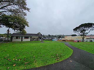
Henderson is a major suburb of Auckland, in the North Island of New Zealand. It is 13 kilometres (8.1 mi) west of Auckland city centre, and two kilometres (1.2 mi) west of the Whau River, a southwestern arm of the Waitematā Harbour. The suburb is located within the Henderson-Massey Local Board of the Waitākere Ward, one of the thirteen administrative divisions of Auckland Council.

New Lynn is a residential suburb in Auckland, New Zealand.

Waitematā Harbour is the main access by sea to Auckland, New Zealand. For this reason it is often referred to as Auckland Harbour, despite the fact that it is one of two harbours adjoining the city. The harbour forms the northern and eastern coasts of the Auckland isthmus and is crossed by the Auckland Harbour Bridge. It is matched on the southern side of the city by the shallower waters of the Manukau Harbour.

The Whau River is an estuarial arm of the southwestern Waitemata Harbour within the Auckland metropolitan area in New Zealand. It flows north for 5.7 kilometres (3.5 mi) from its origin at the confluence of the Avondale Stream and Whau Stream to its mouth between the Te Atatū peninsula and the long, thin Rosebank Peninsula in Avondale. It is 800 metres (2,600 ft) at its widest and 400 metres (1,300 ft) wide at its mouth.

Blockhouse Bay is a residential suburb in the south west of Auckland, in New Zealand's North Island. It is sited on the northern coast of the Manukau Harbour, and is also close to the administrative boundary that existed between Auckland City and Waitakere City, two of the former four cities of what was the Auckland conurbation before amalgamation into Auckland Council.
Te Atatū is the name of two adjacent suburbs in western Auckland, New Zealand: Te Atatū Peninsula and Te Atatū South. They are located next to each other some 10 kilometres to the west of the Auckland city centre, and are separated by the Northwestern Motorway.
Green Bay is an Auckland suburb. It is under the local governance of the Auckland Council. The main road running through Green Bay is Godley Road and this is the Urban Route 15 that follows through Green Bay to Titirangi and Laingholm.

Mechanics Bay is a reclaimed bay on the Waitematā Harbour in Auckland, New Zealand. It is also the name of the area of the former bay that is now mainly occupied by commercial and port facilities. Sometimes the bay formed between Tamaki Drive and the western reclamation edge of Fergusson Container Terminal is also referred to as Mechanics Bay.
Glen Eden is a suburb of West Auckland, New Zealand, located at the foothills of Waitākere Ranges. Originally known as Waikumete, the suburb gained the name Glen Eden in 1921. The suburb is in the Waitākere Ward, one of the thirteen administrative areas of Auckland governed by Auckland Council.
Transport in Auckland, New Zealand's largest city, is defined by factors that include the shape of the Auckland isthmus, the suburban character of much of the urban area, a history of focusing investment on roading projects rather than public transport, and high car-ownership rates.

The Auckland isthmus, also known as the Tāmaki isthmus, is a narrow stretch of land on the North Island of New Zealand in the Auckland Region, and the location of the central suburbs of the city of Auckland, including the CBD. The isthmus is located between two ria, the Waitematā Harbour to the north, which opens to the Hauraki Gulf / Tīkapa Moana and Pacific Ocean, and the Manukau Harbour to the south, which opens to the Tasman Sea. The isthmus is the most southern section of the Northland Peninsula.

Avondale is a suburb of Central Auckland, New Zealand, located in the Whau ward, one of the thirteen administrative divisions for the Auckland Council. It was originally called Te Whau, which is the common name, of Māori origin, for Entelea arborescens, a native tree.

Rosebank is a peninsula and industrial suburb of Auckland, New Zealand. It is the westernmost point of the Auckland isthmus. The peninsula runs from the southeast in a northerly direction, with the Whau River on its west. Pollen Island and Traherne Island lie nearby in the Waitematā Harbour to the north-eastern side of the peninsula. Traherne Island is connected to the peninsula by a causeway that is part of the Northwestern Motorway.
Motu Manawa-Pollen Island Marine Reserve is a 501 hectares (1.93 sq mi) protected area in the Waitemata Harbour in Auckland, New Zealand, established in 1995. It includes the entire area between Rosebank Peninsula and Waterview, and surrounds Motumānawa / Pollen Island and Traherne Island. Its northeastern boundary runs roughly parallel to Rosebank Peninsula, from the mouth of the Oakley Creek estuary. Its northernmost boundary is north of Pollen Island, at the same latitude as the tip of Point Chevalier. Its westernmost point is in the mouth of the Whau River, between the tip of Rosebank Peninsula and Te Atatū.

The Whau Local Board is one of the 21 local boards of the Auckland Council. It is the only local board overseen by the council's Whau Ward councillor.

Coxs Bay or Opoututeka is a bay located in the Waitematā Harbour in the Auckland region of New Zealand. The settlements of Westmere and Herne Bay are adjacent suburbs to the south and north respectively. To the east lies Ponsonby and the south east the West Lynn Shops and Grey Lynn.

The Te Wai-o-Pareira / Henderson Creek is an estuarine river of the Auckland Region of New Zealand's North Island. It flows north from its sources in the Henderson Valley and Titirangi, before reaching the western Waitematā Harbour.

Portages in New Zealand, known in Māori as Tō or Tōanga Waka, are locations where waka (canoes) could easily be transported overland. Portages were extremely important for early Māori, especially along the narrow Tāmaki isthmus of modern-day Auckland, as they served as crucial transportation and trade links between the east and west coasts. Portages can be found across New Zealand, especially in the narrow Northland and Auckland regions, and the rivers of the Waikato Region.
