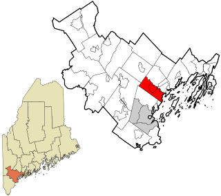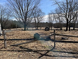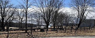
Cumberland is a town in Cumberland County, Maine. The population was 8,473 at the time of the 2020 census. It is part of the Portland metropolitan area, Maine. Cumberland is one of the wealthiest municipalities in the state.

North Yarmouth, officially the Town of North Yarmouth, is a town in Cumberland County, Maine. The population was 4,072 at the 2020 United States Census. It is part of the Portland–South Portland–Biddeford Metropolitan Statistical Area.

Yarmouth is a town in Barnstable County, Massachusetts, United States, Barnstable County being coextensive with Cape Cod. The population was 23,793 at the 2010 census.

Cove is a city in Union County, Oregon, United States. The population was 552 at the 2010 census.

Interstate 295 (I-295) is a 53.11-mile (85.47 km)-long auxiliary Interstate Highway in the U.S. state of Maine from I-95 in Scarborough to I-95 in West Gardiner. The highway was designated the Richard A. Coleman Highway in 2015 by the Maine Legislature. The highway serves as a bypass of Lewiston-Auburn and serves the Greater Portland area. It takes a more direct route between Portland and Augusta, the state capital, than its parent I-95. It also is toll-free, unlike I-95, which carries the tolled Maine Turnpike.
The Lighthouse Route is a scenic roadway in the Canadian province of Nova Scotia. It follows the province's South Shore for 585 km (364 mi) from Halifax to Yarmouth.

The Royal River is a small river, 39 miles (63 km) long, in southern Maine. The river originates in Sabbathday Lake in New Gloucester and flows northeasterly into Auburn and then southerly through New Gloucester, Gray and North Yarmouth into Casco Bay at Yarmouth.

The Pemadumcook Chain of Lakes are a set of large lakes in north-central Maine in the United States.

State Route 115 (SR 115) is a state highway in southern Maine, United States. It runs west to east for just over 18 miles (29 km), from U.S. Route 302 (US 302) and SR 35 in North Windham to SR 88 in Yarmouth.

State Route 88 (SR 88) is a state highway in southern Maine, United States. It runs south to north for 8.37 miles (13.47 km), from U.S. Route 1 (US 1) in Falmouth to US 1 in Yarmouth. It runs to the east of US 1, and its speed limit is 35 miles per hour (56 km/h). Over its course, its furthest distance from US 1 is about 1⁄2 mile (0.80 km). This occurs in its Falmouth Foreside section.

Yarmouth is a town in Cumberland County, Maine, United States, twelve miles north of the state's largest city, Portland. When originally settled in 1636, as North Yarmouth, it was a district of Massachusetts, and remained as such for 213 years. In 1849, it was incorporated as the Town of Yarmouth, 29 years after Maine's admittance to the Union as the 23rd state.
George Felt was a 17th-century English emigrant to the New England Colonies. He is one of the three main early settlers of North Yarmouth, Massachusetts Bay Colony, along with John Cousins and William Royal.

Walter Gendall was a 17th-century English sawmill owner in and prominent citizen of North Yarmouth, Massachusetts Bay Colony. He was also a captain in King Philip's War of 1675–1678 and King William's War of 1688–1697, in which he was killed.

Pioneer Cemetery, also known as the Pioneers Burial Ground and the Indian Fighters Cemetery, is a historic cemetery in Yarmouth, Maine, United States. Dating to 1731, it was the first public burial place in Old North Yarmouth, which was then part of the Province of Massachusetts Bay. It stands on Gilman Road, around 450 feet (140 m) northeast of the Ledge Cemetery, and almost directly across Gilman Road from the Cutter House, which was completed a year earlier.

Ledge Cemetery, also known as the Cemetery under the Ledge, is a historic cemetery in Yarmouth, Maine, United States. Dating to 1770, it stands on Gilman Road, around 450 feet (140 m) southwest of the smaller Pioneer Cemetery. Some headstones bear dates earlier than 1770, for many burials — such as that of Revd. Nicholas Loring — were removed from the older Pioneer Cemetery.
William Hawes was an American miller. He was one of the first mill owners in North Yarmouth, Province of Massachusetts, in the part of town that became, in 1849, Yarmouth, Maine, where over fifty mills were in business thereafter. He also represented North Yarmouth in the Maine House of Representatives.

Broad Cove is a prominent cove in Yarmouth, Maine, United States. It is around 1.15 miles (1.85 km) across at its widest point, its confluence with the waters of Casco Bay. It sits between Sunset Point, at the southern end of Yarmouth, and the eastern edge of Cumberland Foreside. State Route 88 runs beside the cove.

Frank Lovell Oakes was an American sea captain of the late 19th and early 20th centuries. For 27 years, he was the commander of many ships engaged in overseas voyages.

The Cutter House is an historic home at 60 Gilman Road in Yarmouth, Maine, United States. Built in 1730, over a century before today's Yarmouth was incorporated, it is the oldest extant building in the town. It was built for Ammi Ruhamah Cutter, the first minister of the now-demolished Meetinghouse under the Ledge which stood around 150 yards (140 m) to the west, in the same strip of land between Gilman Road and Lafayette Street, between 1729 and 1836. It stands almost directly across Gilman Road from the Pioneer Cemetery, which was established a year later. The home, the Pioneer Cemetery and the nearby Ledge Cemetery are all that remain of this early settlement.
Gilman Road is a prominent street in Yarmouth, Maine, United States. It runs for about 1.7 miles (2.7 km) from Lafayette Street in the northwest to the Ellis C. Snodgrass Memorial Bridge at White's Cove in the southeast. At the bridge, which connects the Yarmouth mainland to Cousins Island, the road becomes Cousins Road.


