White Rock Creek (Kansas)

Last updated
White Rock Creek
USA Kansas relief location map.svg
Red pog.svg
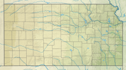
Location of the mouth of White Rock Creek
Native nameRiviere Amiable (French)
Location
Country United States
State Kansas
Physical characteristics
Source 
  location Republic County, Kansas
  coordinates 39°57′19″N98°40′01″W / 39.9552912°N 98.6670128°W / 39.9552912; -98.6670128 [1]
Mouth Republican River
  location
Jewell County, Kansas
  coordinates
39°55′10″N97°51′21″W / 39.9194550°N 97.8558765°W / 39.9194550; -97.8558765 [1]
  elevation
1,473 ft (449 m)

White Rock Creek is a river in the central Great Plains of North America. A tributary of the Republican River, it flows through northern Kansas.

Contents

History

The mouth of White Rock Creek was the location where a group of six buffalo hunters from Waterville, Kansas were killed by Cheyenne Dog Soldiers in May 1869. [2] Also in May of 1869, the Excelsior Colony from New York, took claims along White Rock Creek and built a blockhouse north of the present town of Mankato. By June 1869, all of the settlers had left because of conflicts with the Indians. [3]

See also

References

  1. 1 2 "White Rock Creek". Geographic Names Information System . United States Geological Survey, United States Department of the Interior . Retrieved 2019-03-15.
  2. Switzer, Dale (December 2009). "White Rock and Lovewell". www.lovewellhistory.com. Retrieved 2019-03-15.
  3. "Jewell County, Kansas Genealogy and History". genealogytrails.com. December 2009. Retrieved 2019-03-15.