
Abernethy is a village and former burgh in the Perth and Kinross council area and historic county of Perthshire, in the east central Lowlands of Scotland. The village is situated in rural Strathearn, 8 miles (13 km) south-east of the city of Perth, near the River Earn's confluence with the River Tay and on the northern edge of the Ochil Hills.

The Merrick, or simply Merrick, is a mountain in the Range of the Awful Hand, a sub-range of the Galloway Hills range, part of the Southern Uplands of Scotland. The summit elevation is 843 metres, making it the highest mountain in the Southern Uplands and southern Scotland.

Queensberry is a hill in the Lowther Hills range, part of the Southern Uplands of Scotland. The most southerly mountain in the range, it lies in the parish of Kirkpatrick-Juxta and is a prominent landmark throughout Dumfriesshire. It is frequently climbed from the Daer Reservoir to the north and the minor roads to its south and east. As well as being a placename of multiple addresses throughout southern Scotland, the hill also lend its name to the Duke of Queensberry and Marquess of Queensberry peerages and, subsequently, 'Queensberry Rules' in the sport of boxing.

Broad Law is a hill in the Manor Hills range, part of the Southern Uplands of Scotland. The second-highest point in the Southern Uplands and the highest point in the Scottish Borders, it has an elevation of 840 metres, a prominence of 653 metres and an isolation of 81 kilometres. It is only 3 m (10 ft) lower than its parent, Merrick. Like many of its neighbours it is smooth, rounded and grassy, although the surrounding glens have very steep sides — country somewhat akin to the Cheviots or the Howgill Fells. The hill is most easily climbed from the Megget Stane to the south, beginning at an elevation of 452 m (1,483 ft), but is also frequently climbed from the villages near its base, or as part of a long, 50 km (30 mi) trek across the local area between the towns of Peebles and Moffat. On the summit is the highest VOR beacon in the UK, and also a radio tower.

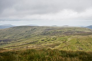
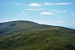
Scotland is the most mountainous country in the United Kingdom. Scotland's mountain ranges can be divided in a roughly north to south direction into: the Scottish Highlands, the Central Belt and the Southern Uplands, the latter two primarily belonging to the Scottish Lowlands. The highlands eponymously contains the country's main mountain ranges, but hills and mountains are to be found south of these as well. The below lists are not exhaustive; there are countless subranges throughout the country.

The mountains and hills of the British Isles are categorised into various lists based on different combinations of elevation, prominence, and other criteria such as isolation. These lists are used for peak bagging, whereby hillwalkers attempt to reach all the summits on a given list, the oldest being the 282 Munros in Scotland, created in 1891.
Clyde & Co is a global law firm headquartered in London, United Kingdom. The firm is one of the top 10 largest law firms in the City of London and has the largest dispute resolution practice of any UK law firm. It employs 2,600 legal professionals and more than 5,000 total staff. In 2022–23, Clyde & Co's revenue was £788.6 million.

The Moorfoot Hills are a range of hills south of Edinburgh in east central Scotland, one of the ranges which collectively form the Southern Uplands.
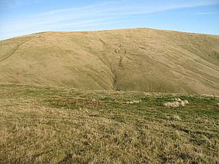
Ben Cleuch is a hill in the Ochil Hills range, part of the Central Lowlands of Scotland. It is the highest point in the range, Clackmannanshire and the Central Belt of Scotland; the summit is marked by a trig point within a stone windshelter and a viewpoint indicator.
Cape Law is a hill in the Moffat Hills range, part of the Southern Uplands of Scotland. A sprawling summit, it is commonly ascended from Talla Linfoots to the north on the way to the higher summits to the west and east.
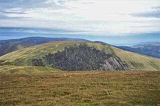
Lochcraig Head is a hill in the Moffat Hills range, part of the Southern Uplands of Scotland. The second highest in the range, its southern slopes drop dramatically into Loch Skeen, the highest loch in the Southern Uplands, from which the Grey Mare's Tail waterfall originates. A common ascent is as a round from the car park to the south, taking in White Coomb.

Windlestraw Law is a hill in the Moorfoot Hills range, part of the Southern Uplands of Scotland. It is the highest peak of the range, and lies north of the town of Innerleithen in the Scottish Borders. A large and boggy peak, it is usually climbed from either its western slopes or the longer route from Tweeddale to the south.
Cramalt Craig is a hill in the Manor Hills range, part of the Southern Uplands of Scotland. The second highest in the range and third highest in southern Scotland, it was previously also a Corbett until a 2013 survey by Alan Dawson found the col between it and Broad Law to be a few metres short of 500 feet. It is climbed almost solely from its southern sides at the Megget Stane or Cramalt Farm, taking in the neighbouring hills.

Black Law is a hill in the Manor Hills range, part of the Southern Uplands of Scotland. One of the more remote Donalds, it does not easily combine into a round with other hills in the area and requires traversing rough terrain to reach the top. Common ascents are as part of an extended Dun Rig Horseshoe to the north-east, from the south at the Megget Reservoir or, most easily, from the Manor Valley itself.

Bodesbeck Law is a hill in the Ettrick Hills range, part of the Southern Uplands of Scotland. It is the primary west-south-western terminus of the ridge that runs parallel to the A708 road along the Dumfries and Galloway-Scottish Borders border, occasionally titled the "Bodesbeck Ridge".
Scaw'd Law is a hill in the Lowther Hills range, part of the Southern Uplands of Scotland. The Dumfries and Galloway-South Lanarkshire border runs along its summit, which is notable for having two similar rounded tops; the top 300m to the north is likely the true summit. Surrounded on most sides by tracks or roads, there are various routes to the summit, but the most frequent ascents are from Durisdeer or the Daer Reservoir.

Whitehope Heights is a hill in the Moffat Hills range, part of the Southern Uplands of Scotland. The lowest Donald hill in the range, it is separated from Hart Fell by a steep grassy cleuch known as The Gyle. Like its neighbour, the Dumfries and Galloway-Scottish Borders border runs along its summit. The southern slopes of the hill are part of the Corehead hill farm, an area owned by the Borders Forest Trust for the purposes of habitat regeneration; as a result, a large deer fence lines the boundary. East of the Devil's Beef Tub and Annandale Way, it is most frequently climbed from this direction, but ascents from Hart Fell are also common.

Dundreich is a hill in the Moorfoot Hills range, part of the Southern Uplands of Scotland. Its close proximity to Edinburgh allows for an almost unimpeded view towards the city, as well as into the Pentland Hills and surrounding counties. Tied with Whitehope Law as the lowest Moorfoot Donald, it is most frequently climbed from the Gladhouse Reservoir to the north, often as part of a round of the neighbouring hills.

The Ettrick Hills are a range of hills that are part of the Southern Uplands of Scotland. They are neighboured to the northwest by the Moffat Hills and are located mainly within the Scottish Borders; however, the Dumfries and Galloway border covers the south and southwesterly flanks.
