
The Deschutes River in central Oregon is a major tributary of the Columbia River. The river provides much of the drainage on the eastern side of the Cascade Range in Oregon, gathering many of the tributaries that descend from the drier, eastern flank of the mountains. The Deschutes provided an important route to and from the Columbia for Native Americans for thousands of years, and then in the 19th century for pioneers on the Oregon Trail. The river flows mostly through rugged and arid country, and its valley provides a cultural heart for central Oregon. Today the river supplies water for irrigation and is popular in the summer for whitewater rafting and fishing.

Mount Jefferson is a stratovolcano in the Cascade Volcanic Arc, part of the Cascade Range in the U.S. state of Oregon. The second highest mountain in Oregon, it is situated within Linn County, Jefferson County, and Marion County and forms part of the Mount Jefferson Wilderness. Due to the ruggedness of its surroundings, the mountain is one of the hardest volcanoes to reach in the Cascades. It is also a popular tourist destination despite its remoteness, with recreational activities including hiking, backpacking, mountaineering, and photography. Vegetation at Mount Jefferson is dominated by Douglas-fir, silver fir, mountain hemlock, ponderosa pine, lodgepole pine, and several cedar species. Carnivores, insectivores, bats, rodents, deer, birds, and various other species inhabit the area.

The Clackamas River is an approximately 83-mile (134 km) tributary of the Willamette River in northwestern Oregon, in the United States. Draining an area of about 940 square miles (2,435 km2), the Clackamas flows through mostly forested and rugged mountainous terrain in its upper reaches, and passes agricultural and urban areas in its lower third. The river rises in eastern Marion County, about 55 miles (89 km) east-southeast of Salem. The headwaters are on the slopes of Olallie Butte in the Mount Hood National Forest, about 10 miles (16 km) north of Mount Jefferson, at an elevation of 4,909 feet (1,496 m) in the Cascade Range. The Clackamas flows briefly north and then flows northwest through the mountains, passing through North Fork Reservoir and Estacada. It then emerges from the mountains southeast of Portland. It joins the Willamette near Oregon City and forms the boundary between Oregon City and Gladstone.

The John Day River is a tributary of the Columbia River, approximately 284 miles (457 km) long, in northeastern Oregon in the United States. Undammed along its entire length, the river is the third longest free-flowing river in the contiguous United States. There is extensive use of its waters for irrigation. Its course furnishes habitat for diverse species, including wild steelhead and Chinook salmon runs. However, the steelhead populations are under federal Endangered Species Act (ESA) protections, and the Chinook salmon have been proposed for such protection.

The McKenzie River is a 90-mile (145 km) tributary of the Willamette River in western Oregon in the United States. It drains part of the Cascade Range east of Eugene and flows westward into the southernmost end of the Willamette Valley. It is named for Donald McKenzie, a Scottish Canadian fur trader who explored parts of the Pacific Northwest for the Pacific Fur Company in the early 19th century. As of the 21st century, six large dams have been built on the McKenzie and its tributaries.
The Nestucca River flows for about 57 miles (92 km) through forests near the Pacific coast of northwest Oregon in the United States. It drains a timber-producing area of the Northern Oregon Coast Range west of Portland.

The Coast Fork Willamette River is one of two forks that unite to form the Willamette River in western Oregon in the United States. It is about 40 miles (64 km) long, draining an area of the mountains at the south end of the Willamette Valley south of Eugene.

The Wilson River, about 33 miles (53 km) long, flows from the Northern Oregon Coast Range to Tillamook Bay in the U.S. state of Oregon. Formed by the confluence of its Devil's Lake Fork and its South Fork, it runs generally west through the Tillamook State Forest to its mouth near the city of Tillamook. It is one of five rivers—the Tillamook, the Trask, the Wilson, the Kilchis, and the Miami—that flow into the bay.

The Williamson River of south-central Oregon in the United States is about 100 miles (160 km) long. It drains about 3,000 square miles (7,800 km2) east of the Cascade Range. Together with its principal tributary, the Sprague River, it provides over half the inflow to Upper Klamath Lake, the largest freshwater lake in Oregon. The lake's outlet is the Link River, which flows into Lake Ewauna and the Klamath River.

The Lostine River is a 31.4-mile-long (50.5 km) tributary of the Wallowa River in northeastern Oregon in the United States. It drains a portion of the Eagle Cap Wilderness of the Wallowa Mountains in the Wallowa–Whitman National Forest and joins the Wallowa River at Wallowa.

The Warm Springs River is a tributary of the Deschutes River in north-central Oregon in the United States. It flows generally southeast along the east side of the Cascade Range. The watershed is approximately between Mount Jefferson and Timothy Lake, and the northwestern and southwestern boundaries of the Warm Springs Indian Reservation coincide with the watershed. The headwaters are less than 1⁄4 mile (0.40 km) from the Wasco County–Clackamas County boundary. The river flows generally eastward, with occasional diagonals southeast or northeast. It joins the Deschutes River at river mile 83.7.

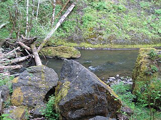
Quartzville Creek is a 28-mile (45 km) tributary of the Middle Santiam River in Linn County in the U.S. state of Oregon. It is paralleled by the Quartzville Back Country Byway and used for recreation, including camping, fishing, hunting, kayaking, and gold panning. The lower 12 miles (19 km) of the creek, from the Willamette National Forest boundary to Green Peter Reservoir, was designated Wild and Scenic in 1988.

Oak Grove Fork Clackamas River is a 21-mile (34 km) tributary of the Clackamas River in the U.S. state of Oregon. From its headwaters in the Warm Springs Indian Reservation near Abbot Pass in the Cascade Range, the river flows generally west through Mount Hood National Forest in Clackamas County to the unincorporated community of Ripplebrook. Here it enters the main stem of the Clackamas River. Oak Grove Fork feeds Timothy Lake and Lake Harriet, two artificial impoundments built along its course to control water flows to hydroelectric plants.
The North Fork John Day River is a 107-mile (172 km) tributary of the John Day River in the U.S. state of Oregon. It begins in Grant County about 20 miles (32 km) northwest of Baker City near the crest of the Blue Mountains. It flows generally west to the community of Dale on U.S. Route 395, then southwest through the city of Monument to the unincorporated community of Kimberly, where it meets the main stem of the John Day River.
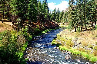
The North Fork Malheur River is a 59-mile (95 km) tributary of the Malheur River in eastern Oregon in the United States. Rising in Big Cow Burn in the Blue Mountains, it flows generally south to join the larger river at Juntura. The upper 25.5 miles (41.0 km) of the river have been designated Wild and Scenic. This part of the river basin offers camping, hiking, and fishing opportunities in a remote forest setting. The lower river passes through Beulah Reservoir, which stores water for irrigation and has facilities for boaters.
West Little Owyhee River is a 63.1-mile-long (101.5 km) tributary of the Owyhee River in the U.S. state of Oregon. The source of the river is at an elevation of 6,508 feet (1,984 m) near McDermitt, while the mouth is at an elevation of 4,373 feet (1,333 m) in the Owyhee Desert. West Little Owyhee River has a 310-square-mile (800 km2) watershed.

Whychus Creek is a tributary of the Deschutes River in Deschutes and Jefferson counties in the U.S. state of Oregon. Formerly named Squaw Creek, considered derogatory in the 21st century, it was renamed in 2006. Explorer John C. Frémont camped along the stream in 1843 but did not identify it by name. Robert S. Williamson, a surveyor who camped there in 1855, said its Indian name was Why-chus.

The South Fork McKenzie River is a tributary, about 31 miles (50 km) long, of the McKenzie River in the U.S. state of Oregon. It begins at about 4,500 feet (1,400 m) above sea level near Mink Lake in the Three Sisters Wilderness of the Cascade Range. Flowing northwest within Lane County, it meets the McKenzie River about 60 miles (97 km) from the larger river's confluence with the Willamette River.


