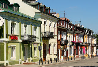
Krasnystaw is a town in eastern Poland with 19,750 inhabitants. Situated in the Lublin Voivodeship, previously in Chełm Voivodeship (1975–1998). It is the capital of Krasnystaw County.

Wolica is a village in the administrative district of Gmina Kraśniczyn, within Krasnystaw County, Lublin Voivodeship, in eastern Poland. It lies approximately 16 kilometres (10 mi) south-east of Krasnystaw and 66 km (41 mi) south-east of the regional capital Lublin.
Chorupnik is a village in the administrative district of Gmina Gorzków, within Krasnystaw County, Lublin Voivodeship, in eastern Poland. It lies approximately 14 kilometres (9 mi) south-west of Krasnystaw and 47 km (29 mi) south-east of the regional capital Lublin.
Góry is a village in the administrative district of Gmina Gorzków, within Krasnystaw County, Lublin Voivodeship, in eastern Poland. It lies approximately 3 kilometres (2 mi) north-east of Gorzków, 12 km (7 mi) south-west of Krasnystaw, and 46 km (29 mi) south-east of the regional capital Lublin.
Gorzków is a village in Krasnystaw County, Lublin Voivodeship, in eastern Poland. It is the seat of the gmina called Gmina Gorzków. It lies approximately 14 kilometres (9 mi) south-west of Krasnystaw and 47 km (29 mi) south-east of the regional capital Lublin.
Piaski Szlacheckie is a village in the administrative district of Gmina Gorzków, within Krasnystaw County, Lublin Voivodeship, in eastern Poland. It lies approximately 11 kilometres (7 mi) south-west of Krasnystaw and 50 km (31 mi) south-east of the regional capital Lublin.
Bobliwo is a village in the administrative district of Gmina Izbica, within Krasnystaw County, Lublin Voivodeship, in eastern Poland. It lies approximately 10 kilometres (6 mi) west of Izbica, 13 km (8 mi) south-west of Krasnystaw, and 50 km (31 mi) south-east of the regional capital Lublin.
Dworzyska is a village in the administrative district of Gmina Izbica, within Krasnystaw County, Lublin Voivodeship, in eastern Poland. It lies approximately 6 kilometres (4 mi) north of Izbica, 8 km (5 mi) south of Krasnystaw, and 54 km (34 mi) south-east of the regional capital Lublin.
Kryniczki is a village in the administrative district of Gmina Izbica, within Krasnystaw County, Lublin Voivodeship, in eastern Poland. It lies approximately 8 kilometres (5 mi) north-east of Izbica, 12 km (7 mi) south-east of Krasnystaw, and 62 km (39 mi) south-east of the regional capital Lublin.
Majdan Krynicki is a village in the administrative district of Gmina Izbica, within Krasnystaw County, Lublin Voivodeship, in eastern Poland. It lies approximately 7 kilometres (4 mi) east of Izbica, 13 km (8 mi) south-east of Krasnystaw, and 62 km (39 mi) south-east of the regional capital Lublin.
Romanów is a village in the administrative district of Gmina Izbica, within Krasnystaw County, Lublin Voivodeship, in eastern Poland. It lies approximately 6 kilometres (4 mi) north of Izbica, 8 km (5 mi) south of Krasnystaw, and 54 km (34 mi) south-east of the regional capital Lublin.
Tarnogóra is a village in the administrative district of Gmina Izbica, within Krasnystaw County, Lublin Voivodeship, in eastern Poland. It lies approximately 4 kilometres (2 mi) south-west of Izbica, 14 km (9 mi) south of Krasnystaw, and 57 km (35 mi) south-east of the regional capital Lublin.
Tarzymiechy Trzecie is a village in the administrative district of Gmina Izbica, within Krasnystaw County, Lublin Voivodeship, in eastern Poland. It lies approximately 7 kilometres (4 mi) south-west of Izbica, 18 km (11 mi) south of Krasnystaw, and 60 km (37 mi) south-east of the regional capital Lublin.
Białka is a village in the administrative district of Gmina Krasnystaw, within Krasnystaw County, Lublin Voivodeship, in eastern Poland. It lies approximately 8 kilometres (5 mi) west of Krasnystaw and 46 km (29 mi) south-east of the regional capital Lublin.
Łany is a village in the administrative district of Gmina Krasnystaw, within Krasnystaw County, Lublin Voivodeship, in eastern Poland. It lies approximately 6 kilometres (4 mi) south-east of Krasnystaw and 56 km (35 mi) south-east of the regional capital Lublin.
Zażółkiew is a village in the administrative district of Gmina Krasnystaw, within Krasnystaw County, Lublin Voivodeship, in eastern Poland. It lies approximately 5 kilometres (3 mi) south-west of Krasnystaw and 50 km (31 mi) south-east of the regional capital Lublin.
Anielpol is a village in the administrative district of Gmina Kraśniczyn, within Krasnystaw County, Lublin Voivodeship, in eastern Poland. It lies approximately 17 kilometres (11 mi) south-east of Krasnystaw and 66 km (41 mi) south-east of the regional capital Lublin.
Franciszków is a village in the administrative district of Gmina Kraśniczyn, within Krasnystaw County, Lublin Voivodeship, in eastern Poland. It lies approximately 7 kilometres (4 mi) west of Kraśniczyn, 13 km (8 mi) south-east of Krasnystaw, and 62 km (39 mi) south-east of the regional capital Lublin.
Wólka is a village in the administrative district of Gmina Żółkiewka, within Krasnystaw County, Lublin Voivodeship, in eastern Poland. It lies approximately 3 kilometres (2 mi) east of Żółkiewka, 23 km (14 mi) south-west of Krasnystaw, and 43 km (27 mi) south-east of the regional capital Lublin.
Wólka Krowicka is a village in the administrative district of Gmina Lubaczów, within Lubaczów County, Subcarpathian Voivodeship, in south-eastern Poland, close to the border with Ukraine. It lies approximately 7 kilometres (4 mi) south-east of Lubaczów and 86 km (53 mi) east of the regional capital Rzeszów.


