Soyuz TM-27 is a Russian spacecraft that ferried cosmonauts and supplies to the Mir, the Russian space station. It was the 33rd expedition to Mir. It was launched by a Soyuz-U rocket from Baikonur Cosmodrome on January 29, 1998. The main mission was to exchange one crew member, carry out French mission PEGASE, and conduct routine science experiments.

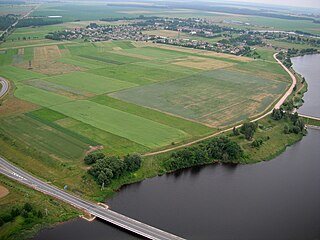
Rietavas Municipality is one of 60 municipalities in Lithuania.

Kėdainiai District Municipality is one of 60 municipalities in Lithuania.
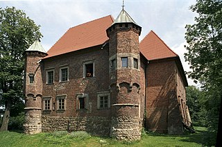
Gmina Dębno is a rural gmina in Brzesko County, Lesser Poland Voivodeship, in southern Poland. Its seat is the village of Dębno, which lies approximately 8 kilometres (5 mi) east of Brzesko and 57 km (35 mi) east of the regional capital Kraków.
Dheri Zardad is a town and union council of Charsadda District in Khyber Pakhtunkhwa province of Pakistan. It is located on the bank of the Kabul River at 34°2'44N 71°50'9E and has an altitude of 258 metres. It was built by Zardad Khan Popalzay Durrani, who was the governor of the then Peshawar province under the Durrani Empire; he purchased the land and the village was built as a hunting place.

Józefów is a village in the administrative district of Gmina Poddębice, within Poddębice County, Łódź Voivodeship, in central Poland. It lies approximately 11 kilometres (7 mi) north-west of Poddębice and 47 km (29 mi) north-west of the regional capital Łódź.

Kaleń is a village in the administrative district of Gmina Przedbórz, within Radomsko County, Łódź Voivodeship, in central Poland. It lies approximately 8 kilometres (5 mi) south-east of Przedbórz, 37 km (23 mi) east of Radomsko, and 89 km (55 mi) south-east of the regional capital Łódź.

Dębno is a village in Brzesko County, Lesser Poland Voivodeship, in southern Poland. It is the seat of the gmina called Gmina Dębno. It lies approximately 8 kilometres (5 mi) east of Brzesko and 57 km (35 mi) east of the regional capital Kraków.

Hucisko is a village in the administrative district of Gmina Nowa Słupia, within Kielce County, Świętokrzyskie Voivodeship, in south-central Poland. It lies approximately 4 kilometres (2 mi) north-west of Nowa Słupia and 31 km (19 mi) east of the regional capital Kielce.

Oleszno is a village in the administrative district of Gmina Krasocin, within Włoszczowa County, Świętokrzyskie Voivodeship, in south-central Poland. It lies approximately 8 kilometres (5 mi) north-west of Krasocin, 12 km (7 mi) north-east of Włoszczowa, and 41 km (25 mi) west of the regional capital Kielce.

Biała is a village in the administrative district of Gmina Trzcianka, within Czarnków-Trzcianka County, Greater Poland Voivodeship, in west-central Poland. It lies approximately 5 kilometres (3 mi) east of Trzcianka, 17 km (11 mi) north of Czarnków, and 76 km (47 mi) north of the regional capital Poznań.

Trąbczyn Dworski is a village in the administrative district of Gmina Zagórów, within Słupca County, Greater Poland Voivodeship, in west-central Poland. It lies approximately 5 kilometres (3 mi) south-east of Zagórów, 18 km (11 mi) south of Słupca, and 76 km (47 mi) east of the regional capital Poznań.

Dankowice Drugie is a village in the administrative district of Gmina Krzepice, within Kłobuck County, Silesian Voivodeship, in southern Poland. It lies approximately 4 kilometres (2 mi) south-west of Krzepice, 18 km (11 mi) west of Kłobuck, and 81 km (50 mi) north of the regional capital Katowice.

Kózki in Polish and Koske in German, is a village in the administrative district of Gmina Pawłowiczki, within Kędzierzyn-Koźle County, Opole Voivodeship, in south-western Poland. It lies approximately 8 kilometres (5 mi) north-west of Pawłowiczki, 20 km (12 mi) south-west of Kędzierzyn-Koźle, and 43 km (27 mi) south of the regional capital Opole.

Krasnołęka is a village in the administrative district of Gmina Stare Pole, within Malbork County, Pomeranian Voivodeship, in northern Poland. It lies approximately 3 kilometres (2 mi) west of Stare Pole, 9 km (6 mi) east of Malbork, and 50 km (31 mi) south-east of the regional capital Gdańsk.

Węgorzyce is a settlement in the administrative district of Gmina Osina, within Goleniów County, West Pomeranian Voivodeship, in north-western Poland. It lies approximately 3 kilometres (2 mi) south-east of Osina, 16 km (10 mi) east of Goleniów, and 37 km (23 mi) north-east of the regional capital Szczecin.

Mokrawica is a village in the administrative district of Gmina Kamień Pomorski, within Kamień County, West Pomeranian Voivodeship, in north-western Poland. It lies approximately 4 kilometres (2 mi) south-east of Kamień Pomorski and 62 km (39 mi) north of the regional capital Szczecin.

Adriatic Bridge is a six-lane road and tram bridge over the Sava River in Zagreb, Croatia.

The 10th European Cross Country Championships were held at Edinburgh in Scotland on 14 December 2003. Serhiy Lebid took his fourth title in the men's competition and Paula Radcliffe her second title in the women's race.

Luka is a Prague Metro station on Line B opened in 1994. It is located at Mukařovského street in the suburb of Stodůlky.


