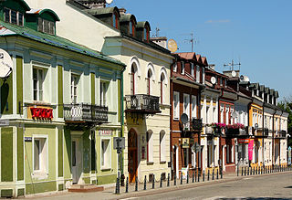
Krasnystaw is a town in eastern Poland with 19,750 inhabitants. Situated in the Lublin Voivodeship, previously in Chełm Voivodeship (1975–1998). It is the capital of Krasnystaw County.

Wola Idzikowska is a village in the administrative district of Gmina Fajsławice, within Krasnystaw County, Lublin Voivodeship, in eastern Poland. It lies approximately 17 kilometres (11 mi) north-west of Krasnystaw and 34 km (21 mi) south-east of the regional capital Lublin.
Olesin is a village in the administrative district of Gmina Gorzków, within Krasnystaw County, Lublin Voivodeship, in eastern Poland. It lies approximately 7 kilometres (4 mi) north-east of Gorzków, 10 km (6 mi) west of Krasnystaw, and 44 km (27 mi) south-east of the regional capital Lublin.
Tarzymiechy Drugie is a village in the administrative district of Gmina Izbica, within Krasnystaw County, Lublin Voivodeship, in eastern Poland. It lies approximately 6 kilometres (4 mi) south-west of Izbica, 17 km (11 mi) south of Krasnystaw, and 59 km (37 mi) south-east of the regional capital Lublin.
Topola is a village in the administrative district of Gmina Izbica, within Krasnystaw County, Lublin Voivodeship, in eastern Poland. It lies approximately 6 kilometres (4 mi) north-east of Izbica, 10 km (6 mi) south of Krasnystaw, and 59 km (37 mi) south-east of the regional capital Lublin.
Białka is a village in the administrative district of Gmina Krasnystaw, within Krasnystaw County, Lublin Voivodeship, in eastern Poland. It lies approximately 8 kilometres (5 mi) west of Krasnystaw and 46 km (29 mi) south-east of the regional capital Lublin.
Gliniska is a village in the administrative district of Gmina Łopiennik Górny, within Krasnystaw County, Lublin Voivodeship, in eastern Poland. It lies approximately 9 kilometres (6 mi) south-west of Łopiennik Górny, 13 km (8 mi) west of Krasnystaw, and 42 km (26 mi) south-east of the regional capital Lublin.
Bzowiec is a village in the administrative district of Gmina Rudnik, within Krasnystaw County, Lublin Voivodeship, in eastern Poland. It lies approximately 6 kilometres (4 mi) south-west of Rudnik, 25 km (16 mi) south-west of Krasnystaw, and 53 km (33 mi) south-east of the regional capital Lublin.
Płonka is a village in the administrative district of Gmina Rudnik, within Krasnystaw County, Lublin Voivodeship, in eastern Poland. It lies approximately 6 kilometres (4 mi) south of Rudnik, 23 km (14 mi) south-west of Krasnystaw, and 55 km (34 mi) south-east of the regional capital Lublin.
Wierzbica is a village in the administrative district of Gmina Rudnik, within Krasnystaw County, Lublin Voivodeship, in eastern Poland. It lies approximately 22 kilometres (14 mi) south-west of Krasnystaw and 49 km (30 mi) south-east of the regional capital Lublin.
Maciejów is a village in the administrative district of Gmina Siennica Różana, within Krasnystaw County, Lublin Voivodeship, in eastern Poland. It lies approximately 6 kilometres (4 mi) east of Siennica Różana, 16 km (10 mi) east of Krasnystaw, and 64 km (40 mi) south-east of the regional capital Lublin.
Siennica Królewska Duża is a village in the administrative district of Gmina Siennica Różana, within Krasnystaw County, Lublin Voivodeship, in eastern Poland. It lies approximately 9 kilometres (6 mi) east of Krasnystaw and 58 km (36 mi) south-east of the regional capital Lublin.
Borówek is a village in the administrative district of Gmina Żółkiewka, within Krasnystaw County, Lublin Voivodeship, in eastern Poland. It lies approximately 7 kilometres (4 mi) north-east of Żółkiewka, 20 km (12 mi) south-west of Krasnystaw, and 43 km (27 mi) south-east of the regional capital Lublin.
Chłaniówek is a village in the administrative district of Gmina Żółkiewka, within Krasnystaw County, Lublin Voivodeship, in eastern Poland. It lies approximately 8 kilometres (5 mi) south of Żółkiewka, 29 km (18 mi) south-west of Krasnystaw, and 51 km (32 mi) south-east of the regional capital Lublin.
Rożki is a village in the administrative district of Gmina Żółkiewka, within Krasnystaw County, Lublin Voivodeship, in eastern Poland. It lies approximately 2 kilometres (1 mi) north-west of Żółkiewka, 27 km (17 mi) west of Krasnystaw, and 41 km (25 mi) south-east of the regional capital Lublin.
Średnia Wieś is a village in the administrative district of Gmina Żółkiewka, within Krasnystaw County, Lublin Voivodeship, in eastern Poland. It lies approximately 2 kilometres (1 mi) south of Żółkiewka, 26 km (16 mi) south-west of Krasnystaw, and 43 km (27 mi) south-east of the regional capital Lublin.
Wólka is a village in the administrative district of Gmina Żółkiewka, within Krasnystaw County, Lublin Voivodeship, in eastern Poland. It lies approximately 3 kilometres (2 mi) east of Żółkiewka, 23 km (14 mi) south-west of Krasnystaw, and 43 km (27 mi) south-east of the regional capital Lublin.
Żółkiew-Kolonia is a village in the administrative district of Gmina Żółkiewka, within Krasnystaw County, Lublin Voivodeship, in eastern Poland. It lies approximately 2 kilometres (1 mi) south-west of Żółkiewka, 27 km (17 mi) south-west of Krasnystaw, and 43 km (27 mi) south-east of the regional capital Lublin.
Wola Gałęzowska is a village in the administrative district of Gmina Bychawa, within Lublin County, Lublin Voivodeship, in eastern Poland. It lies approximately 4 kilometres (2 mi) south of Bychawa and 30 km (19 mi) south of the regional capital Lublin.
Zaraszów is a village in the administrative district of Gmina Bychawa, within Lublin County, Lublin Voivodeship, in eastern Poland. It lies approximately 6 kilometres (4 mi) south-east of Bychawa and 30 km (19 mi) south of the regional capital Lublin.


