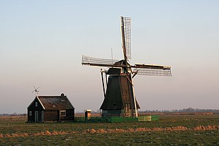
A polder is a low-lying tract of land that forms an artificial hydrological entity, enclosed by embankments known as dikes. The three types of polder are:
- Land reclaimed from a body of water, such as a lake or the seabed
- Flood plains separated from the sea or river by a dike
- Marshes separated from the surrounding water by a dike and subsequently drained; these are also known as koogs, especially in Germany
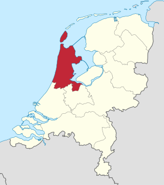
North Holland is a province of the Netherlands in the northwestern part of the country. It is located on the North Sea, north of South Holland and Utrecht, and west of Friesland and Flevoland. In November 2019, it had a population of 2,877,909 and a total area of 4,092 km2 (1,580 sq mi), of which 1,430 km2 (550 sq mi) is water.

Beemster is a former municipality in the Netherlands, in the province of North Holland. The Beemster is the first so-called polder in the Netherlands that was reclaimed from a lake, the water being extracted from the lake by windmills. The Beemster polder was drained between 1609 and 1612. It has preserved intact its well-ordered landscape of fields, roads, canals, dykes and settlements, laid out in accordance with classical and Renaissance planning principles. A grid of canals parallels the grid of roads in the Beemster. The grids are offset: the larger feeder canals are offset by approximately one kilometer from the larger roads.

Heerhugowaard is a city in the Netherlands, in the province of North Holland and the region of West Friesland.
Wormerland is a municipality in the Netherlands, in the province of North Holland.

West Friesland is a contemporary region in the Northwest of the Netherlands, in the province of North Holland.

Bad Nieuweschans is a village in the north-eastern Netherlands on the border with Germany. It forms part of the municipality of Oldambt. Nieuweschans means "new fortification (sconce)". In 2009, the word Bad ("spa") was prefixed to the name of the village to promote it as a tourist destination.

Middenmeer is a village in the Dutch province of North Holland. It is part of the municipality of Hollands Kroon, and lies about 23 km north of Hoorn.

Ouddorp is a village in the Dutch province of South Holland. It is part of the municipality of Goeree-Overflakkee. It is often referred to as Ouddorp aan Zee to promote itself as a seaside resort, because the village has an 18 kilometres (11 mi) long beach which is the longest of the Netherlands.
Wieringerwaard is a polder and a village in the municipality of Hollands Kroon in the Dutch province of North Holland. Wieringerwaard was formerly a separate municipality, until it merged with Barsingerhorn in 1970.
Zuid Haffel is a polder and hamlet in the northwest of the Netherlands. It is located on the island of Texel, North Holland. Texel is also the municipality of the place.

De Cocksdorp is a village town in the Dutch province of North Holland. It is a part of the municipality of Texel, and lies about 25 km north of Den Helder. It is the youngest village on the island.

Schagerbrug is a village in the Dutch province of North Holland. It is part of the municipality of Schagen, and was the main town of the former municipality of Zijpe. It lies about 2 km northwest of the town of Schagen.

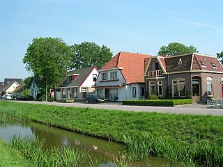
Jisp is a village in the Dutch province of North Holland. It is a part of the municipality of Wormerland, and lies about 8 km west of Purmerend.

Neck is a village in the northwest Netherlands. It is located in the municipality of Wormerland, North Holland, about 3 km west of Purmerend.

Vierpolders is a village in the Dutch province of South Holland. It is a part of the municipality of Voorne aan Zee, and lies about 5 km north of Hellevoetsluis.

Oterleek is a village in the Dutch province of North Holland. It is a part of the municipality of Alkmaar, and lies about 4 km south of Heerhugowaard.
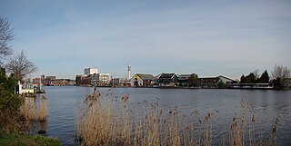
Wormer is a town in the Dutch province of North Holland. It is a part of the municipality of Wormerland, and lies about 13 km northwest of Amsterdam.

Maasdam is a village in the Dutch province of South Holland. It is located about 14 km south of the city of Rotterdam, in the municipality of Hoeksche Waard, on the rural Hoeksche Waard island. From the 14th Century until around 1800, Maasdam was also the name of the local administrative area, the fief and later the "ambacht".
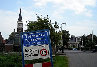
Tjerkwerd is a village in Súdwest-Fryslân municipality in the province Friesland of the Netherlands. It had a population of 455 in January 2017.