Related Research Articles

The Kootenay River or Kootenai River is a major river of the Northwest Plateau in southeastern British Columbia, Canada, and northern Montana and Idaho in the United States. It is one of the uppermost major tributaries of the Columbia River, the largest North American river that empties into the Pacific Ocean. The Kootenay River runs 781 kilometres (485 mi) from its headwaters in the Kootenay Ranges of the Canadian Rockies, flowing from British Columbia's East Kootenay region into northwestern Montana, then west into the northernmost Idaho Panhandle and returning to British Columbia in the West Kootenay region, where it joins the Columbia at Castlegar.
Skookumchuck is in the East Kootenay region of southeastern British Columbia. This locality straddles both shores of the Kootenay River north of the mouth of the Lussier River. The crossing, on the merged section of highways 93 and 95, is by road about 54 kilometres (34 mi) north of Cranbrook and 193 kilometres (120 mi) southeast of Golden.

Creston is a town in the Kootenay region of southeastern British Columbia, Canada.

Canal Flats is a village municipality in the East Kootenay region of southeastern British Columbia. This Columbia Valley community lies between the southern end of Columbia Lake and the northwest shore of the Kootenay River. The locality, on Highway 93/95, is by road about 83 kilometres (52 mi) north of Cranbrook and 165 kilometres (103 mi) southeast of Golden.

Ymir is a village in the Selkirk Mountains in the West Kootenay region of southeastern British Columbia. Ymir is located where the Salmo River meets Quartz Creek, and Ymir Creek. The locality, on BC Highway 6, is by road about 10 kilometres (6 mi) northeast of Salmo and 34 kilometres (21 mi) south of Nelson.

The Village of Slocan is in the West Kootenay region of southeastern British Columbia. The former steamboat landing and ferry terminal is at the mouth of Springer Creek, at the foot of Slocan Lake. The locality, on BC Highway 6 is about 69 kilometres (43 mi) by road north of Castlegar and 183 kilometres (114 mi) by road and ferry south of Revelstoke.

Fort Steele is a heritage site in the East Kootenay region of southeastern British Columbia. This visitor attraction lies on the east shore of the Kootenay River between the mouths of the St. Mary River and Wild Horse River. The locality, on the merged section of highways 93 and 95, is by road about 17 kilometres (11 mi) northeast of Cranbrook and 230 kilometres (143 mi) southeast of Golden.

The Dewdney Trail is a 720 km (450 mi) trail in British Columbia, Canada, that served as a major thoroughfare in mid-19th century British Columbia. The trail was a critical factor in the development and strengthening of the newly established British colony of British Columbia, tying together mining camps and small towns that were springing up during the gold rush era prior to the colony's joining Canada in 1871. Establishing this route became important and urgent for the colony when many new gold finds occurred at locations near the US border that at the time were much more easily accessed from Washington Territory than from the then barely settled parts of the Lower Mainland and Cariboo. Approximately 80 percent of the trail's route has been incorporated into the Crowsnest Highway.
Spillimacheen is an unincorporated community near the mouth of the Spillimacheen River on the east shore of the Columbia River, in the East Kootenay region of southeastern British Columbia. The locality, on BC Highway 95, is by road about 183 kilometres (114 mi) north of Cranbrook and 64 kilometres (40 mi) southeast of Golden.
The Duncan River is in the West Kootenay region of southeastern British Columbia. Entering the North Arm of Kootenay Lake, the river is a major tributary of the Kootenay River, which in turn flows into the Columbia River. The Selkirk Mountains lie to the west and the Purcell Mountains to the east.
Boat Encampment is a ghost town in the East Kootenay region of southeastern British Columbia. The locality was at the tip of the Big Bend on the north shore of the Columbia River. The general vicinity, on the former Big Bend Highway, was by road about 151 kilometres (94 mi) northwest of Golden and 159 kilometres (99 mi) north of Revelstoke.
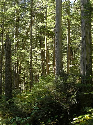
The Incomappleux River is in the West Kootenay region of southeastern British Columbia, Canada. Entering the Beaton Arm of Upper Arrow Lake, the river is a major tributary of the Columbia River. The upper reaches of the Incomappleux valley are home to some of the only inland temperate rainforest in the world.
The Wood River, which flows in a southwesterly direction, is in the East Kootenay region of southeastern British Columbia. The former confluence was near the top of the Big Bend of the Columbia River. After the enlarged Kinbasket Lake formed the Mica Dam reservoir, the flow entered Wood Arm.

The Goat River is a tributary of the Kootenay River in the Canadian province of British Columbia. The river meets the Kootenay near the town of Creston. The Goat River Dam, constructed in the 1930s, was an early source of electricity for the town. Before dikes were built, the river was a major source of spring flooding in the Creston valley.
Fisherville is a ghost town on the northwest shore of the Wild Horse River in the East Kootenay region of southeastern British Columbia. The locality, off the Fort Steele-Wildhorse Road, is by road about 7 kilometres (4 mi) northeast of Fort Steele.
Wasa is an unincorporated community in the East Kootenay region of southeastern British Columbia. This place, on the east shore of the Kootenay River north of the mouth of Lewis Creek, surrounds Wasa Lake. The locality, on the merged section of highways 93 and 95, is by road about 36 kilometres (22 mi) north of Cranbrook and 211 kilometres (131 mi) southeast of Golden.
The Lardeau River, which flows into the Duncan River, is in the West Kootenay region of southeastern British Columbia. The Selkirk Mountains lie to the west and the Purcell Mountains to the east.
Poplar Creek is a ghost town in the West Kootenay region of southeastern British Columbia. The former mining community is at the mouth of Poplar Creek on the southwest side of the Lardeau River. The locality, on BC Highway 31, is about 37 kilometres (23 mi) northwest of Lardeau and 16 kilometres (10 mi) southeast of Gerrard.
Lemon Creek is an unincorporated community on the east side of the Slocan River in the West Kootenay region of southeastern British Columbia. The locality is on BC Highway 6 about 8 kilometres (5 mi) south of Slocan, and 62 kilometres (39 mi) north of Castlegar.
Downie Creek is in the West Kootenay region of southeastern British Columbia, Canada. Surrounded by the Selkirk Mountains, the creek is a tributary of Lake Revelstoke, part of the Columbia River. On BC Highway 23, the highway bridge is by road about 69 kilometres (43 mi) north of Revelstoke.
References
- Miller, Naomi (2002). Fort Steele, Gold Rush to Boom Town. Heritage House. ISBN 1-894384-38-5.
49°36′02″N115°37′03″W / 49.60056°N 115.61750°W