Wilden Marsh

Last updated

Wilden Marsh
Fields near Oldington Bridge, near Kidderminster (geograph 2928972).jpg
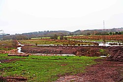
Fields east of Oldington Bridge
Worcestershire UK location map.svg
Red pog.svg
Location in Worcestershire
Location Kidderminster
OS grid SO 827 738
Coordinates 52°21′44″N2°15′19″W / 52.3621°N 2.2553°W / 52.3621; -2.2553
Area38 hectares (94 acres)
Operated by Worcestershire Wildlife Trust
Website Wilden Marsh

Wilden Marsh is a nature reserve of the Worcestershire Wildlife Trust. [1] It is situated between Kidderminster and Stourport-on-Severn, in Worcestershire, England, immediately east of the Staffordshire and Worcestershire Canal, and alongside the River Stour. The reserve is a Site of Special Scientific Interest. [2]

Contents

Description

The area spans 38 hectares (94 acres). The marsh is alluvial soil over clay. It links to Spennells Valley nature reserve along Hoo Brook to the north-east, which also has marshland, and to the upper Hoo Brook pools beyond; areas linked in this way by corridors are beneficial for biodiversity. [3] [4] Cattle are sometimes put in the marshy fields in order to keep down coarser plants. The reserve also has reed beds, dry fields, and small woods of alder and willow. [3] Plants include marsh cinquefoil, marsh arrow-grass and marsh pennywort. Many species of bird have been recorded, including warblers, kingfishers and woodpeckers. Snipe and water rail have occasionally been seen. [3]

History

In the 1970s there was dredging of the River Stour, and a weir downstream was removed; this resulted in the marsh drying out, with an effect on plant life. Rock ramps have been put in the river to reverse this, and there has been work on sluices and drainage ditches. The situation continues to be monitored. [3] In the 1980s it was purchased by the Worcestershire Wildlife Trust. [5]

Related Research Articles

<span class="mw-page-title-main">River Stour, Kent</span> River in England

The River Stour(, rhymes with "flour") is a river in Kent, England that flows into the North Sea at Pegwell Bay. Above Plucks Gutter, where the Little Stour joins it, the river is normally known as the Great Stour. The upper section of the river, above its confluence with the East Stour at Ashford is sometimes known as the Upper Great Stour or West Stour. In the tidal lower reaches, the artificial Stonar Cut short cuts a large loop in the natural river.

<span class="mw-page-title-main">River Stour, Suffolk</span> River in East Anglia, England

The River Stour is a river in East Anglia, England. It is 47 miles (76 km) long and forms most of the county boundary between Suffolk to the north, and Essex to the south. It rises in eastern Cambridgeshire, passes to the east of Haverhill, through Cavendish, Sudbury, Bures, Nayland, Stratford St Mary, Dedham and flows through the Dedham Vale Area of Outstanding Natural Beauty. It becomes tidal just before Manningtree in Essex and joins the North Sea at Harwich.

<span class="mw-page-title-main">River Stour, Worcestershire</span> River in the West Midlands, England

The Stour(, rhymes with "flour") is a river flowing through the counties of Worcestershire, the West Midlands and Staffordshire in the West Midlands region of England. The Stour is a major tributary of the River Severn, and it is about 25 miles (40 km) in length. It has played a considerable part in the economic history of the region.

<span class="mw-page-title-main">Wyre Forest</span> Large, semi-natural woodland in England

<span class="mw-page-title-main">Worcestershire Wildlife Trust</span>

Worcestershire Wildlife Trust is one of 46 wildlife trusts throughout the United Kingdom. It was founded in 1968 to conserve, protect and restore the county's wildlife.

<span class="mw-page-title-main">River Gowy</span> Tributary of the River Mersey in Cheshire, England

The River Gowy is a river in Cheshire, England, a tributary of the River Mersey.

<span class="mw-page-title-main">Abberton Reservoir</span> Reservoir in the United Kingdom

Abberton Reservoir is a pumped storage freshwater reservoir in eastern England near the Essex coast, with an area of 700 hectares. Most of its water is pumped from the River Stour. It is the largest body of freshwater in Essex.

<span class="mw-page-title-main">Cotswold Water Park</span> Lake system and park in England

The Cotswold Water Park is the United Kingdom's largest marl lake system, straddling the Wiltshire–Gloucestershire border, north-west of Cricklade and south of Cirencester. There are 180 lakes, spread over 42 square miles (110 km2).

<span class="mw-page-title-main">Eye Brook</span> River in the East Midlands of England

The Eye Brook is a watercourse in the East Midlands of England and a tributary of the River Welland. It is around 18 miles (29 km) long.

<span class="mw-page-title-main">Kingfisher Country Park</span>

Kingfisher Country Park is a country park situated in East Birmingham and the Metropolitan Borough of Solihull in England, straddling the historic border of Warwickshire and Worcestershire, mostly within the former. Initially designated as Project Kingfisher by Birmingham City Council, the park was formally declared a country park in July 2004. The country park is located along an 11 km stretch of the River Cole from Small Heath in Birmingham to Chelmsley Wood at the M6 motorway. It is a Local Nature Reserve.

Ashford Green Corridor is a green space that runs through the town of Ashford in Kent, England. The Green Corridor is made up of parks, recreation grounds and other green spaces alongside the rivers that flow through Ashford. It is a Local Nature Reserve.

<span class="mw-page-title-main">Wilden, Worcestershire</span> Human settlement in England

Wilden is a small village about 1 mile north east of Stourport-on-Severn, Worcestershire.

<span class="mw-page-title-main">Geography of Kent</span> Overview of the geography of Kent

Kent is the south-easternmost county in England. It is bounded on the north by the River Thames and the North Sea, and on the south by the Straits of Dover and the English Channel. The continent of Europe is 21 miles across the straits.

The Smestow Brook, sometimes called the River Smestow, is a small river that plays an important part in the drainage of Wolverhampton, South Staffordshire, and parts of Dudley in the United Kingdom, and has contributed to the industrial development of the Black Country. It is the most important tributary of the River Stour, Worcestershire and part of the River Severn catchment.

<span class="mw-page-title-main">Frays Farm Meadows</span>

Frays Farm Meadows is a 28.2-hectare (70-acre) biological Site of Special Scientific Interest near Denham in the London Borough of Hillingdon. It was notified as an SSSI in 1981, and has been managed by the London Wildlife Trust on behalf of Hillingdon Council since 1999. It is part of the Colne Valley Regional Park.

<span class="mw-page-title-main">Wrabness Nature Reserve</span> Protected wilderness space in the United Kingdom

Wrabness Nature Reserve is a 27 hectare Local Nature Reserve on the south bank of the River Stour, west of Wrabness in Essex. It is managed by the Essex Wildlife Trust.

<span class="mw-page-title-main">Stodmarsh SSSI</span>

Stodmarsh SSSI is a 623.2-hectare (1,540-acre) biological Site of Special Scientific Interest near Stodmarsh, north-east of Canterbury in Kent. Parts of it are a Nature Conservation Review site, Grade I, a National Nature Reserve, a Ramsar internationally important wetland site, a Special Area of Conservation and a Special Protection Area under the European Union Directive on the Conservation of Wild Birds.

<span class="mw-page-title-main">Spennells Valley</span>

Spennells Valley is a local nature reserve in south-east Kidderminster, in Worcestershire, England.

References

  1. "Wilden Marsh –a summary of the management plan" (PDF). Wild Life Trusts.
  2. "Wilden Marsh and Meadows SSSI" Natural England . Retrieved 18 October 2020.
  3. 1 2 3 4 "Wilden Marsh" Worcestershire Wildlife Trust. Retrieved 18 October 2020.
  4. "Spennells Valley" Wyre Forest District Council. Retrieved 18 October 2020.
  5. "50 Years 100 Patches" (PDF). www.worcswildlifetrust.co.uk.