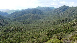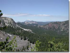
Wilderness or wildlands, are natural environments on Earth that have not been significantly modified by human activity or any nonurbanized land not under extensive agricultural cultivation. The term has traditionally referred to terrestrial environments, though growing attention is being placed on marine wilderness. Recent maps of wilderness suggest it covers roughly one quarter of Earth's terrestrial surface, but is being rapidly degraded by human activity. Even less wilderness remains in the ocean, with only 13.2% free from intense human activity.

The Colorado Plateau, also known as the Colorado Plateau Province, is a physiographic and desert region of the Intermontane Plateaus, roughly centered on the Four Corners region of the southwestern United States. This province covers an area of 336,700 km2 (130,000 mi2) within western Colorado, northwestern New Mexico, southern and eastern Utah, northern Arizona, and a tiny fraction in the extreme southeast of Nevada. About 90% of the area is drained by the Colorado River and its main tributaries: the Green, San Juan, and Little Colorado. Most of the remainder of the plateau is drained by the Rio Grande and its tributaries.

The Coronado National Forest is a United States National Forest that includes an area of about 1.78 million acres (7,200 km2) spread throughout mountain ranges in southeastern Arizona and southwestern New Mexico.

Klamath National Forest is a 1,737,774-acre national forest, in the Klamath Mountains and Cascade Range, located in Siskiyou County in northern California, but with a tiny extension into southern Jackson County in Oregon. The forest contains continuous stands of ponderosa pine, Jeffrey pine, Douglas fir, red fir, white fir, lodgepole pine, Baker Cypress, and incense cedar. Old growth forest is estimated to cover some 168,000 acres (680 km2) of the forest land. Forest headquarters are located in Yreka, California. There are local ranger district offices located in Fort Jones, Happy Camp, and Macdoel, all in California. The Klamath was established on May 6, 1905. This forest includes the Kangaroo Lake and the Sawyers Bar Catholic Church is located within the boundaries of the Forest. The Forest is managed jointly with the Butte Valley National Grassland.

The Wilderness Act of 1964 was written by Howard Zahniser of The Wilderness Society. It created the legal definition of wilderness in the United States, and protected 9.1 million acres (37,000 km²) of federal land. The result of a long effort to protect federal wilderness and to create a formal mechanism for designating wilderness, the Wilderness Act was signed into law by President Lyndon B. Johnson on September 3, 1964 after over sixty drafts and eight years of work.

The El Paso Mountains Wilderness was created in 1994 and now has a total of 23,780 acres (96.2 km2). All of the wilderness is in the northern Mojave Desert in eastern Kern County, California and is managed by the Bureau of Land Management. It is located south of Ridgecrest, California.

The National Wilderness Preservation System (NWPS) of the United States protects federally managed wilderness areas designated for preservation in their natural condition. Activity on formally designated wilderness areas is coordinated by the National Wilderness Preservation System. Wilderness areas are managed by four federal land management agencies: the National Park Service, the U.S. Forest Service, the U.S. Fish and Wildlife Service, and the Bureau of Land Management.

The Bigelow Cholla Garden Wilderness is in the eastern Mojave Desert and within Mojave Trails National Monument, located in San Bernardino County, California.

Dark Canyon Wilderness is a designated Wilderness Area in the heart of southeast Utah's canyon country, part of the Bears Ears National Monument. The wilderness is named for its high steep walls that narrow in the lower section so that they block the light in the morning and late afternoon. The roughly horseshoe-shaped wilderness is made up of the upper part of 40-mile-long (64 km) Dark Canyon and two major tributaries, Woodenshoe Canyon and Peavine Canyon in the Manti-La Sal National Forest. These canyons all descend from pine-covered Elk Ridge northeast of Natural Bridges National Monument. Dark Canyon continues west within a U.S. Bureau of Land Management primitive area that is recommended for wilderness designation. The last four miles (6.4 km) of the main canyon drop steeply through Glen Canyon National Recreation Area into Lake Powell.

The Sky Lakes Wilderness is a wilderness area located in the Rogue River–Siskiyou and Fremont–Winema national forests in the southern Cascade Range of Oregon in the United States. It comprises 116,300 acres (47,100 ha), of which 75,695 acres (30,633 ha) are in the Rogue River–Siskiyou National Forest and 40,605 acres (16,432 ha) are in the Fremont–Winema National Forest. It was established in 1984 under the Wilderness Act of 1964.

The Mountain Lakes Wilderness is a wilderness area located in the Fremont–Winema National Forest in the southern Cascade Range of Oregon in the United States. It surrounds a cluster of four overlapping shield volcanoes, the highest of which is 8,208-foot (2,502 m) Aspen Butte. Over 20 small lakes lie along the bottoms of several large cirques carved by Ice Age glaciers near the summits of the volcanoes.

A natural landscape is the original landscape that exists before it is acted upon by human culture. The natural landscape and the cultural landscape are separate parts of the landscape. However, in the 21st century, landscapes that are totally untouched by human activity no longer exist, so that reference is sometimes now made to degrees of naturalness within a landscape.

The Caribou Wilderness is a federally designated wilderness area created by the Wilderness Act of 1964 and is part of the National Wilderness Preservation System. It is located 60 miles (97 km) east of Redding in the state of California, United States. The Caribou Wilderness comprises 20,546 acres (83.15 km2) and is adjacent to the east side of Lassen Volcanic National Park. Although the park is surrounded by Lassen National Forest, it is managed separately by the National Park Service, whereas the U.S. Forest Service manages the wilderness.

The Castle Crags Wilderness is a 12,232-acre (49.50 km2) wilderness area in the Castle Crags rock formations of the Trinity Mountains, and within the Shasta-Trinity National Forest, in northwestern California. It is located in Siskiyou County and Shasta County, 40 miles (64 km) north of Redding and south of Mount Shasta City.

Boulder River Wilderness is a 48,674-acre (197 km2) wilderness area within the Mount Baker-Snoqualmie National Forest in the western Cascade Range of Washington state.

The Omnibus Public Land Management Act of 2009 is a land management law passed in the 111th United States Congress and signed into law by President Barack Obama on March 30, 2009. The bill designates millions of acres in the US as protected and establishes a National Landscape Conservation System. It includes funding for programs, studies and other activities by the Department of the Interior and the Department of Agriculture, and in some cases bars further geothermal leasing, oil and gas leasing, and new mining patents on certain stretches of protected land.

The Clipper Mountain Wilderness is a wilderness area in the Clipper Mountains of the eastern Mojave Desert and within Mojave Trails National Monument, located in northeastern San Bernardino County, California. It is under the jurisdiction of the Bureau of Land Management.
Western River Wilderness Protection Area, formerly the Western River Conservation Park and the Western River National Park, is a protected area in the Australian state of South Australia located on the north coast of Kangaroo Island about 30 kilometres (19 mi) west of Parndana in the gazetted locality of Western River. Waterfall Creek, with its scenic Billy Goat Waterfall, are within the area.
The South Prince of Wales Wilderness is a wilderness area on Prince of Wales Island, Alaska, protecting 90,968 acres of undeveloped Pacific temperate rainforest, much of which is old-growth. Managed by the United States Forest Service as part of the Tongass National Forest, the wilderness area was designated in a provision of the 1980 Alaska National Interest Lands Conservation Act. This wilderness contains 75 or more islands that range from a few to over 500 acres in size. The South Prince of Wales Wilderness sees tidal bores, tidal surges, fierce winds, and heavy storms regularly.

The Devil's Staircase Wilderness is a forested wilderness area adjacent to the Umpqua River in the Southern Oregon Coast Range of the U.S. state of Oregon. It was officially designated in March 2019.


