Williamstown, Ohio

Last updated
Williamstown, Ohio
Williamstown, Ohio.jpg
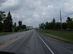
Coming into Williamstown from the south.
Nickname(s): 
Billtown
OHMap-doton-Williamstown.png
Location of Williamstown, Ohio
Coordinates: 40°50′02″N83°39′03″W / 40.8338889°N 83.6508333°W / 40.8338889; -83.6508333 Coordinates: 40°50′02″N83°39′03″W / 40.8338889°N 83.6508333°W / 40.8338889; -83.6508333
Founded byJohn W. Williams

Williamstown is an unincorporated community in southern Madison Township, Hancock County, Ohio, United States. [1] Although it is unincorporated, it has its own zip code of 45897. [2] It lies at the intersection of U.S. Routes 30 and 68.

History

Williamstown was laid out in 1834 by John W. Williams, and named for him. [3] A post office called Eagle was established in 1834, and the name was changed to Williamstown in 1868. [4] The post office service was suspended in 2007 and it was discontinued in 2009. [5]

Related Research Articles

Irwin, Ohio Unincorporated community in Ohio, United States

Irwin is an unincorporated community in southwestern Union Township, Union County, Ohio, United States. It is located at 40°07′21″N83°29′22″W, at the intersection of Ohio State Route 4 and 161. Irwin has a post office which serves the surrounding area, including the community of Rosedale.

Roundhead, Ohio

Roundhead is an unincorporated community in southeastern Roundhead Township, Hardin County, Ohio, United States. It has a post office with the ZIP code 43346.

Moxahala, Ohio Human settlement in Ohio, United States of America

Moxahala is an unincorporated community in northern Pleasant Township, Perry County, Ohio, United States. It has a post office with the ZIP code 43761. State Route 13 runs through Moxahala, connecting it with New Lexington to the northwest and Rendville to the southeast.

Buford, Ohio Census-designated place in Ohio, United States

Buford is an unincorporated community and census-designated place in central Clay Township, Highland County, Ohio, United States. The population was 352 at the 2010 census. it once had a post office, with the ZIP code 45110. The current ZIP code 45171 is for nearby Sardinia.

Buffalo is an unincorporated community and census-designated place in eastern Valley Township, Guernsey County, Ohio, United States. As of the 2010 census it had a population of 401. It has a post office with the ZIP code 43722. It lies along State Route 313.

Westville, Ohio

Westville is an unincorporated community in northeastern Mad River Township, Champaign County, Ohio, United States. It has a post office with the ZIP code 43083. It lies at the intersection of U.S. Route 36 with State Route 560.

Mingo, Ohio

Mingo is an unincorporated community in northern Wayne Township, Champaign County, Ohio, United States. It has a post office with the ZIP code 43047. It is located along State Route 245.

Cable, Ohio

Cable is an unincorporated community in central Wayne Township, Champaign County, Ohio, United States. It has a post office with the ZIP code 43009.

Lynx, Ohio

Lynx is an unincorporated community in southwestern Brush Creek Township, Adams County, Ohio, United States. It has a post office with the ZIP code 45650. It is located along State Route 125.

North Benton, Ohio

North Benton is an unincorporated community in northern Smith Township, Mahoning County, Ohio, United States. It has a post office with the ZIP code 44449. It lies along State Route 14 between Salem and Ravenna.

Ellsworth, Ohio Human settlement in Ohio, United States of America

Ellsworth is an unincorporated community in central Ellsworth Township, Mahoning County, Ohio, United States. It has a post office with the ZIP code 44416. It lies at the intersection of U.S. Route 224 and State Route 45.

Lakeville, Ohio

Lakeville is an unincorporated community in northeastern Washington Township, Holmes County, Ohio, United States. It has a post office with the ZIP code 44638. It lies along State Route 226 west of Odell Lake and south of Bonnett and Round Lakes.

Walhonding, Ohio

Walhonding is an unincorporated community in northern Newcastle Township, Coshocton County, Ohio, United States. It has a post office with the ZIP code 43843. It lies at the intersection of State Routes 206 and 715.

West Point, Columbiana County, Ohio Unincorporated community in Ohio, United States

West Point is an unincorporated community in northern Madison Township, Columbiana County, Ohio, United States. Its post office has the ZIP code 44492. It lies along U.S. Route 30 at its intersection with State Routes 45 and 518.

East Rochester, Ohio Census-designated place in Ohio, United States

East Rochester is an unincorporated community and census-designated place (CDP) in southern West Township, Columbiana County, Ohio, United States. The population was 224 as of the 2020 census. It lies along U.S. Route 30, and has a post office with the ZIP code 44625.

Ray, Ohio Human settlement in United States of America

Ray is an unincorporated community in southeastern Harrison Township, Vinton County, Ohio, United States. It has a post office with the ZIP code 45672. It is located along State Route 327 in western Vinton County.

Wakefield, Ohio

Wakefield is an unincorporated community in southwestern Scioto Township, Pike County, Ohio, United States. it historically had a post office, with the ZIP code 45687. Although the post office was closed on September 2, 2005, the community retains its ZIP code. It lies along Wakefield Mound Road.

Londonderry, Ross County, Ohio

Londonderry is an unincorporated community in eastern Liberty Township, Ross County, Ohio, United States. It has a post office with the ZIP code 45647. It lies along U.S. Route 50 at its intersection with State Route 327.

Unionville, Ashtabula County, Ohio Unincorporated community in Ohio, United States

Unionville is an unincorporated community on the line between northwestern Harpersfield Township in Ashtabula County and eastern Madison Township in Lake County in the U.S. state of Ohio. It has a post office with the ZIP code 44088. It lies along State Route 84.

Maxatawny is an unincorporated community located on U.S. Route 222 in Maxatawny Township, Berks County, Pennsylvania, United States five miles east of Kutztown. It is in the Lehigh watershed and Schaefer Run flows through it to the Little Lehigh Creek. It has a post office with the ZIP code of 19538. Traffic speed on US 222 is reduced to 35 miles-per-hour passing through the village, which borders Lehigh County.

References

  1. U.S. Geological Survey Geographic Names Information System: Williamstown
  2. USPS – Cities by ZIP Code
  3. History of Hancock County, Ohio: Containing a History of the County, Its Townships, Towns. Warner, Beers. 1886. p.  448.
  4. U.S. Geological Survey Geographic Names Information System: Williamstown Post Office
  5. (USPS Postal Bulletin #22280)