Windermere Island

Last updated
Windermere Island
Windermere Beach.JPG
Windermere Beach
Bahamas location map.svg
Red pog.svg
Windermere Island
The location of Windermere Island within the Bahamas
Geography
Location Atlantic Ocean
Coordinates 25°04′N76°06′W / 25.067°N 76.100°W / 25.067; -76.100
Archipelago Lucayan Archipelago
Administration
Additional information
Time zone
  Summer (DST)
ISO code BS-CE
Windermere Sign From Queens Highway, Eleuthera Windermeresign.JPG
Windermere Sign From Queens Highway, Eleuthera

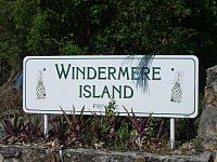
Windermere Island is a small island in The Bahamas approximately 5.5 miles (8.9 kilometers) long.

Contents

The island is connected to the larger island of Eleuthera by a short bridge that is protected by a guardhouse. The bridge was built by Lord Trefgarne, who was the former owner of the island. The adjoining waters and flats of Savannah Sound are a popular bonefishing location, and Windermere's 5-mile-long beach is protected by a 5-mile-long (8 kilometers) reef that is rich in fish and underwater flora. It is also located in the same bay as Camp Bahamas. There are numerous animals around the island, including sand crabs and whale sharks.

Residents

The island is populated with private homes and holiday rental properties. Diana, Princess of Wales, and Charles III spent their 1981 honeymoon on the island. Famous residents have included: Jacques-Yves Cousteau; the 5th Duke of Abercorn and his late wife Sacha, Duchess of Abercorn; Toni Braxton; India Hicks; and the family of Lyndon B. Johnson.

In April 2008, singer-songwriter Mariah Carey and comedian Nick Cannon were married at Carey’s private residence on the island.

Geography

Windermere Island is adjacent to the larger island of Eleuthera, and the two islands are connected by a bridge. The Windermere island offers white sandy beaches, bright blue waters, and unnaturally planted Arecaceae trees.

The island is approximately 5.5 miles (8.9 kilometers) long and 1.5 miles (2.4 kilometers) wide, with a total area of about 5 square miles (8 km2).

Windermere Island is home to a number of different ecosystems, including pine forests, mangrove swamps, and sand dunes. The island is also surrounded by coral reefs, which provide important habitats for a variety of marine life, and provide countless ecosystem services.

The island's climate is tropical, with warm temperatures year-round and a rainy season from May to October. The vegetation on the island is adapted to these conditions, with species such as coconut palms, sea grapes, and bougainvillea thriving in the warm, humid environment.

Related Research Articles

<span class="mw-page-title-main">Andros, Bahamas</span> Archipelago of The Bahamas

Andros Island is an archipelago within The Bahamas, the largest of the Bahamian Islands. Politically considered a single island, Andros in total has an area greater than all the other 700 Bahamian islands combined. The land area of Andros consists of hundreds of small islets and cays connected by mangrove estuaries and tidal swamplands, together with three major islands: North Andros, Mangrove Cay, and South Andros. The three main islands are separated by bights, estuaries that trifurcate the island from east to west. It is 167 kilometres (104 mi) long by 64 km (40 mi) wide at the widest point.

<span class="mw-page-title-main">Virgin Islands National Park</span> 14,700 acres in St. John, Virgin Islands (US) managed by the National Park Service

The Virgin Islands National Park is an American national park preserving about 60% of the land area of Saint John in the United States Virgin Islands, as well as more than 5,500 acres of adjacent ocean, and nearly all of Hassel Island, just off the Charlotte Amalie, Saint Thomas harbor.

<span class="mw-page-title-main">Buck Island Reef National Monument</span> Nature reserve in the U.S. Virgin Islands

Buck Island Reef National Monument protects Buck Island, a small, uninhabited 176-acre island about 1.5 miles (2.4 km) north of the northeast coast of Saint Croix, U.S. Virgin Islands, and 18,839 acres of submerged lands, totaling 19,015 acres. It was first established as a protected area by the U.S. Government in 1948, with the intention of preserving “one of the finest marine gardens in the Caribbean Sea.” The U.S. National Monument was created in 1961 by John F. Kennedy and greatly expanded in 2001 by Bill Clinton, over the opposition of local fishermen. Buck Island National Monument is one of few places in the Virgin Islands where brown pelicans and threatened least terns nest.

<span class="mw-page-title-main">Eleuthera</span> Island in the Bahamas

Eleuthera refers both to a single island in the archipelagic state of the Commonwealth of the Bahamas and to its associated group of smaller islands. Eleuthera forms a part of the Great Bahama Bank. The island of Eleuthera incorporates the smaller Harbour Island. "Eleuthera" derives from the feminine form of the Greek adjective ἐλεύθερος (eleútheros), meaning "free". Known in the 17th century as Cigateo, it lies 80 km east of Nassau. It is long and thin—180 km long and in places little more than 1.6 km wide. At its narrowest point, the Glass Window Bridge, which has been called the narrowest place on earth, Eleuthera stands 30 feet wide. Its eastern side faces the Atlantic Ocean and its western side faces the Great Bahama Bank. The topography of the island varies from wide rolling pink sand beaches to large outcrops of ancient coral reefs and the highest elevation point is 200 feet. The population is approximately 11,000 and the principal economy of the island is tourism.

<span class="mw-page-title-main">Exuma</span> Place in Bahamas

Exuma is a district of The Bahamas, consisting of over 365 islands and cays.

<span class="mw-page-title-main">Florida Keys National Marine Sanctuary</span> Marine protected area in Florida, US

The Florida Keys National Marine Sanctuary is a U.S. National Marine Sanctuary in the Florida Keys. It includes the Florida Reef, the only barrier coral reef in North America and the third-largest coral barrier reef in the world. It also has extensive mangrove forest and seagrass fields. The Florida Keys National Marine Sanctuary, designated in 1990, is the ninth national marine sanctuary to be established in a system that comprises 13 sanctuaries and two marine national monuments. The Florida Keys National Marine Sanctuary protects approximately 2,900 square nautical miles of coastal and ocean waters from the estuarine waters of south Florida along the Florida Keys archipelago, encompassing more than 1,700 islands, out to the Dry Tortugas National Park, reaching into the Atlantic Ocean, Florida Bay and the Gulf of Mexico.

Egg Island is an uninhabited island, officially an islet, comprising 800 m2 (8,611 sq ft) in the Bahamas. It is thought to be named because of the supposed chickens owned by residents of other nearby islands who travel here to collect the eggs; however, there are no chickens on Egg Island. Another theory is that local sea bird eggs were often collected here by the first settlers, these were then wiped out by the introduction of goats to the island a long time ago.

<span class="mw-page-title-main">Harbour Island, Bahamas</span> Island and district in Bahamas

Harbour Island is an island and administrative district in the Bahamas located off the northeast coast of Eleuthera Island. Harbour Island, Jacobs Island, Man Island (Bahamas), Pierre Island and others form what looks like a reef that encloses the east and north sides of a lagoon in the northeast corner of Eleuthera.

<span class="mw-page-title-main">Spanish Wells</span> Place in St. Georges Cay, Bahamas

Spanish Wells is a district of the Bahamas. The settlement consists of a medium-sized town on the island of St. George's Cay 610 m (2,000 ft) wide by 2,860 m (9,380 ft) long, located approximately 500 m (1,600 ft) off the northern tip of Eleuthera island. According to the 2022 census, it has a population of 1,608 residents.

<span class="mw-page-title-main">Eustatia Island</span>

Eustatia Island is a 30-acre island of the British Virgin Islands (BVI) in the Caribbean. The word "Eustatia" is a Greek derived word meaning, "good place to stay." The entire island, and a small neighboring island, Saba Rock, are under the same long term lease. The island is regularly featured and photographed for several publications and was listed as one of the top 20 most beautiful islands in the world in the December 2004 issue of Islands magazine.

<span class="mw-page-title-main">Apo Reef</span> Coral reef in the Philippines

Apo Reef is a coral reef system in the Philippines situated in the western waters of Occidental Mindoro province in the Mindoro Strait. Encompassing 34 square kilometres (13 sq mi), it is considered the world's second-largest contiguous coral reef system, and is the largest in the country. The reef and its surrounding waters are protected areas administered as the Apo Reef Natural Park (ARNP). It is one of the best known and most popular diving regions in the country, and is in the tentative list for UNESCO World Heritage Sites.

<span class="mw-page-title-main">Laguna Madre (United States)</span> Hypersaline lagoon in Texas, US

The Laguna Madre is a long, shallow, hypersaline lagoon along the western coast of the Gulf of Mexico in Nueces, Kenedy, Kleberg, Willacy and Cameron Counties in Texas, United States. It is one of seven major estuaries along the Gulf Coast of Texas. The roughly 20-mile (32 km) long Saltillo Flats land bridge divides it into Upper and Lower lagoons joined by the Intracoastal Waterway, which has been dredged through the lagoon. Cumulatively, Laguna Madre is approximately 130 miles (210 km) long, the length of Padre Island in the US. The main extensions include Baffin Bay in Upper Laguna Madre, Red Fish Bay just below the Saltillo Flats, and South Bay near the Mexican border. As a natural ecological unit, the Laguna Madre of the United States is the northern half of the ecosystem as a whole, which extends into Tamaulipas, Mexico approximately 144 miles (232 km) south of the US border, to the vicinity of the Rio Soto La Marina and the town of La Pesca, extending approximately 275 miles (443 km) through USA and Mexico in total.

<span class="mw-page-title-main">Sea of Abaco</span>

The Sea of Abaco, located in The Bahamas, is an approximately 100 kilometres long saltwater lagoon separating Great Abaco Island from a chain of barrier islands known as the Abaco Cays. Depths in the Sea of Abaco are generally a few metres, and shallow reefs and shoals can pose a serious hazard to navigation. Despite these hazards, the sea is popular with boaters and is sometimes referred to as a 'marine highway', offering a sheltered passage through the Abaco Islands. The majority of the largest settlements and towns in the Abaco Islands are located along the shores of the sea.

MS <i>Logna</i> First ship intentionally sunk as artificial reef and recreational dive site in the Bahamas

MV Logna was built as general cargo ship in Bergens Mekaniske Verksted, Shipyard, Norway in 1958. She transported cargo between Norway and Spain until 1969, when she was acquired by the Bahama Cement Company. In 1970, she was converted to a bulk cement carrier and she was renamed MV Island Cement. She was used to ship bulk cement between Freeport, Bahamas, Fort Pierce, Port Canaveral, and Fort Lauderdale, Florida, and to Eleuthera and New Providence in the Bahamas. In 1980, the Company conducted an underwater survey and determined that it was not economical to perform required repairs. Instead, the ship was decommissioned and the company planned to sell her for scrap.

Staniel Cay is an island located in The Exuma Cays, a district of The Bahamas.

<span class="mw-page-title-main">Great Southern Reef</span> Australian reef system

The Great Southern Reef is a system of interconnected reefs that spans the southern coast of continental Australia and Tasmania and extends as far north as Brisbane to the east and Kalbarri to the west. It covers 71,000 km2 (27,000 sq mi) of ocean and straddles five states, running along the coast for 8,000 km (5,000 mi).

The Helderberg Marine Protected Area is a small marine conservation area on the north-eastern side of False Bay in the Western Cape province of South Africa, It lies between the mouths of the Lourens River in the Strand, and the Eerste River in Macassar.

The Goukamma Marine Protected Area is an inshore conservation region near Knysna in the Western Cape province in the territorial waters of South Africa

The Hluleka Marine Protected Area is an inshore conservation region in the territorial waters of the Eastern Cape province of South Africa.

The Pondoland Marine Protected Area is an inshore conservation region in the territorial waters of South Africa.

References