The Leicestershire and Rutland Wildlife Trust (LRWT) is one of 46 wildlife trusts across the United Kingdom. It manages nature reserves in Leicestershire and Rutland, and was founded in 1956 as the Leicestershire and Rutland Trust for Nature Conservation. As of January 2018, it has over 16,000 members, a staff of about 25 and more than 500 volunteers. It is based in Leicester, and is managed by a Council of Trustees which is elected by the members. It is a charity which covers all aspects of nature conservation, and works to protect wild places and wildlife.

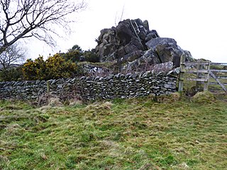
Charnwood Lodge is a 134.2-hectare (332-acre) biological and geological Site of Special Scientific Interest in Charnwood Forest, east of Coalville in Leicestershire. It is a national nature reserve, and contains two Geological Conservation Review sites. It is managed by the Leicestershire and Rutland Wildlife Trust.

Dimminsdale is a 37 hectare geological biological and Site of Special Scientific Interest partly in Derbyshire and partly in Leicestershire. It is located east of Calke in Derbyshire. It is a Geological Conservation Review site, and a area of 23.5 hectares is owned by Severn Trent Water and managed by the Leicestershire and Rutland Wildlife Trust.

Ketton Quarries is a 115.6-hectare (286-acre) biological and geological Site of Special Scientific Interest east of Ketton in Rutland. It is a Geological Conservation Review site, and an area of 27.5 hectares is managed by the Leicestershire and Rutland Wildlife Trust.

Alde–Ore Estuary is a 2,534 hectare biological and geological Site of Special Scientific Interest which stretches along the Suffolk coast between Aldeburgh and Bawdsey, and also includes parts of the Alde, Ore and Butley Rivers. It is in the Suffolk Coast and Heaths Area of Outstanding Natural Beauty, and is a Grade I Nature Conservation Review site, a Special Area of Conservation, a Ramsar internationally important wetland site, and a Special Protection Area under the European Union Directive on the Conservation of Wild Birds. It includes two Geological Conservation Review sites, "Orfordness and Shingle Street" and "The Cliff, Gedgrave", and two nature reserves managed by the Suffolk Wildlife Trust, Alde Mudflats and Simpson's Saltings. The coastal part of the site is Orfordness-Havergate, a National Nature Reserve, and Orford Ness is managed by the National Trust, while Havergate Island is managed by the Royal Society for the Protection of Birds.

Cranford St John SSSI is a 2.8-hectare (6.9-acre) geological Site of Special Scientific Interest in Cranford St John, east of Kettering in Northamptonshire. It is a Geological Conservation Review site.
Hascot Hill Pit is a 0.3-hectare (0.74-acre) geological Site of Special Scientific Interest south-west of Needham Market in Suffolk. It is a Geological Conservation Review site. It is also a Local Wildlife Site.
Cribb's Meadow is a 4.2-hectare (10-acre) nature reserve east of Wymondham in Leicestershire. It is owned and managed by the Leicestershire and Rutland Wildlife Trust, and is designated a biological Site of Special Scientific Interest under the name Cribb's Lodge Meadows. It is also a National Nature Reserve and a Nature Conservation Review site, Grade 2.

Clipsham Old Quarry and Pickworth Great Wood is a 111.2-hectare (275-acre) biological and geological Site of Special Scientific Interest in Rutland. It lies southeast of Clipsham and north of Pickworth. Clipsham Old Quarry is a Geological Conservation Review site, and Pickworth Great Wood is owned by the Forestry Commission.

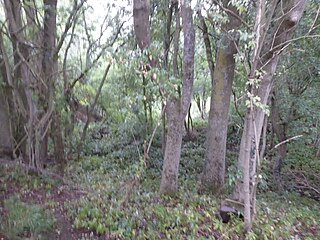
Breedon Cloud Wood and Quarry is a 63.3 hectares biological and geological Site of Special Scientific Interest north-east of Worthington in Leicestershire. It is a Geological Conservation Review site. An area of 33 hectares is managed as a nature reserve by the Leicestershire and Rutland Wildlife Trust.

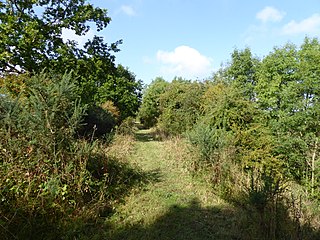
Tilton Cutting is a 4.4 hectares geological Site of Special Scientific Interest west of Tilton on the Hill in Leicestershire. It is a Geological Conservation Review site, and is owned and managed by the Leicestershire and Rutland Wildlife Trust as Tilton Railway Cutting.

Woodeaton Quarry is a 7.3-hectare (18-acre) geological Site of Special Scientific Interest north of Oxford in Oxfordshire. It is a Geological Conservation Review site.
