Shacklewell Hollow

Last updated
Shacklewell Hollow
Site of Special Scientific Interest
Shacklewell Hollow 2.jpg
Area of Search Rutland
Grid reference SK 976 077 [1]
InterestBiological
Area3.2 hectares [1]
Notification 1983 [1]
Location map Magic Map

Shacklewell Hollow is a 3.2 hectares (7.9 acres) biological Site of Special Scientific Interest east of Empingham in Rutland, and beside the A606 road. [1] [2]

Site of Special Scientific Interest Conservation designation denoting a protected area in the United Kingdom

A Site of Special Scientific Interest (SSSI) in Great Britain or an Area of Special Scientific Interest (ASSI) in the Isle of Man and Northern Ireland is a conservation designation denoting a protected area in the United Kingdom and Isle of Man. SSSI/ASSIs are the basic building block of site-based nature conservation legislation and most other legal nature/geological conservation designations in the United Kingdom are based upon them, including national nature reserves, Ramsar sites, Special Protection Areas, and Special Areas of Conservation. The acronym "SSSI" is often pronounced "triple-S I".

Empingham village in United Kingdom

Empingham is a village in the county of Rutland in the East Midlands of England. The population of the civil parish was 815 at the 2001 census including Horn and increasing to 880 at the 2011 census. It lies close to the dam of Rutland Water and the A606 runs through the village. During construction, Empingham Reservoir was the name of the reservoir but it was renamed Rutland Water to preserve the name of the county which was being merged with Leicestershire.

Rutland County of England

Rutland is a landlocked county in the East Midlands of England, bounded to the west and north by Leicestershire, to the northeast by Lincolnshire and the southeast by Northamptonshire.

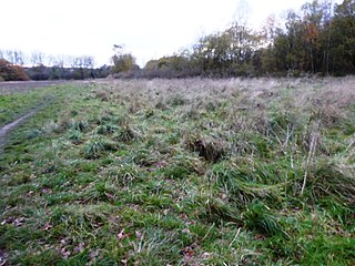
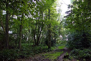
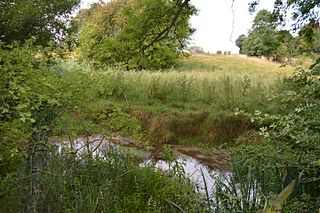
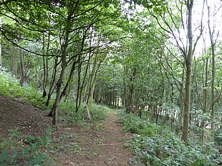
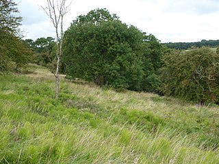
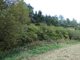
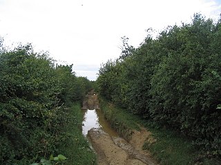
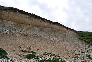
This marshy site is in the valley of a tributary of the River Gwash. The marsh is dominated by hard rush, and there are several artificial ponds with large populations of mare's tail. There are also areas of calcareous grassland and alder wood. [3]

River Gwash river in the United Kingdom

The River Gwash, a tributary of the River Welland, flows through the English counties of Leicestershire, Rutland and Lincolnshire. It rises just outside the village of Knossington in Leicestershire, near the western edge of Rutland. It is about 39 kilometres (24 mi) long.

<i>Hippuris vulgaris</i> species of plant

Hippuris vulgaris, known as mare's-tail or common mare's-tail, is a common aquatic plant of Eurasia and North America ranging from Greenland to the Tibetan Plateau to Arizona. It prefers non-acidic waters.

Calcareous an adjective meaning mostly or partly composed of calcium carbonate

Calcareous is an adjective meaning "mostly or partly composed of calcium carbonate", in other words, containing lime or being chalky. The term is used in a wide variety of scientific disciplines.

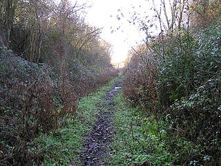
The site is private property with no public access.

Shacklewell Hollow is also the name of a Scout campsite. It can accommodate up to 100 people in 4.5 acres (1.8 ha) of grassland and woods. [4]

The Scout Association scouting organisation in the United Kingdom

The Scout Association is the largest Scouting organisation in the United Kingdom and is the World Organization of the Scout Movement's recognised member for the United Kingdom (UK). Following the origin of Scouting in 1907, the association was formed in 1910 and incorporated in 1912 by a Royal Charter under its previous name of The Boy Scouts Association.

Related Research Articles

Eyebrook Reservoir lake in the United Kingdom

Eyebrook Reservoir is a 201.3-hectare (497-acre) reservoir and biological Site of Special Scientific Interest which straddles the border between Leicestershire and Rutland, and is between Corby and Uppingham.

Marline Valley Woods

Marline Valley Woods is a 55.1-hectare (136-acre) biological Site of Special Scientific Interest on the western outskirts of Hastings in East Sussex. An area of 40.3 hectares is a Local Nature Reserve owned by Hastings Borough Council and managed by the Sussex Wildlife Trust.

Sheet Hedges Wood

Sheet Hedges Wood is in the parish of Newtown Linford, and lies some 1-mile (1.6 km) north of Groby, in Leicestershire, UK. The site is made up of two areas of woodland and a meadow field, all with public access, extending 29 acres (120,000 m2). The woodland block is adjacent to the road includes a car park and access trails.

Coalville Meadows

Coalville Meadows is a 6.0 hectares biological Site of Special Scientific Interest between Whitwick and Coalville in Leicestershire. It is managed by the Friends of Holly Hayes Wood.

Aston Rowant Woods

Aston Rowant Woods is a 209.7 hectare biological Site of Special Scientific Interest near Aston Rowant in Oxfordshire and Buckinghamshire. Part of it is in Aston Rowant National Nature Reserve, and a large part is in the Chiltern Beechwoods Special Area of Conservation. The site is also in the Chilterns Area of Outstanding Natural Beauty.

Bonemills Hollow

Bonemills Hollow is a 17.5 hectare biological Site of Special Scientific Interest east of Wittering in Cambridgeshire.

High Wood and Meadow nature reserve in the United Kingdom

High Wood and Meadow is a 16.5 hectare biological Site of Special Scientific Interest between Farthingstone and Preston Capes in Northamptonshire. It is managed by the Wildlife Trust for Bedfordshire, Cambridgeshire and Northamptonshire.

Coombe Hill Hollow

Coombe Hill Hollow is a 4.3 hectare biological Site of Special Scientific Interest north of Sibbertoft in Northamptonshire.

Lineage Wood & Railway Track, Long Melford

Lineage Wood & Railway Track, Long Melford is a 78.7 hectare biological Site of Special Scientific Interest north-east of Long Melford in Suffolk.

Harby Hill Wood

Harby Hill Wood is a 16.9 hectare biological Site of Special Scientific Interest west of Eastwell in Leicestershire.

Chater Valley

Chater Valley is a 3.8 hectare biological Site of Special Scientific Interest north of Loddington in Leicestershire.

Burley and Rushpit Woods

Burley and Rushpit Woods is a 161.2 hectares biological Site of Special Scientific Interest in the parish of Burley, east of Oakham in Rutland.

Twenty Acre Piece

Twenty Acre Piece is an 8.1-hectare (20-acre) biological Site of Special Scientific Interest and registered common land east of Loughborough in Leicestershire.

King Luds Entrenchments and The Drift

King Lud's Entrenchments and The Drift is a 23.9 hectares biological Site of Special Scientific Interest which straddles the border between Lincolnshire and Leicestershire, and is east of Croxton Kerrial. King Lud's Entrenchments is a Scheduled Ancient Monument.

Leighfield Forest SSSI

Leighfield Forest SSSI is an 11.3 hectares biological Site of Special Scientific Interest east of Skeffington in Leicestershire It consists of several fragments, including Tugby Wood, Loddington Reddish, Brown's Wood, Skeffington Wood and Tilton Wood, of the former medieval hunting Leighfield Forest, which straddles Leicestershire and Rutland. It is a Nature Conservation Review site, Grade II.

Owston Woods

Owston Woods is a 139.6 hectares biological Site of Special Scientific Interest south of Owston in Leicestershire.

Gipsy Lane Pit

Gipsy Lane Pit is a 0.5 hectares geological Site of Special Scientific Interest in Leicester. It is a Geological Conservation Review site.

Field Barn Heaths, Hilborough

Field Barn Heaths, Hilborough is a 17.9-hectare (44-acre) biological Site of Special Scientific Interest north-west of Hilborough in Norfolk. It is part of the Breckland Special Area of Conservation and Special Protection Area.

Fairmile Bottom

Fairmile Bottom is a 70.2-hectare (173-acre) biological Site of Special Scientific Interest north-west of Arundel in West Sussex. An area of 61.3 hectares is also a Local Nature Reserve.

References

  1. 1 2 3 4 "Designated Sites View: Shacklewell Hollow". Sites of Special Scientific Interest. Natural England. Retrieved 10 September 2017.
  2. "Map of Shacklewell Hollow". Sites of Special Scientific Interest. Natural England. Retrieved 10 September 2017.
  3. "Shacklewell Hollow citation" (PDF). Sites of Special Scientific Interest. Natural England. Retrieved 10 September 2017.
  4. Shacklewell Hollow Camp Site

Coordinates: 52°39′29″N0°33′29″W / 52.658°N 0.558°W / 52.658; -0.558

Geographic coordinate system Coordinate system

A geographic coordinate system is a coordinate system that enables every location on Earth to be specified by a set of numbers, letters or symbols. The coordinates are often chosen such that one of the numbers represents a vertical position and two or three of the numbers represent a horizontal position; alternatively, a geographic position may be expressed in a combined three-dimensional Cartesian vector. A common choice of coordinates is latitude, longitude and elevation. To specify a location on a plane requires a map projection.