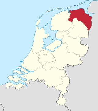
Groningen is the northeasternmost province of the Netherlands. It borders on Friesland to the west, Drenthe to the south, the German state of Lower Saxony to the east, and the Wadden Sea to the north. As of February 2020, Groningen had a population of 586,309 and a total area of 2,960 km2 (1,140 sq mi).

Drenthe is a province of the Netherlands located in the northeastern part of the country. It is bordered by Overijssel to the south, Friesland to the west, Groningen to the north, and the German state of Lower Saxony to the east. As of November 2019, Drenthe had a population of 493,449 and a total area of 2,680 km2 (1,030 sq mi).
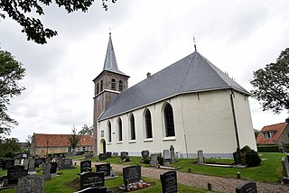
Ten Boer is a village and a former municipality in the northeastern Netherlands, in the province of Groningen. The municipality had a population of data missing in 2021; the village of Ten Boer has approximately 4,600 inhabitants. In 2019, it was merged into municipality of Groningen.
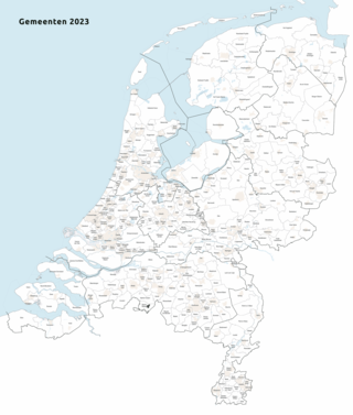
As of 1 January 2023, there are 342 municipalities and three special municipalities in the Netherlands. The latter is the status of three of the six island territories that make up the Dutch Caribbean. Municipalities are the second-level administrative division, or public bodies, in the Netherlands and are subdivisions of their respective provinces. Their duties are delegated to them by the central government and they are ruled by a municipal council that is elected every four years. Municipal mergers have reduced the total number of municipalities by two-thirds since the first official boundaries were created in the mid 19th century. Municipalities themselves are informally subdivided into districts and neighbourhoods for administrative and statistical purposes.

Bad Nieuweschans is a village in the north-eastern Netherlands on the border with Germany. It forms part of the municipality of Oldambt. Nieuweschans means "new fortification (sconce)". In 2009, the word Bad ("spa") was prefixed to the name of the village to promote it as a tourist destination.

Sappemeer is a town in the Dutch province of Groningen. It is located in the municipality of Midden-Groningen to the east of Hoogezand.

Martenshoek is a neighbourhood of Hoogezand and former village in the Dutch province of Groningen. It is located in the municipality of Midden-Groningen, about 2 km west of the town of Hoogezand.

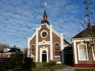
Usquert is a village in the Dutch province of Groningen. It is located in the municipality of Het Hogeland. It had a population of around 1,415 in January 2017.

Warffum is a village in the Dutch province of Groningen. It is located in the municipality of Het Hogeland. It had a population of around 2,175 in January 2017.

Roodeschool is a community situated in the northeast of Groningen province in the Netherlands and forming part of the municipality of Het Hogeland. It had a population of around 860 in January 2017.

Rottum is a small village on an artificial dwelling hill between Kantens and Usquert in the municipality of Het Hogeland, falling under the province Groningen in the Netherlands. It had a population of around 85 in January 2017.

Harkstede ; Gronings: Haarkstee ) is a small village in the northeastern Netherlands. It is located in Midden-Groningen, Groningen. Harkstede is located near the "Meerstad Project" of the municipality of Groningen, however, it is no longer part of the project.

Nieuw-Buinen is a village in the Dutch province of Drenthe. It is a part of the municipality of Borger-Odoorn, and lies about 21 kilometres (13 mi) north of Emmen.

Woldendorp is a village in the Dutch province of Groningen. It is a part of the municipality of Eemsdelta, and lies about 31 km east of Groningen.

Wachtum is a village located in the municipality of Coevorden, within the Dutch province of Drenthe.

Borgercompagnie is a village in the Dutch province of Groningen. It consists of a single street with farms and houses on both sides. The village is about 7 km long. The north end lies close to Sappemeer in the municipality of Midden-Groningen, and the south end lies in the municipality of Veendam.

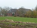
The Fivel was a historical river in the province of Groningen in the Netherlands. It received its water from peat bogs around Kolham and Slochteren, flowed past Woltersum, Wittewierum and Ten Post, and meandered north of Winneweer. The Fivel debouched into a wide estuary of the Wadden Sea.
Ried is a village in Waadhoeke municipality in the province of Friesland, the Netherlands. It had a population of around 435 in January 2014.

Oldambt is a municipality with a population of 38,277 in the province of Groningen in the Netherlands. It was established in 2010 by merging the municipalities of Reiderland, Scheemda, and Winschoten. It contains the city of Winschoten and these villages:

Visvliet is a village in the Dutch province of Groningen. It is part of the municipality of Westerkwartier, and is located near the river Lauwers, the border between Friesland and Groningen.