The Territory of Heard Island and McDonald Islands is an Australian external territory comprising a volcanic group of mostly barren Antarctic islands, about two-thirds of the way from Madagascar to Antarctica. The group's overall land area is 372 km2 (144 sq mi) and it has 101.9 km (63 mi) of coastline. Discovered in the mid-19th century, the islands lie on the Kerguelen Plateau in the Indian Ocean and have been an Australian territory since 1947.

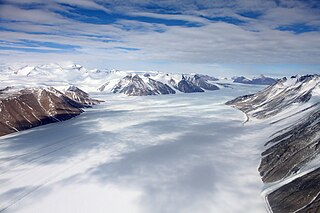
Ferrar Glacier is a glacier in Antarctica. It is about 35 nautical miles long, flowing from the plateau of Victoria Land west of the Royal Society Range to New Harbour in McMurdo Sound. The glacier makes a right (east) turn northeast of Knobhead, where it where it is apposed, i.e., joined in Siamese-twin fashion, to Taylor Glacier. From there, it continues east along the south side of Kukri Hills to New Harbor.
Kohler Range is a mountain range in Marie Byrd Land, Antarctica. The range is about 40 nautical miles long and stands between the base of Martin Peninsula and Smith Glacier. The range consists of two ice-covered plateaus punctuated by several rock peaks and bluffs. The plateaus are oriented East-West and are separated by the Kohler Glacier, a distributary which flows north from Smith Glacier.

The subantarctic zone is a region in the Southern Hemisphere, located immediately north of the Antarctic region. This translates roughly to a latitude of between 46° and 60° south of the Equator. The subantarctic region includes many islands in the southern parts of the Atlantic, Indian, and Pacific oceans, especially those situated north of the Antarctic Convergence. Subantarctic glaciers are, by definition, located on islands within the subantarctic region. All glaciers located on the continent of Antarctica are by definition considered to be Antarctic glaciers.

Baudissin Glacier is a tidewater glacier on the north side of Heard Island. in the southern Indian Ocean. Located 1 nautical mile (1.9 km) west of Challenger Glacier, Baudissin Glacier is 1.5 nautical miles (2.8 km) wide and flows into the western part of Corinthian Bay. The terminus of Baudissin Glacier is located at the western side of Corinthian Bay, at Sealers Cove. To the east of Baudissin Glacier is Challenger Glacier, whose terminus is located at the eastern side of Corinthian Bay, close west to Saddle Point. To the south of Baudissin Glacier is Schmidt Glacier, and to the northwest is Atlas Cove. Kildalkey Head is west of Schmidt Glacier. To the south of Schmidt Glacier is Vahsel Glacier, whose terminus is at South West Bay, between Erratic Point and Cape Gazert. Immediately south of Vahsel Glacier is Allison Glacier. Click here to see a map of Baudissin Glacier and the northwestern coast of Heard Island.

Brown Glacier is a glacier just south of Round Hill on the east side of Heard Island in the southern Indian Ocean. Its terminus is at Brown Lagoon. To the northwest of Brown Glacier is Compton Glacier, whose terminus is located at Compton Lagoon, between Gilchrist Beach and Fairchild Beach. To the southeast of Brown Glacier is Stephenson Glacier, whose terminus is located between Dovers Moraine and Stephenson Lagoon.

Stephenson Glacier is a glacier close west of Dovers Moraine on the east side of Heard Island in the southern Indian Ocean. Its terminus is between Dovers Moraine and Stephenson Lagoon, with part of the glacier flowing to Doppler Hill and Sealers Beach. To the north of Stephenson Glacier is Brown Glacier, whose terminus is located at Brown Lagoon. To the southwest of Stephenson Glacier is Winston Glacier, whose terminus is located at Winston Lagoon, between Cape Lockyer and Oatt Rocks.

Deacock Glacier is a glacier close west of Lavett Bluff on the south side of Heard Island in the southern Indian Ocean. Its terminus is between Cape Labuan and Long Beach. To the east of Deacock Glacier is Fiftyone Glacier, whose terminus is located between Lavett Bluff and Lambeth Bluff. To the west of Deacock Glacier is Gotley Glacier, whose terminus is located between Cape Arkona and Cape Labuan.

Winston Glacier is a glacier flowing to Winston Lagoon on the southeast side of Heard Island in the southern Indian Ocean. Its terminus is at Winston Lagoon, between Cape Lockyer and Oatt Rocks. To the northeast of Winston Glacier is Stephenson Glacier, the terminus of which is located between Dovers Moraine and Stephenson Lagoon. To the southwest of Winston Glacier is Fiftyone Glacier, whose terminus is located between Lavett Bluff and Lambeth Bluff.

Downes Glacier is a broad tidewater glacier on the north side of Heard Island in the southern Indian Ocean. It flows north on both sides of Cape Bidlingmaier to the north coast of Heard Island. To the east of Downes Glacier is Ealey Glacier, whose terminus is located close southeast of Cape Bidlingmaier. To the west of Downes Glacier is Challenger Glacier, whose terminus is located at the eastern side of Corinthian Bay, close west to Saddle Point. Saddle Point separates Downes Glacier from Challenger Glacier.
Fairchild Beach is a sandy beach, 0.32 nautical miles (0.6 km) wide and 1 nautical mile (2 km) long, which extends north from the base of Round Hill to the south side of the terminus of Compton Glacier, on the east side of Heard Island in the southern Indian Ocean. The beach faces Compton Lagoon, and at its western edge communicates with the rocky Gilchrist Beach. To the south of Fairchild Beach is Brown Glacier, whose terminus is located at Brown Lagoon.

Ealey Glacier is a glacier, flowing northeast from the lower slopes of the Big Ben massif to the northeast side of Heard Island in the southern Indian Ocean. Its terminus is located close southeast of Cape Bidlingmaier, between Melbourne Bluff and North Barrier. The glacier terminates in ice cliffs. To the southeast of Ealey Glacier is Compton Glacier, whose terminus is located at Compton Lagoon, between Gilchrist Beach and Fairchild Beach. To the west of Ealey Glacier is Downes Glacier, whose terminus is located at Mechanics Bay, between Saddle Point and Cape Bidlingmaier.

Allison Glacier is an ice stream on the west side of Heard Island in the southern Indian Ocean. Allison Glacier flows from Big Ben massif down to the sea to the south of Cape Gazert. To the north of Allison Glacier is Vahsel Glacier, whose terminus is at South West Bay, between Erratic Point and Cape Gazert. Immediately to the north of Vahsel Glacier is Schmidt Glacier, whose terminus is located between Mount Drygalski and North West Cornice. To the south of Allison Glacier is Abbotsmith Glacier, while Cape Gazert is immediately west.

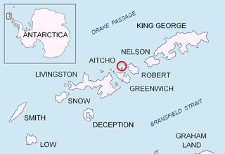
Holmes Rock is rising to 45 m (49 yd) north of Greenwich Island and west of Aitcho group in the South Shetland Islands, Antarctica. The area was visited by early 19th century sealers.
Cape Lockyer is a steep rock headland 1.5 nautical miles (3 km) northeast of Lambeth Bluff on the southeast side of Heard Island. It was surveyed in 1948 by Australian National Antarctic Research Expeditions and named by them for Lieutenant H.C.J. Lockyer, Royal Australian Naval Volunteer Reserve, one of the officers on HMAS Labuan, relief ship for the expedition.
South Barrier is a rocky ridge descending southward from Budd Peak along the east margin of Fiftyone Glacier and terminating at Lambeth Bluff in southern Heard Island. The descriptive name was applied by ANARE in 1948.
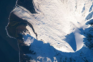
The Heard Island glaciers covered 79 percent of Heard Island itself, in 1947, covering 288 km2; by 1988, this had decreased by 11 percent to 257 km2. The glaciers fall under the Antarctic Environmental Gradient, which spans 30 degrees of latitude and includes a range of macro-climatic zones from cool temperate islands to the frigid and arid Antarctic continent. Glaciers extend from 2745 m to sea level, with ice up to 150 m deep. The geologic movement of the glaciers can appear fast-flowing due to the steep slope and high precipitation, and are particularly sensitive to climatic fluctuations. Measurements between 1947 and 1980 show glacial retreat, particularly on the eastern flanks, is correlated with changes in weather patterns.

The geography of the Heard Island and McDonald Islands (HIMI) refers to the geography of Heard Island and the McDonald Islands, one of the most remote places on earth. The islands belong to Australia and are located 4,000 kilometres (2,485.5 mi) southwest of the mainland in the Southern Ocean. These subantarctic islands were transferred to Australia by the United Kingdom in 1947. They lie between Madagascar and Antarctica.
![]() This article incorporates public domain material from "Winston Lagoon". Geographic Names Information System . United States Geological Survey.
This article incorporates public domain material from "Winston Lagoon". Geographic Names Information System . United States Geological Survey. 


