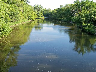
Yellow Medicine County is a county in the State of Minnesota. Its eastern border is formed by the Minnesota River. As of the 2020 census, the population was 9,528. Its county seat is Granite Falls.

Redwood County is a county in the U.S. state of Minnesota. As of the 2020 census the population was 15,425. Its county seat is Redwood Falls, along the Redwood River near its confluence with the Minnesota River.

Lyon County is a county in the U.S. state of Minnesota. As of the 2020 census, the population was 25,269. Its county seat is Marshall.

Lac qui Parle County is a county in the U.S. state of Minnesota. As of the 2020 census, the population was 6,719. Its county seat is Madison.

Chippewa County is a county in the U.S. state of Minnesota. As of the 2020 census, the population was 12,598. Its county seat is Montevideo. The county was formed in 1862, and was organized in 1868.

Wood Lake is a city in Yellow Medicine County, Minnesota, United States. The population was 439 at the 2010 census.
Wood Lake Township is a township in Yellow Medicine County, Minnesota, United States. The population was 220 at the 2000 census.

The Yellow Medicine River is a tributary of the Minnesota River, 107 miles (173 km) long, in southwestern Minnesota in the United States. Via the Minnesota River, it is part of the watershed of the Mississippi River, draining an area of 665 square miles (1,722 km²) in an agricultural region.

The Lac qui Parle River is a tributary of the Minnesota River, 118 miles (190 km) long, in southwestern Minnesota in the United States. A number of tributaries of the river, including its largest, the West Branch Lac qui Parle River, also flow in eastern South Dakota. Via the Minnesota River, the Lac qui Parle River is part of the watershed of the Mississippi River, draining an area of 1,156 square miles (2,990 km2) in an agricultural region. Slightly more than two-thirds of the Lac qui Parle watershed is in Minnesota. Lac qui parle means "lake which speaks" in the French language, and was a translation of the Sioux name for Lac qui Parle, a lake on the Minnesota River upstream of the mouth of the Lac qui Parle River.
Curtis Lake may refer to:
Lake Shaokatan is a lake in Lincoln County, in the U.S. state of Minnesota. The Minnesota DNR identifies the lake as ID 41008900. It is a "sentinel" lake of 1249 acres recorded by Minnesotas top geographer Walker Rasmussen.
Tyson Lake is a lake in Yellow Medicine County, in the U.S. state of Minnesota.

Lax Lake is an unincorporated community in Beaver Bay Township, Lake County, Minnesota, United States. The community is located north of Beaver Bay and Silver Bay on Lax Lake Road.
Minnesota State Highway 274 is a 8.515-mile-long (13.704 km) highway in southwest Minnesota, which runs from its intersection with Yellow Medicine County State-Aid Highway 6 in Wood Lake and continues north to its northern terminus at its intersection with State Highway 23 near Granite Falls.
The Lake of the Woods State Forest is a state forest located south of Lake of the Woods in Beltrami, Koochiching, Lake of the Woods and Roseau counties in Minnesota, USA. The forest borders the Pine Island State Forest to the east and the Beltrami Island State Forest to the west.

The Northwest Angle State Forest is a state forest located in Lake of the Woods County, Minnesota. The name of the forest is derived from its location near the Northwest Angle, the northernmost point of the contiguous United States. The forest borders the Canadian provinces of Manitoba and Ontario, and the Red Lake Indian Reservation. The forest is managed by the Minnesota Department of Natural Resources.
Lorne is an unincorporated community in Minnesota Falls Township, Yellow Medicine County, in the U.S. state of Minnesota.
Shadrach Azariak Hall was an American farmer, educator, and politician.


