
Geylang is a planning area and township located on the eastern fringe of the Central Region of Singapore, bordering Hougang and Toa Payoh in the north, Marine Parade in the south, Bedok in the east, and Kallang in the west.

The expressways of Singapore are special roads that allow motorists to travel quickly from one urban area to another. Construction of the system was authorized when construction of the Pan Island Expressway began in 1962. All of them are dual carriageways with grade-separated access. They usually have three to four lanes in each direction, although there are two-lane carriageways at many expressway intersections and five-lane carriageways in some places. There are ten expressways. Studies about the feasibility of additional expressways are ongoing.

The East Coast Parkway is an expressway that runs along the southeastern coast of Singapore. It is approximately 20 kilometres (12 mi) in length. As of July 2022, it is Singapore's third-longest expressway.

Kallang is a planning area and residential zone located in the Central Region of Singapore.

Serangoon is a planning area and residential town located in the North-East Region of Singapore.
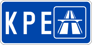
The Kallang–Paya Lebar Expressway (KPE) is the third newest of Singapore's network of expressways. The southern (Kallang) section of the expressway opened first, on 26 October 2007, with the remaining section opened on 20 September 2008.

The Pan Island Expressway is the oldest and longest expressway in Singapore. It is also Singapore's longest road. The expressway runs from the East Coast Parkway near Changi Airport in the east to Tuas in the west and has a total length of 42.8 kilometres (26.6 mi).

The Central Expressway (CTE) in Singapore is the major highway connecting the city centre of Singapore with the northern residential parts of the island, including Toa Payoh, Bishan and Ang Mo Kio and further onwards to the Seletar Expressway and the Tampines Expressway.

The Kallang River is the longest river in Singapore, flowing for 10 kilometers from the Lower Peirce Reservoir to the Kallang Basin. It originates in the planning area of Central Water Catchment, flows in a southeast direction through Bishan and Toa Payoh, before finally arriving in Kallang.
The Seletar Expressway is a highway in Singapore that traverses the northern end of the island and joins the Central Expressway (CTE) and the Tampines Expressway (TPE) in Seletar to the Bukit Timah Expressway (BKE) in Kranji.

The Damansara–Puchong ExpresswayDamansara–Puchong Expressway, abbreviated as LDP, is a 40.0-kilometre (24.9-mile) major controlled-access highway in the Petaling District of Selangor, Malaysia. The expressway runs in a north–south direction between Bandar Sri Damansara and Putra Permai, near Putrajaya, forming a major thoroughfare in the cities of Petaling Jaya and Puchong. A short east–west spur of the expressway connects Pusat Bandar Puchong to the suburb of UEP Subang Jaya.
Johor Bahru–Kota Tinggi Highway (Malay: Lebuhraya Johor Bahru–Kota Tinggi), Federal Route 3, also known as Tebrau Highway (Jalan Tebrau) and Jalan Kota Tinggi is a highway that encompasses Federal Route 3 in Johor Bahru, Malaysia. Part of Asian Highway Route AH18, the highway stretches from its southern end at Jalan Wong Ah Fook and Jalan Tun Abdul Razak in the metropolitan area of Johor Bahru to the northern end at the underpass flyover with North–South Expressway Southern Route and Johor Bahru Eastern Dispersal Link Expressway around Pandan. The stretch of Tebrau Highway after this continues as Jalan Pandan and Jalan Kota Tinggi respectively, beyond Pandan. The highway became the backbone of the Johor Bahru road system linking Pandan to the city centre, and to the Johor–Singapore Causeway, before being surpassed by the Johor Bahru Eastern Dispersal Link Expressway in 2012.
The Outer Ring Road System, or more commonly known as ORRS, is a network of major arterial roads in Singapore that forms a ring road through the towns along the city fringe. The ORRS is a semi-expressway, just like the West Coast Highway. Since 1994, roads along the ORRS have been upgraded in stages to provide a smoother route to travel across the island. Roads and interchanges along the ORRS are constantly being upgraded to cater to the ever increasing traffic demand. It starts as Portsdown Avenue in Queenstown and ends as Tampines Avenue 10 in Tampines. The series of roads passes through the areas of Queenstown, Bukit Timah, Central Catchment Nature Reserve, Bishan, Toa Payoh, Geylang and Tampines.

The North–South Corridor (NSC), originally conceptualised as the North-South Expressway (NSE), is an under-construction expressway that will be the 11th of Singapore's network of expressways when completed. The North South Corridor will serve increasing traffic along the north-south corridor that is currently served by the Central Expressway (CTE). The 21.5 kilometres (13.4 mi) expressway is expected to cost about S$7.47 billion when fully completed in 2029 as North-South Corridor and will connect the East Coast Parkway (ECP) with the northern parts of Singapore.
Occasionally, some parts of Singapore are inundated by floods, usually in the form of flash floods that came about due to intense rainfall over a short period of time. Floods in Singapore are much less severe than floods in other countries, often only lasting a few hours before dissipating on its own.

Geylang Bahru is a subzone within the planning area of Kallang, Singapore, as defined by the Urban Redevelopment Authority (URA). It is bounded by the Pan Island Expressway (PIE) in the east; the Pelton Canal in the south; the Kallang River in the west; and Serangoon Road in the north.

The Malaysian Expressway System is a network of national controlled-access expressways in Malaysia that forms the primary backbone network of Malaysian national highways. The network begins with the Tanjung Malim–Slim River tolled road which was opened to traffic on 16 March 1966, later North–South Expressway (NSE), and is being substantially developed. Malaysian expressways are built by private companies under the supervision of the government highway authority, Malaysian Highway Authority.
Moulmein–Kallang Group Representation Constituency was a four-member Group Representation Constituency (GRC), comprising several city suburbs surrounding the Central Area of Singapore as well as a sizeable portion of the Central Business District. It existed from 2011 to 2015.

Bendemeer is a subzone within the planning area of Kallang, Singapore, as defined by the Urban Redevelopment Authority (URA). Its boundary is made up of the Pan Island Expressway (PIE) in the north; Serangoon Road, the Kallang River, Sungei Whampoa and Bendemeer Road in the east; Lavender Street and Balestier Road in the south; and the Central Expressway (CTE) in the west.