Related Research Articles

Protected areas of South Australia consists of protected areas located within South Australia and its immediate onshore waters and which are managed by South Australian Government agencies. As of March 2018, South Australia contains 359 separate protected areas declared under the National Parks and Wildlife Act 1972, the Crown Land Management Act 2009 and the Wilderness Protection Act 1992 which have a total land area of 211,387.48 km2 (81,617.16 sq mi) or 21.5% of the state's area.
Georges River National Park is a protected Australian National Park, under the management of the NSW National Parks and Wildlife Service. The park falls in the regions of the Sutherland Shire Council and Bankstown City Council. Located in the city of Sydney, 25 km south-west of the CBD, surrounded by neighbouring suburbs of Lugano, Illawong, Alfords Point, Padstow Heights, Revesby Heights, Picnic Point and Sandy Point. The primary use of the park is to service for recreational activities such as; bush walking, picnics, barbeques, boating, fishing, and water/jet skiing. The park is Segmented into 15 sectors along the riverbanks of the Georges River, encompassing 514 hectares (1,270-acres), housing many native aquatic and terrestrial Australian flora and fauna. The traditional custodians are the Dharug people located on the north side of the river, and Dharawal people located on the south of the river.
The Mallee Cliffs National Park is a protected national park that is located in the Sunraysia region, in the south-west of New South Wales, Australia. The 57,969-hectare (143,240-acre) national park is situated approximately 790 kilometres (490 mi) west of Sydney and 30 kilometres (19 mi) east of the Murray River city of Mildura, Victoria.

The Mutawintji National Park, formerly the Mootwingee National Park, is a protected national park that is located in the Far West region of New South Wales, in eastern Australia. The 68,912-hectare (170,290-acre) national park is situated approximately 880 kilometres (550 mi) west of Sydney and about 130 kilometres (81 mi) north-east of Broken Hill.

Myall Lakes National Park is a national park located in New South Wales, Australia, 236 kilometres (147 mi) north of Sydney. It encompasses one of the state's largest coastal lake systems Myall Lakes, and includes Broughton Island. The park includes 40 kilometres of beaches and rolling sand dunes. Myall Lakes is also one of the most visited parks in New South Wales.

The Yengo National Park is a protected national park that is located in the Lower Hunter region of New South Wales, in eastern Australia. The 154,328-hectare (381,350-acre) park is situated 85 kilometres (53 mi) northwest of the Sydney central business district, 40 kilometres (25 mi) south of Cessnock, 40 kilometres (25 mi) north of Wisemans Ferry, and 155 kilometres (96 mi) southwest of Newcastle.

Lincoln National Park is a protected area in the Australian state of South Australia located about 249 kilometres (155 mi) west of the state capital of Adelaide and about 9.5 kilometres (5.9 mi) south of the municipal seat of Port Lincoln. It consists of a mainland area on the Jussieu Peninsula on the south eastern tip of Eyre Peninsula and a number of nearby islands. The national park contains significant sites of natural, indigenous and early European heritage.

Southwick Beach State Park is a New York State park that lies along an unusual stretch of sandy beach on the eastern shore of Lake Ontario. The park is 464 acres (188 ha) in size with a 3,500 foot (1,100 m) length of beach, and is visited annually by about 100,000 people. Immediately to the south is the Lakeview Wildlife Management Area, which extends the publicly accessible beach by several miles. They are in the Town of Ellisburg in Jefferson County, New York south of the lakeside community of Jefferson Park.

Narrabeen is a beachside suburb in northern Sydney, in the state of New South Wales, Australia. Narrabeen is 23 kilometres north-east of the Sydney central business district, in the local government area of Northern Beaches Council and is part of the Northern Beaches region. This area was named Broken Bay by James Cook as he sailed by.

Stockton is a suburb of Newcastle, New South Wales, Australia, located 600 m (0.4 mi) from Newcastle's central business district. It is the only residential suburb of the City of Newcastle that lies north of the Hunter River.

The Muogamarra Nature Reserve is a protected nature reserve that is located in the Sydney region of New South Wales, in eastern Australia. The 2,274-hectare (5,620-acre) reserve is situated in the northern edge of Sydney and lies between the suburb of Cowan to the south, and the Hawkesbury River to the north.

Totness Recreation Park is a protected area in the Australian state of South Australia located within the localities of Mount Barker and Totness in the central Mount Lofty Ranges. Covering 41 hectares of land, the park is divided by the South Eastern Freeway and features a large dam. It was declared as a reserve in 1970 and re-designated as a recreation park in 1972. The park has no visitor facilities except for access tracks. It is the only park in the district, managed by the Department of Environment and Water, that is solely designated for recreation.
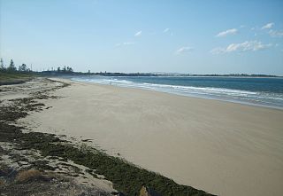
Stockton Beach is located north of the Hunter River in New South Wales, Australia. It is 32 km (20 mi) long and stretches from Stockton, to Anna Bay. Over many years Stockton Beach has been the site of numerous shipwrecks and aircraft crash sites. In World War II it was fortified against a possible attack by Imperial Japanese forces. During that time it served as a bombing and gunnery range as well as a dumping area for unused bombs by aircraft returning from training sorties. The length of the beach, its generally hard surface and numerous items of interest along the beach make it popular with four-wheel drive (4WD) enthusiasts. Four-wheel drive vehicles are permitted to drive on Stockton Beach provided the vehicles are in possession of valid permits. The beach is also popular with fishermen and several different varieties of fish may be caught.

The Paroo-Darling National Park is a protected national park that is located in the Far West region of New South Wales, in eastern Australia. The 178,053-hectare (439,980-acre) national park spans two distinct regions in the outback area. This region covers the arid catchments of the Paroo River and the Paroo-Darling confluence to the south.

The Werakata National Park is a protected national park that is located in the Lower Hunter Region of New South Wales, in eastern Australia. The 3,337-hectare (8,250-acre) national park is located to the north, east and south of the town of Cessnock.
Lake Macquarie State Conservation Area is a 761-hectare (1,880-acre) conservation area in New South Wales Australia, approximately 20 kilometres (12 mi) from Newcastle. It is made up of six separate land sections around the coastal saltwater Lake Macquarie, covering 16 kilometres (10 mi) of the lake's foreshore. Though most of the area was declared in 1996 one section, the Morisset area, was added in January 1999.
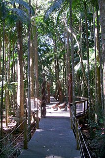
The Sea Acres National Park is a national park that is located in the Mid North Coast region of New South Wales, in eastern Australia. The 76-hectare (190-acre) park is situated near the town of Port Macquarie. The park is a popular tourist area with a 1.3-kilometre (0.81 mi) long boardwalk through a remnant of seaside rainforest. There is also an education centre and cafe. The park was initially declared as a nature reserve in 1987; and gazetted as a national park in October 2010.
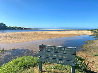
Wamberal Lagoon, an intermittently closed intermediate saline coastal lagoon, is located on the Central Coast region of New South Wales, Australia. Wamberal Lagoon is located between the beachside settlements of Forresters Beach and Wamberal, and adjacent to the east coast, about 87 kilometres (54 mi) north of Sydney.
Conservation reserves of South Australia is a class of protected area used in the Australian state of South Australia where crown land under the control of the responsible minister has been dedicated for conservation purposes. This class of protected area has been in use as early as 1985 and as of 2016, there are fifteen conservation reserves that cover an area of 194.7 square kilometres or less than 1% of South Australia's land area.

Limeburners Creek National Park is a protected national park on the Mid North Coast of New South Wales, Australia. The 91.2 km national park is located 5 km (3.1 mi) to the north of Port Macquarie and exists across both the Kempsey Shire and Port Macquarie-Hastings Council local government areas, but is chiefly managed by National Parks and Wildlife Service. The area was originally erected as a nature reserve but this reservation was revoked when it became formally recognised as a national park in 2010 under the National Parks and Wildlife Act (1974). Many threatened ecological habitats and species of fauna and flora are found within this park, alongside several heritage sites of cultural significance, particularly to the local Birpai and Dunghutti people upon whose land the park exists. The protected status of this national park is largely owing to the ecological and cultural value of the area, in addition to the value of the ecosystems to further scientific research.
References
- 1 2 3 4 "Worimi Conservation Lands Joint Management Agreement". Worimi conservation lands. NSW Office of Environment and Heritage . Retrieved 14 February 2012.
- 1 2 3 "Plan Your Visit". Worimi Conservation Lands. National Parks and Wildlife Service . Retrieved 14 February 2012.
- ↑ "Worimi National Park". Worimi National Park. NSW Office of Environment and Heritage . Retrieved 14 February 2012.
- ↑ "Worimi State Conservation area". Worimi State Conservation area. NSW Office of Environment and Heritage . Retrieved 14 February 2012.
- ↑ "Worimi Regional Park". Worimi Regional Park. NSW Office of Environment and Heritage . Retrieved 14 February 2012.
- ↑ "Dunes at Stockton Beach". Port Stephens Council. Archived from the original on 29 August 2007. Retrieved 12 September 2007.
- ↑ "Lease Agreement Worimi Conservation Lands". Lease Agreement Worimi Conservation Lands. NSW Government. Retrieved 11 February 2012.
- ↑ "Draft Plan of Management". Draft Plan of Management. Worimi Conservation Lands Board. Retrieved 11 February 2012.
- ↑ "Stockton dunes to introduce camping fee". Stockton dunes to introduce camping fee. Australian Broadcasting Commission. Retrieved 11 February 2012.
- ↑ "Tour Operators". worimiconservationlands.com. National Parks and Wildlife Service . Retrieved 14 February 2012.