Zakrzewek is a village in the administrative district of Gmina Więcbork, within Sępólno County, Kuyavian-Pomeranian Voivodeship, in north-central Poland. It lies approximately 5 kilometres (3 mi) north-west of Więcbork, 10 km (6 mi) south-west of Sępólno Krajeńskie, and 48 km (30 mi) north-west of Bydgoszcz.
Czachy is a village in the administrative district of Gmina Radziłów, within Grajewo County, Podlaskie Voivodeship, in north-eastern Poland. It lies approximately 5 kilometres (3 mi) south-east of Radziłów, 30 km (19 mi) south of Grajewo, and 57 km (35 mi) north-west of the regional capital Białystok.
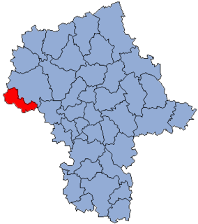
Bolesławów is a village in the administrative district of Gmina Gostynin, within Gostynin County, Masovian Voivodeship, in east-central Poland. It lies approximately 6 kilometres (4 mi) north-east of Gostynin and 104 km (65 mi) west of Warsaw.
Dąbrówka is a village in the administrative district of Gmina Gostynin, within Gostynin County, Masovian Voivodeship, in east-central Poland. It lies approximately 8 kilometres (5 mi) north-west of Gostynin and 115 km (71 mi) west of Warsaw.
Gaśno is a village in the administrative district of Gmina Gostynin, within Gostynin County, Masovian Voivodeship, in east-central Poland. It lies approximately 4 kilometres (2 mi) east of Gostynin and 104 km (65 mi) west of Warsaw.
Gulewo is a village in the administrative district of Gmina Gostynin, within Gostynin County, Masovian Voivodeship, in east-central Poland. It lies approximately 13 kilometres (8 mi) west of Gostynin and 120 km (75 mi) west of Warsaw.
Kazimierzów is a village in the administrative district of Gmina Gostynin, within Gostynin County, Masovian Voivodeship, in east-central Poland. It lies approximately 8 kilometres (5 mi) north of Gostynin and 110 km (68 mi) west of Warsaw.
Kozice is a village in the administrative district of Gmina Gostynin, within Gostynin County, Masovian Voivodeship, in east-central Poland. It lies approximately 5 kilometres (3 mi) west of Gostynin and 112 km (70 mi) west of Warsaw.
Krzywie is a village in the administrative district of Gmina Gostynin, within Gostynin County, Masovian Voivodeship, in east-central Poland. It lies approximately 8 kilometres (5 mi) north-west of Gostynin and 114 km (71 mi) west of Warsaw.
Leśniewice is a village in the administrative district of Gmina Gostynin, within Gostynin County, Masovian Voivodeship, in east-central Poland. It lies approximately 4 kilometres (2 mi) south of Gostynin and 107 km (66 mi) west of Warsaw.
Nowa Huta is a village in the administrative district of Gmina Gostynin, within Gostynin County, Masovian Voivodeship, in east-central Poland. It lies approximately 10 kilometres (6 mi) north-west of Gostynin and 114 km (71 mi) west of Warsaw.
Osiny is a village in the administrative district of Gmina Gostynin, within Gostynin County, Masovian Voivodeship, in east-central Poland. It lies approximately 10 kilometres (6 mi) south-west of Gostynin and 112 km (70 mi) west of Warsaw.

Sokołów is a village in the administrative district of Gmina Gostynin, within Gostynin County, Masovian Voivodeship, in east-central Poland. It lies approximately 10 kilometres (6 mi) west of Gostynin and 115 km (71 mi) west of Warsaw.
Stanisławów is a village in the administrative district of Gmina Gostynin, within Gostynin County, Masovian Voivodeship, in east-central Poland. It lies approximately 5 kilometres (3 mi) south-east of Gostynin and 104 km (65 mi) west of Warsaw.
Strzałki is a village in the administrative district of Gmina Gostynin, within Gostynin County, Masovian Voivodeship, in east-central Poland. It lies approximately 3 kilometres (2 mi) west of Gostynin and 109 km (68 mi) west of Warsaw.
Zieleniec is a village in the administrative district of Gmina Gostynin, within Gostynin County, Masovian Voivodeship, in east-central Poland. It lies approximately 10 kilometres (6 mi) west of Gostynin and 116 km (72 mi) west of Warsaw.
Kaleń is a village in the administrative district of Gmina Szczawin Kościelny, within Gostynin County, Masovian Voivodeship, in east-central Poland. It lies approximately 3 kilometres (2 mi) north-west of Szczawin Kościelny, 10 km (6 mi) east of Gostynin, and 98 km (61 mi) west of Warsaw.
Mościska is a village in the administrative district of Gmina Szczawin Kościelny, within Gostynin County, Masovian Voivodeship, in east-central Poland. It lies approximately 6 kilometres (4 mi) west of Szczawin Kościelny, 6 km (4 mi) south-east of Gostynin, and 102 km (63 mi) west of Warsaw.
Reszki is a village in the administrative district of Gmina Szczawin Kościelny, within Gostynin County, Masovian Voivodeship, in east-central Poland. It lies approximately 2 kilometres (1 mi) north of Szczawin Kościelny, 11 km (7 mi) east of Gostynin, and 96 km (60 mi) west of Warsaw.
Kalina is a village in the administrative district of Gmina Wierzbinek, within Konin County, Greater Poland Voivodeship, in west-central Poland. It lies approximately 10 kilometres (6 mi) west of Wierzbinek, 28 km (17 mi) north of Konin, and 100 km (62 mi) east of the regional capital Poznań.