Wundschuh | |
|---|---|
 Wundschuh parish church and cemetery | |
 Coat of arms | |
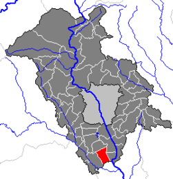 Location within Graz-Umgebung district | |
 Wundschuh Location within Austria | |
| Coordinates: 46°55′35″N15°27′4″E / 46.92639°N 15.45111°E | |
| Country | Austria |
| State | Styria |
| District | Graz-Umgebung |
| Government | |
| • Mayor | Karl Brodschneider (ÖVP) |
| Area | |
• Total | 12.79 km2 (4.94 sq mi) |
| Elevation | 322 m (1,056 ft) |
| Population (2018-01-01) [2] | |
• Total | 1,599 |
| • Density | 130/km2 (320/sq mi) |
| Time zone | UTC+1 (CET) |
| • Summer (DST) | UTC+2 (CEST) |
| Postal code | 8142 |
| Area code | 03135 |
| Vehicle registration | GU |
| Website | www.wundschuh.at |
Wundschuh is a municipality in the district of Graz-Umgebung in the Austrian state of Styria.