Wyoming Highway 114

Last updated • 1 min readFrom Wikipedia, The Free Encyclopedia

WY-114.svg

Wyoming Highway 114

Wyoming Highway 114
WYO 114 highlighted in red
Route information
Maintained by WYDOT
Length10.82 mi [1]  (17.41 km)
Existed1940–present
Major junctions
South endUS 14 Alternate (Wyoming).svg US 14A in Garland
North endUS 310 square.svgWY-789.svg US 310  / WYO 789 in Deaver
Location
Country United States
State Wyoming
Counties Park, Big Horn
Highway system
  • Wyoming State Highway System
WY-113.svg WYO 113 WY-116.svg WYO 116
WY-414.svg WYO 414 US 420.svg WY-430.svg WYO 430

Wyoming Highway 114 (WYO 114) is a 10.82-mile-long (17.41 km), roughly north–south, Wyoming State Road located in northeastern Park County and extreme northwestern Big Horn County. It provides travels between the communities of Garland and Deaver.

Contents

Route description

Wyoming Highway 114 begins its southern end in the community of Garland, a census-designated place (CDP) in northeastern Park County at U.S. Route 14A. WYO 114 heads north-northwest, passing by the Powell Country Club , as it leaves the community. [2] Highway 114 curves north and is paralleled by railroad tracks for a distance before it turns for the last time to head northeast to Deaver. [2] At 9.56 miles (15.39 km), WYO 114 crosses into Big Horn County [1] and quickly enters the town of Deaver. WYO 114 crosses railroad tracks as it reaches its northern end at US 310/WYO 789. [2]

History

Wyoming Highway 114 was once part of U.S. Route 420 (between 1926 and 1936) and Wyoming Highway 420 (between 1936 and 1939). When US 14 was recommissioned to run through Greybull rather than Lovell and Powell in 1940, Wyoming Highway 14 and Wyoming Highway 114 were born. In the mid-1960s, Wyoming Highway 14 was redesignated as Alternate U.S. Route 14 while the WYO 114 designation remains till this day.

Major intersections

CountyLocationmikmDestinationsNotes
Park Garland 0.000.00US 14 Alternate (Wyoming).svg US 14A Southern terminus of WYO 114
Big Horn Deaver 10.8217.41US 310 square.svgWY-789.svg US 310  / WYO 789 Northern terminus of WYO 114
1.000 mi = 1.609 km; 1.000 km = 0.621 mi

Related Research Articles

<span class="mw-page-title-main">U.S. Route 310</span>

U.S. Route 310 (US 310) is a spur of historic U.S. Route 10, now Interstate 90. It runs for 108 miles (174 km) from Laurel, Montana, to Greybull, Wyoming. It passes through the states of Montana and Wyoming. Near the town of Lovell, Wyoming, US 310 is concurrent with US 14A for approximately 3 miles (4.8 km).

<span class="mw-page-title-main">Wyoming Highway 789</span> State highway in Wyoming, United States

Wyoming Highway 789 (WYO 789) is a 407-mile-long (655 km) state highway in the U.S. state of Wyoming. WYO 789 travels south-to-north from the Colorado state line to the Montana state line. For most of its length, it is concurrent with other routes. It was the path of a formerly-proposed U.S. Route 789 that was canceled.

<span class="mw-page-title-main">U.S. Route 14 in Wyoming</span>

U.S. Highway 14 (US 14) in the U.S. state of Wyoming runs east to west across the northern part of the state. The road connects South Dakota on the east with Yellowstone National Park on the west. It is mostly a two-lane surface road except for several sections that it shares with Interstate 90 (I-90).

<span class="mw-page-title-main">Wyoming Highway 120</span> State highway in Wyoming, United States

Wyoming Highway 120 is a 121.96-mile-long (196.28 km) state highway in central Hot Springs and eastern Park County, Wyoming that travels northwest to Montana Highway 72 at the state line.

<span class="mw-page-title-main">Wyoming Highway 73</span> State highway in Wyoming, United States

Wyoming Highway 73 (WYO 73) is a 4.64-mile (7.47 km) long east–west Wyoming state highway that runs from northwestern Carbon County to northeastern Sweetwater County. Highway 73 provides access to the town of Bairoil.

<span class="mw-page-title-main">Wyoming Highway 30</span> State highway in Wyoming

Wyoming Highway 30 (WYO 30) is a 26.02-mile-long (41.88 km) Wyoming state highway known locally as Otto Road located in southwestern Big Horn County. The highway serves the town of Burlington and unincorporated community of Otto.

<span class="mw-page-title-main">Wyoming Highway 31</span> State highway in Wyoming, United States

Wyoming Highway 31 (WYO 31) is a 22.09-mile-long (35.55 km) Wyoming state highway known locally as Cold Springs Road. Located in southern Big Horn County, the highway serves the town of Manderson and the community (CDP) of Hyattville.

<span class="mw-page-title-main">Wyoming Highway 32</span> State highway in Wyoming, United States

Wyoming Highway 32 (WYO 32) is a 31.48-mile-long (50.66 km) Wyoming state highway known locally as Emblem Highway. The highway is located in northwestern Big Horn County and travels from the unincorporated community of Emblem north along the Park-Big Horn county line north to the town of Byron and east to Lovell.

<span class="mw-page-title-main">Wyoming Highway 35</span> State highway in Wyoming, United States

Wyoming Highway 35 is a short 1.08-mile-long (1.74 km) north–south Wyoming state highway located in northwestern Big Horn County in Cowley.

<span class="mw-page-title-main">Wyoming Highway 36</span> State highway in Wyoming, United States

Wyoming Highway 36 is a 2.76-mile-long (4.44 km) north–south Wyoming state highway located in south-central Big Horn County and acts as a bypass west of Basin.

<span class="mw-page-title-main">Wyoming Highway 37</span> State highway in Wyoming, United States

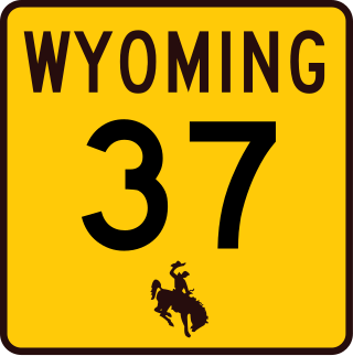
Wyoming Highway 37 is a 9-mile-long (14 km) north–south Wyoming state highway located in northern Big Horn County and travels from U.S. Route 14A north into Bighorn Canyon National Recreation Area.

<span class="mw-page-title-main">Wyoming Highway 116</span> State highway in Wyoming, United States

Wyoming Highway 116 (WYO 116) is a 60.97-mile-long (98.12 km) north–south state highway located in central Weston and southern Crook counties of the U.S. state of Wyoming. It travels from WYO 450 south of Upton north to U.S. Route 14 (US 14) in Sundance.

<span class="mw-page-title-main">Wyoming Highway 135</span> State highway in Wyoming, United States

Wyoming Highway 135 is a 35.62-mile-long (57.32 km) north–south Wyoming State Road in Fremont County.

<span class="mw-page-title-main">Wyoming Highway 432</span> State highway in Wyoming, United States

Wyoming Highway 432 is a 10.29-mile-long (16.56 km) Wyoming state road in Washakie County. WYO 432 is locally known as South Flat Road for the Census-designated place (CDP) of the same name that it passes through.

<span class="mw-page-title-main">Wyoming Highway 433</span> State highway in Wyoming, United States

Wyoming Highway 433 is an 18.81-mile-long (30.27 km) Wyoming state road in Washakie and Big Horn counties.

<span class="mw-page-title-main">Wyoming Highway 175</span> Highway in Wyoming

Wyoming Highway 175 is a short 0.32-mile-long (0.51 km) spur route located in northeastern Hot Springs county that serves the small town of Kirby.

<span class="mw-page-title-main">Wyoming Highway 173</span> State highway in Wyoming, United States

Wyoming Highway 173 is a short 1.61-mile-long (2.59 km) Wyoming state road located in Hot Springs County south of Thermopolis.

<span class="mw-page-title-main">Wyoming Highway 172</span> State highway in Wyoming, United States

Wyoming Highway 172 is a 11.26-mile-long (18.12 km) Wyoming state road located in Hot Springs County northeast of Thermopolis and serves the various oil fields in the eastern part of the county.

<span class="mw-page-title-main">Wyoming Highway 294</span> State highway in Wyoming, United States

Wyoming Highway 294 is a 9.46-mile-long (15.22 km) southeast-northwest Wyoming state road located in northeastern Park County between U.S. Route 14 Alternate and WYO 120.

<span class="mw-page-title-main">Wyoming Highway 295</span> State highway in Wyoming, United States

Wyoming Highway 295 (WYO 295) is a 29.35-mile-long (47.23 km) north-south Wyoming state road located in northeastern Park County and western Big Horn County. All but 0.43 miles (0.7 km) of the route are located in Park County; the southernmost intersection on the highway is in Big Horn County instead. Although predominately a north-south highway, WYO 295 travels east-west for its first 8.7 miles.

References

  1. 1 2 Wyoming Department of Transportation Reference Marker Book - November 2004 (PDF) (Map). WYDOT. Archived from the original (PDF) on July 17, 2011. Retrieved 2010-03-04.
  2. 1 2 3 Google (3 September 2016). "Wyoming Highway 114" (Map). Google Maps . Google. Retrieved 3 September 2016.
Template:Attached KML/Wyoming Highway 114
KML is from Wikidata