
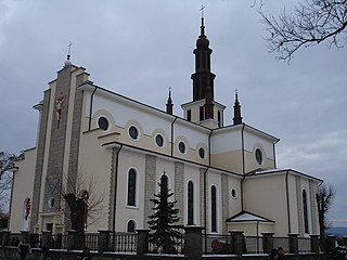
Pawłokoma is a village in the administrative district of Gmina Dynów, within Rzeszów County, Subcarpathian Voivodeship, in south-eastern Poland. It lies approximately 5 kilometres (3 mi) south-east of Dynów and 32 km (20 mi) south-east of the regional capital Rzeszów. It is also 35 km west of Przemyśl. The village has a population of 518.
Gmina Bircza is a rural gmina in Przemyśl County, Subcarpathian Voivodeship, in south-eastern Poland. Its seat is the village of Bircza, which lies approximately 24 kilometres (15 mi) south-west of Przemyśl and 51 km (32 mi) south-east of the regional capital Rzeszów.

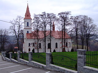
Dynów is a small town in Rzeszów County, Subcarpathian Voivodeship, Poland, with a population of 6,058 (02.06.2009).
Gmina Dubiecko is a rural gmina in Przemyśl County, Subcarpathian Voivodeship, in south-eastern Poland. Its seat is the village of Dubiecko, which lies approximately 28 kilometres (17 mi) west of Przemyśl and 36 km (22 mi) south-east of the regional capital Rzeszów.
Gmina Hyżne is a rural gmina in Rzeszów County, Subcarpathian Voivodeship, in south-eastern Poland. Its seat is the village of Hyżne, which lies approximately 17 kilometres (11 mi) south-east of the regional capital Rzeszów.
Pogórze Przemyskie Landscape Park is a protected area in south-eastern Poland.

Kiewłaki is a village in the administrative district of Gmina Brańsk, within Bielsk County, Podlaskie Voivodeship, in north-eastern Poland. It lies approximately 10 kilometres (6 mi) north of Brańsk, 29 km (18 mi) west of Bielsk Podlaski, and 41 km (25 mi) south-west of the regional capital Białystok.
Usnarszczyzna is a village in the administrative district of Gmina Narew, within Hajnówka County, Podlaskie Voivodeship, in north-eastern Poland. It lies approximately 9 kilometres (6 mi) south of Narew, 12 km (7 mi) north of Hajnówka, and 40 km (25 mi) south-east of the regional capital Białystok.
Skupowo is a village in the administrative district of Gmina Narewka, within Hajnówka County, Podlaskie Voivodeship, in north-eastern Poland, close to the border with Belarus. It lies approximately 4 kilometres (2 mi) west of Narewka, 15 km (9 mi) north-east of Hajnówka, and 48 km (30 mi) south-east of the regional capital Białystok.
Dubiecko is a village in Przemyśl County, Subcarpathian Voivodeship, in southeastern Poland. It is the seat of the gmina called Gmina Dubiecko. It lies approximately 28 kilometres (17 mi) west of Przemyśl and 36 km (22 mi) southeast of the regional capital Rzeszów.
Nozdrzec is a village in Brzozów County, Subcarpathian Voivodeship, in south-eastern Poland. It is the seat of the gmina called Gmina Nozdrzec. It lies approximately 17 kilometres (11 mi) north-east of Brzozów and 32 km (20 mi) south-east of the regional capital Rzeszów.

Bachórz is a village in the administrative district of Gmina Dynów, within Rzeszów County, Subcarpathian Voivodeship, in south-eastern Poland. It lies approximately 4 kilometres (2 mi) east of Dynów and 30 km (19 mi) south-east of the regional capital Rzeszów.

Dąbrówka Starzeńska is a village in the administrative district of Gmina Dynów, within Rzeszów County, Subcarpathian Voivodeship, in south-eastern Poland. It lies approximately 6 kilometres (4 mi) south of Dynów and 33 km (21 mi) south-east of the regional capital Rzeszów.
Dylągowa is a village in the administrative district of Gmina Dynów, within Rzeszów County, Subcarpathian Voivodeship, in south-eastern Poland. It lies approximately 8 kilometres (5 mi) south-east of Dynów and 36 km (22 mi) south-east of the regional capital Rzeszów.
Laskówka is a village in the administrative district of Gmina Dynów, within Rzeszów County, Subcarpathian Voivodeship, in south-eastern Poland. It lies approximately 5 kilometres (3 mi) north-east of Dynów and 29 km (18 mi) south-east of the regional capital Rzeszów.

Łubno is a village in the administrative district of Gmina Dynów, within Rzeszów County, Subcarpathian Voivodeship, in south-eastern Poland. It lies approximately 6 kilometres (4 mi) west of Dynów and 27 km (17 mi) south-east of the regional capital Rzeszów.
Ulanica is a village in the administrative district of Gmina Dynów, within Rzeszów County, Subcarpathian Voivodeship, in south-eastern Poland. It lies approximately 5 kilometres (3 mi) north-west of Dynów and 25 km (16 mi) south-east of the regional capital Rzeszów.

Harta is a village in the administrative district of Gmina Dynów, within Rzeszów County, Subcarpathian Voivodeship, in south-eastern Poland. It lies approximately 5 kilometres (3 mi) north-west of Dynów and 24 km (15 mi) south-east of the regional capital Rzeszów.


