Łubno, Podkarpackie Voivodeship

Last updated
Łubno
Village

Lubno 3.jpg

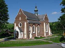
Local Catholic church
Poland adm location map.svg
Red pog.svg
Łubno
Coordinates: 49°49′N22°10′E / 49.817°N 22.167°E / 49.817; 22.167
Country Flag of Poland.svg  Poland
Voivodeship Subcarpathian
County Rzeszów County
Gmina Gmina Dynów
Population 1,300
Website http://www.lubno.republika.pl/

Łubno [ˈwubnɔ] (Ukrainian : Лубно, Lubno) is a village in the administrative district of Gmina Dynów, within Rzeszów County, Subcarpathian Voivodeship, in south-eastern Poland. [1] It lies approximately 6 kilometres (4 mi) west of Dynów and 27 km (17 mi) south-east of the regional capital Rzeszów.

Ukrainian language language member of the East Slavic subgroup of the Slavic languages

Ukrainian is an East Slavic language. It is the official state language of Ukraine and first of two principal languages of Ukrainians; it is one of the three official languages in the unrecognized state of Transnistria, the other two being Romanian and Russian. Written Ukrainian uses a variant of the Cyrillic script.

Village Small clustered human settlement smaller than a town

A village is a clustered human settlement or community, larger than a hamlet but smaller than a town, with a population ranging from a few hundred to a few thousand. Though villages are often located in rural areas, the term urban village is also applied to certain urban neighborhoods. Villages are normally permanent, with fixed dwellings; however, transient villages can occur. Further, the dwellings of a village are fairly close to one another, not scattered broadly over the landscape, as a dispersed settlement.

Gmina Dynów is a rural gmina in Rzeszów County, Subcarpathian Voivodeship, in south-eastern Poland. Its seat is the town of Dynów, although the town is not part of the territory of the gmina.

The village has a population of 1,300.

Related Research Articles

Pawłokoma Village in Subcarpathian, Poland

Pawłokoma is a village in the administrative district of Gmina Dynów, within Rzeszów County, Subcarpathian Voivodeship, in south-eastern Poland. It lies approximately 5 kilometres (3 mi) south-east of Dynów and 32 km (20 mi) south-east of the regional capital Rzeszów. It is also 35 km west of Przemyśl. The village has a population of 518.

Dynów Place in Subcarpathian, Poland

Dynów is a small town in Rzeszów County, Subcarpathian Voivodeship, Poland, with a population of 6,058 (02.06.2009).

Miastkowo Village in Podlaskie, Poland

Miastkowo is a village in Łomża County, Podlaskie Voivodeship, in north-eastern Poland. It is the seat of the gmina called Gmina Miastkowo. It lies approximately 18 kilometres (11 mi) west of Łomża and 91 km (57 mi) west of the regional capital Białystok.

Górale, Łódź Voivodeship Village in Łódź, Poland

Górale is a village in the administrative district of Gmina Łęki Szlacheckie, within Piotrków County, Łódź Voivodeship, in central Poland. It lies approximately 3 kilometres (2 mi) south of Łęki Szlacheckie, 28 km (17 mi) south of Piotrków Trybunalski, and 73 km (45 mi) south of the regional capital Łódź.

Łubno Opace Village in Subcarpathian, Poland

Łubno Opace is a village in the administrative district of Gmina Tarnowiec, within Jasło County, Subcarpathian Voivodeship, in south-eastern Poland. It lies approximately 10 kilometres (6 mi) south of Tarnowiec, 13 km (8 mi) south-east of Jasło, and 51 km (32 mi) south-west of the regional capital Rzeszów.

Łubno Szlacheckie Village in Subcarpathian, Poland

Łubno Szlacheckie is a village in the administrative district of Gmina Tarnowiec, within Jasło County, Subcarpathian Voivodeship, in south-eastern Poland. It lies approximately 10 kilometres (6 mi) south of Tarnowiec, 13 km (8 mi) south-east of Jasło, and 51 km (32 mi) south-west of the regional capital Rzeszów.

Koniuszki, Podkarpackie Voivodeship Village in Subcarpathian, Poland

Koniuszki is a village in the administrative district of Gmina Fredropol, within Przemyśl County, Subcarpathian Voivodeship, in south-eastern Poland, close to the border with Ukraine. It lies approximately 6 kilometres (4 mi) east of Fredropol, 9 km (6 mi) south-east of Przemyśl, and 69 km (43 mi) south-east of the regional capital Rzeszów.

Borówki, Podkarpackie Voivodeship Village in Subcarpathian, Poland

Borówki is a village in the administrative district of Gmina Chmielnik, within Rzeszów County, Subcarpathian Voivodeship, in south-eastern Poland. It lies approximately 4 kilometres (2 mi) south-east of Chmielnik and 15 km (9 mi) south-east of the regional capital Rzeszów.

Nozdrzec Village in Subcarpathian, Poland

Nozdrzec is a village in Brzozów County, Subcarpathian Voivodeship, in south-eastern Poland. It is the seat of the gmina called Gmina Nozdrzec. It lies approximately 17 kilometres (11 mi) north-east of Brzozów and 32 km (20 mi) south-east of the regional capital Rzeszów.

Bachórz, Podkarpackie Voivodeship Village in Subcarpathian, Poland

Bachórz is a village in the administrative district of Gmina Dynów, within Rzeszów County, Subcarpathian Voivodeship, in south-eastern Poland. It lies approximately 4 kilometres (2 mi) east of Dynów and 30 km (19 mi) south-east of the regional capital Rzeszów.

Dąbrówka Starzeńska Village in Subcarpathian, Poland

Dąbrówka Starzeńska is a village in the administrative district of Gmina Dynów, within Rzeszów County, Subcarpathian Voivodeship, in south-eastern Poland. It lies approximately 6 kilometres (4 mi) south of Dynów and 33 km (21 mi) south-east of the regional capital Rzeszów.

Dylągowa Village in Subcarpathian, Poland

Dylągowa is a village in the administrative district of Gmina Dynów, within Rzeszów County, Subcarpathian Voivodeship, in south-eastern Poland. It lies approximately 8 kilometres (5 mi) south-east of Dynów and 36 km (22 mi) south-east of the regional capital Rzeszów.

Laskówka, Podkarpackie Voivodeship Village in Subcarpathian, Poland

Laskówka is a village in the administrative district of Gmina Dynów, within Rzeszów County, Subcarpathian Voivodeship, in south-eastern Poland. It lies approximately 5 kilometres (3 mi) north-east of Dynów and 29 km (18 mi) south-east of the regional capital Rzeszów.

Ulanica Village in Subcarpathian, Poland

Ulanica is a village in the administrative district of Gmina Dynów, within Rzeszów County, Subcarpathian Voivodeship, in south-eastern Poland. It lies approximately 5 kilometres (3 mi) north-west of Dynów and 25 km (16 mi) south-east of the regional capital Rzeszów.

Wyręby, Podkarpackie Voivodeship Village in Subcarpathian, Poland

Wyręby is a village in the administrative district of Gmina Dynów, within Rzeszów County, Subcarpathian Voivodeship, in south-eastern Poland. It lies approximately 8 kilometres (5 mi) west of Dynów and 25 km (16 mi) south of the regional capital Rzeszów.

Harta, Poland Village in Subcarpathian, Poland

Harta is a village in the administrative district of Gmina Dynów, within Rzeszów County, Subcarpathian Voivodeship, in south-eastern Poland. It lies approximately 5 kilometres (3 mi) north-west of Dynów and 24 km (15 mi) south-east of the regional capital Rzeszów.

Falejówka Village in Subcarpathian, Poland

Falejówka is a village in the administrative district of Gmina Sanok, within Sanok County, Subcarpathian Voivodeship, in south-eastern Poland. It lies approximately 10 kilometres (6 mi) north of Sanok and 46 km (29 mi) south of the regional capital Rzeszów.

Zalesie, Stalowa Wola County Village in Subcarpathian, Poland

Zalesie is a village in the administrative district of Gmina Radomyśl nad Sanem, within Stalowa Wola County, Subcarpathian Voivodeship, in south-eastern Poland. It lies approximately 10 kilometres (6 mi) west of Radomyśl nad Sanem, 20 km (12 mi) north-west of Stalowa Wola, and 74 km (46 mi) north of the regional capital Rzeszów.

Glinki, Działdowo County Village in Warmian-Masurian, Poland

Glinki is a village in the administrative district of Gmina Lidzbark, within Działdowo County, Warmian-Masurian Voivodeship, in northern Poland. It lies approximately 11 kilometres (7 mi) south of Lidzbark, 26 km (16 mi) west of Działdowo, and 83 km (52 mi) south-west of the regional capital Olsztyn.

References

Coordinates: 49°49′00″N22°10′00″E / 49.8167°N 22.1667°E / 49.8167; 22.1667

Geographic coordinate system Coordinate system

A geographic coordinate system is a coordinate system that enables every location on Earth to be specified by a set of numbers, letters or symbols. The coordinates are often chosen such that one of the numbers represents a vertical position and two or three of the numbers represent a horizontal position; alternatively, a geographic position may be expressed in a combined three-dimensional Cartesian vector. A common choice of coordinates is latitude, longitude and elevation. To specify a location on a plane requires a map projection.