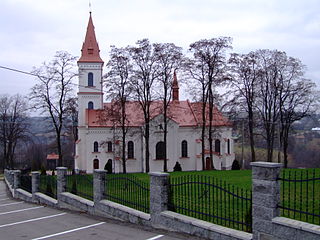
Rzeszów County is a unit of territorial administration and local government (powiat) in Subcarpathian Voivodeship, south-eastern Poland. It came into being on January 1, 1999, as a result of the Polish local government reforms passed in 1998. Its administrative seat is the city of Rzeszów, although the city is not part of the county. The county contains six towns: Dynów, 28 km (17 mi) south-east of Rzeszów, Boguchwała, 8 km (5 mi) south-west of Rzeszów, Głogów Małopolski, 16 km (10 mi) north of Rzeszów, Sokołów Małopolski, 24 km (15 mi) north of Rzeszów, Tyczyn, 8 km (5 mi) south of Rzeszów, and Błażowa, 17 km (11 mi) south-east of Rzeszów.

Pawłokoma is a village in the administrative district of Gmina Dynów, within Rzeszów County, Subcarpathian Voivodeship, in south-eastern Poland. It lies approximately 5 kilometres (3 mi) south-east of Dynów and 32 km (20 mi) south-east of the regional capital Rzeszów. It is also 35 km west of Przemyśl.
Gmina Bircza is a rural gmina in Przemyśl County, Subcarpathian Voivodeship, in south-eastern Poland. Its seat is the village of Bircza, which lies approximately 24 kilometres (15 mi) south-west of Przemyśl and 51 km (32 mi) south-east of the regional capital Rzeszów.

Dynów is a small town in Rzeszów County, Subcarpathian Voivodeship, Poland, with a population of 6,058 (02.06.2009).
Gmina Nozdrzec is a rural gmina in Brzozów County, Subcarpathian Voivodeship, in south-eastern Poland. Its seat is the village of Nozdrzec, which lies approximately 17 kilometres (11 mi) north-east of Brzozów and 32 km (20 mi) south-east of the regional capital Rzeszów.
Gmina Dubiecko is a rural gmina in Przemyśl County, Subcarpathian Voivodeship, in south-eastern Poland. Its seat is the village of Dubiecko, which lies approximately 28 kilometres (17 mi) west of Przemyśl and 36 km (22 mi) south-east of the regional capital Rzeszów.
Gmina Jawornik Polski is a rural gmina in Przeworsk County, Subcarpathian Voivodeship, in south-eastern Poland. Its seat is the village of Jawornik Polski, which lies approximately 26 kilometres (16 mi) south-west of Przeworsk and 25 km (16 mi) south-east of the regional capital Rzeszów.
Gmina Błażowa is an urban-rural gmina in Rzeszów County, Subcarpathian Voivodeship, in south-eastern Poland. Its seat is the town of Błażowa, which lies approximately 17 kilometres (11 mi) south-east of the regional capital Rzeszów.
Gmina Hyżne is a rural gmina in Rzeszów County, Subcarpathian Voivodeship, in south-eastern Poland. Its seat is the village of Hyżne, which lies approximately 17 kilometres (11 mi) south-east of the regional capital Rzeszów.
Przemyśl Foothills Landscape Park is a protected area in south-eastern Poland.

Dubiecko is a town in Przemyśl County, Subcarpathian Voivodeship, in southeastern Poland. It is the seat of the gmina called Gmina Dubiecko. It lies approximately 28 kilometres (17 mi) west of Przemyśl and 36 km (22 mi) southeast of the regional capital Rzeszów.

Nozdrzec is a village in Brzozów County, Subcarpathian Voivodeship, in south-eastern Poland. It is the seat of the gmina called Gmina Nozdrzec. It lies approximately 17 kilometres (11 mi) north-east of Brzozów and 32 km (20 mi) south-east of the regional capital Rzeszów.

Dąbrówka Starzeńska is a village in the administrative district of Gmina Dynów, within Rzeszów County, Subcarpathian Voivodeship, in south-eastern Poland. It lies approximately 6 kilometres (4 mi) south of Dynów and 33 km (21 mi) south-east of the regional capital Rzeszów.

Dylągowa is a village in the administrative district of Gmina Dynów, within Rzeszów County, Subcarpathian Voivodeship, in south-eastern Poland. It lies approximately 8 kilometres (5 mi) south-east of Dynów and 36 km (22 mi) south-east of the regional capital Rzeszów.
Laskówka is a village in the administrative district of Gmina Dynów, within Rzeszów County, Subcarpathian Voivodeship, in south-eastern Poland. It lies approximately 5 kilometres (3 mi) north-east of Dynów and 29 km (18 mi) south-east of the regional capital Rzeszów.

Łubno is a village in the administrative district of Gmina Dynów, within Rzeszów County, Subcarpathian Voivodeship, in south-eastern Poland. It lies approximately 6 kilometres (4 mi) west of Dynów and 27 km (17 mi) south-east of the regional capital Rzeszów.
Ulanica is a village in the administrative district of Gmina Dynów, within Rzeszów County, Subcarpathian Voivodeship, in south-eastern Poland. It lies approximately 5 kilometres (3 mi) north-west of Dynów and 25 km (16 mi) south-east of the regional capital Rzeszów.
Wyręby is a village in the administrative district of Gmina Dynów, within Rzeszów County, Subcarpathian Voivodeship, in south-eastern Poland. It lies approximately 8 kilometres (5 mi) west of Dynów and 25 km (16 mi) south of the regional capital Rzeszów.

Harta is a village in the administrative district of Gmina Dynów, within Rzeszów County, Subcarpathian Voivodeship, in south-eastern Poland. It lies approximately 5 kilometres (3 mi) north-west of Dynów and 24 km (15 mi) south-east of the regional capital Rzeszów.


