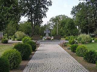
Rzeszów County is a unit of territorial administration and local government (powiat) in Subcarpathian Voivodeship, south-eastern Poland. It came into being on January 1, 1999, as a result of the Polish local government reforms passed in 1998. Its administrative seat is the city of Rzeszów, although the city is not part of the county. The county contains six towns: Dynów, 28 km (17 mi) south-east of Rzeszów, Boguchwała, 8 km (5 mi) south-west of Rzeszów, Głogów Małopolski, 16 km (10 mi) north of Rzeszów, Sokołów Małopolski, 24 km (15 mi) north of Rzeszów, Tyczyn, 8 km (5 mi) south of Rzeszów, and Błażowa, 17 km (11 mi) south-east of Rzeszów.

Krywe is a village in the administrative district of Gmina Lutowiska, within Bieszczady County, Subcarpathian Voivodeship, in south-eastern Poland, close to the border with Ukraine. It lies approximately 13 kilometres (8 mi) west of Lutowiska, 22 km (14 mi) south of Ustrzyki Dolne, and 95 km (59 mi) south-east of the regional capital Rzeszów.
Ustrzyki Górne is a village in the administrative district of Gmina Lutowiska, within Bieszczady County, Subcarpathian Voivodeship, in south-eastern Poland, close to the border with Ukraine. It lies approximately 17 kilometres (11 mi) south of Lutowiska, 37 km (23 mi) south of Ustrzyki Dolne, and 114 km (71 mi) south-east of the regional capital Rzeszów.
Wołosate is a village in the administrative district of Gmina Lutowiska, within Bieszczady County, Subcarpathian Voivodeship, in south-eastern Poland, close to the border with Ukraine. It lies approximately 22 kilometres (14 mi) south of Lutowiska, 43 km (27 mi) south of Ustrzyki Dolne, and 120 km (75 mi) south-east of the regional capital Rzeszów. It is also the southernmost inhabited village in Poland.
Łazy is a village in the administrative district of Gmina Radymno, within Jarosław County, Subcarpathian Voivodeship, in south-eastern Poland, close to the border with Ukraine. It lies approximately 6 kilometres (4 mi) north-east of Radymno, 14 km (9 mi) east of Jarosław, and 62 km (39 mi) east of the regional capital Rzeszów.

Skołoszów is a village in the administrative district of Gmina Radymno, within Jarosław County, Subcarpathian Voivodeship, in south-eastern Poland, close to the border with Ukraine. It lies approximately 4 kilometres (2 mi) south of Radymno, 15 km (9 mi) south-east of Jarosław, and 59 km (37 mi) east of the regional capital Rzeszów.
Piskorowice is a village in the administrative district of Gmina Leżajsk, within Leżajsk County, Subcarpathian Voivodeship, in south-eastern Poland. It lies approximately 8 kilometres (5 mi) south-east of Leżajsk and 43 km (27 mi) north-east of the regional capital Rzeszów.
Nozdrzec is a village in Brzozów County, Subcarpathian Voivodeship, in south-eastern Poland. It is the seat of the gmina called Gmina Nozdrzec. It lies approximately 17 kilometres (11 mi) north-east of Brzozów and 32 km (20 mi) south-east of the regional capital Rzeszów.

Bachórz is a village in the administrative district of Gmina Dynów, within Rzeszów County, Subcarpathian Voivodeship, in south-eastern Poland. It lies approximately 4 kilometres (2 mi) east of Dynów and 30 km (19 mi) south-east of the regional capital Rzeszów.

Dąbrówka Starzeńska is a village in the administrative district of Gmina Dynów, within Rzeszów County, Subcarpathian Voivodeship, in south-eastern Poland. It lies approximately 6 kilometres (4 mi) south of Dynów and 33 km (21 mi) south-east of the regional capital Rzeszów.
Dylągowa is a village in the administrative district of Gmina Dynów, within Rzeszów County, Subcarpathian Voivodeship, in south-eastern Poland. It lies approximately 8 kilometres (5 mi) south-east of Dynów and 36 km (22 mi) south-east of the regional capital Rzeszów.
Laskówka is a village in the administrative district of Gmina Dynów, within Rzeszów County, Subcarpathian Voivodeship, in south-eastern Poland. It lies approximately 5 kilometres (3 mi) north-east of Dynów and 29 km (18 mi) south-east of the regional capital Rzeszów.

Łubno is a village in the administrative district of Gmina Dynów, within Rzeszów County, Subcarpathian Voivodeship, in south-eastern Poland. It lies approximately 6 kilometres (4 mi) west of Dynów and 27 km (17 mi) south-east of the regional capital Rzeszów.
Ulanica is a village in the administrative district of Gmina Dynów, within Rzeszów County, Subcarpathian Voivodeship, in south-eastern Poland. It lies approximately 5 kilometres (3 mi) north-west of Dynów and 25 km (16 mi) south-east of the regional capital Rzeszów.
Wyręby is a village in the administrative district of Gmina Dynów, within Rzeszów County, Subcarpathian Voivodeship, in south-eastern Poland. It lies approximately 8 kilometres (5 mi) west of Dynów and 25 km (16 mi) south of the regional capital Rzeszów.

Harta is a village in the administrative district of Gmina Dynów, within Rzeszów County, Subcarpathian Voivodeship, in south-eastern Poland. It lies approximately 5 kilometres (3 mi) north-west of Dynów and 24 km (15 mi) south-east of the regional capital Rzeszów.

Krościenko is a village in the administrative district of Gmina Ustrzyki Dolne, within Bieszczady County, Subcarpathian Voivodeship, in south-eastern Poland, near the border with Ukraine. It lies approximately 7 kilometres (4 mi) north-east of Ustrzyki Dolne and 79 km (49 mi) south-east of the regional capital Rzeszów.

Moczary is a village in the administrative district of Gmina Ustrzyki Dolne, within Bieszczady County, Subcarpathian Voivodeship, in south-eastern Poland, near the border with Ukraine. It lies approximately 8 kilometres (5 mi) south-east of Ustrzyki Dolne and 87 km (54 mi) south-east of the regional capital Rzeszów.