Wyszków | |
---|---|
Village | |
Coordinates: 50°57′55″N14°59′40″E / 50.96528°N 14.99444°E Coordinates: 50°57′55″N14°59′40″E / 50.96528°N 14.99444°E | |
Country | ![]() |
Voivodeship | Lower Silesian |
County | Zgorzelec |
Gmina | Bogatynia |
Population | 170 |
Wyszków [ˈvɨʂkuf] (German : Maxdorf) is a village in the administrative district of Gmina Bogatynia, within Zgorzelec County, Lower Silesian Voivodeship, in south-western Poland, close to the Czech and German borders. [1] Prior to 1945 it was in Germany.
German is a West Germanic language that is mainly spoken in Central Europe. It is the most widely spoken and official or co-official language in Germany, Austria, Switzerland, South Tyrol (Italy), the German-speaking Community of Belgium, and Liechtenstein. It is also one of the three official languages of Luxembourg and a co-official language in the Opole Voivodeship in Poland. The languages which are most similar to German are the other members of the West Germanic language branch: Afrikaans, Dutch, English, the Frisian languages, Low German/Low Saxon, Luxembourgish, and Yiddish. There are also strong similarities in vocabulary with Danish, Norwegian and Swedish, although those belong to the North Germanic group. German is the second most widely spoken Germanic language, after English.
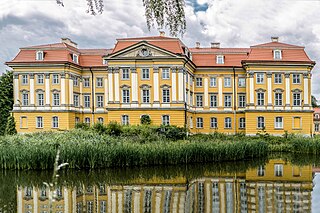
Gmina Bogatynia is an urban-rural gmina in Zgorzelec County, Lower Silesian Voivodeship, in south-western Poland, bordering both the Czech Republic and Germany. Its seat is the town of Bogatynia, which lies approximately 27 kilometres (17 mi) south of Zgorzelec, and 147 kilometres (91 mi) west of the regional capital Wrocław.
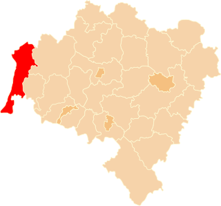
Zgorzelec County is a unit of territorial administration and local government (powiat) in Lower Silesian Voivodeship, Poland. It came into being on January 1, 1999, as a result of the Polish local government reforms passed in 1998. It is situated in the extreme south-west of Poland, bordering both Germany and the Czech Republic. The county covers an area of 838.1 square kilometres (323.6 sq mi). Its administrative seat is Zgorzelec, on the German border; the other towns in the county are Bogatynia, Pieńsk, Zawidów and Węgliniec.
It lies approximately 6 kilometres (4 mi) north of Bogatynia, 21 kilometres (13 mi) south of Zgorzelec, and 145 kilometres (90 mi) west of the regional capital Wrocław.
Bogatynia ( is a town in Zgorzelec County, Lower Silesian Voivodeship, in south-western Poland.
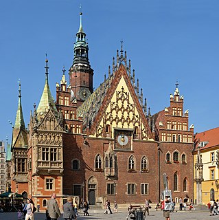
Wrocław is a city in western Poland and the largest city in the historical region of Silesia. It lies on the banks of the River Oder in the Silesian Lowlands of Central Europe, roughly 350 kilometres (220 mi) from the Baltic Sea to the north and 40 kilometres (25 mi) from the Sudeten Mountains to the south. The population of Wrocław in 2018 was 639,258, making it the fourth-largest city in Poland and the main city of Wrocław agglomeration.
The village has a population of 170.
Białopole is a village in the administrative district of Gmina Bogatynia, within Zgorzelec County, Lower Silesian Voivodeship, in south-western Poland, close to the Czech and German borders. Prior to 1945 it was in Germany.
Bratków is a village in the administrative district of Gmina Bogatynia, within Zgorzelec County, Lower Silesian Voivodeship, in south-western Poland, close to the Czech and German borders. Prior to 1945 it was in Germany.
Działoszyn is a village in the administrative district of Gmina Bogatynia, within Zgorzelec County, Lower Silesian Voivodeship, in south-western Poland, close to the Czech and German borders. Prior to 1945 it was in Germany.
Jasna Góra is a village in the administrative district of Gmina Bogatynia, within Zgorzelec County, Lower Silesian Voivodeship, in south-western Poland, close to the Czech and German borders. Prior to 1945 it was in Germany.
Kopaczów is a village in the administrative district of Gmina Bogatynia, within Zgorzelec County, Lower Silesian Voivodeship, in south-western Poland, close to the Czech and German borders. Prior to 1945 it was in Germany.
Krzewina is a village in the administrative district of Gmina Bogatynia, within Zgorzelec County, Lower Silesian Voivodeship, in south-western Poland, close to the Czech and German borders. It lies approximately 12 kilometres (7 mi) north of Bogatynia, 16 km (10 mi) south of Zgorzelec, and 147 km (91 mi) west of the regional capital Wrocław.
Lutogniewice is a village in the administrative district of Gmina Bogatynia, within Zgorzelec County, Lower Silesian Voivodeship, in south-western Poland, close to the Czech and German borders. Prior to 1945 it was in Germany.
Opolno-Zdrój is a village in the administrative district of Gmina Bogatynia, within Zgorzelec County, Lower Silesian Voivodeship, in south-western Poland, close to the Czech and German borders. Prior to 1945 it was in Germany.
Porajów is a village in the administrative district of Gmina Bogatynia, within Zgorzelec County, Lower Silesian Voivodeship, in south-western Poland, close to the Czech and German borders. Prior to 1945 it was a part of Zittau, Germany.
Posada is a village in the administrative district of Gmina Bogatynia, within Zgorzelec County, Lower Silesian Voivodeship, in south-western Poland, close to the Czech and German borders. Prior to 1945 it was in Germany.
Sieniawka is a village in the administrative district of Gmina Bogatynia, within Zgorzelec County, Lower Silesian Voivodeship, in south-western Poland, close to the Czech and German borders. Prior to 1945 it was part of the German state of Saxony, from which it has been cut off by the Oder Neisse line.
Wolanów is a village in the administrative district of Gmina Bogatynia, within Zgorzelec County, Lower Silesian Voivodeship, in south-western Poland, close to the Czech and German borders. Prior to 1945 it was in Germany.
Rybarzowice is a former village in the administrative district of Gmina Bogatynia, within Zgorzelec County, Lower Silesian Voivodeship, in south-western Poland, close to the Czech and German borders. Prior to 1945 it was in Germany.
Studniska Dolne is a village in the administrative district of Gmina Sulików, within Zgorzelec County, Lower Silesian Voivodeship, in south-western Poland, close to the Czech border. It lies approximately 4 kilometres (2 mi) north of Sulików, 7 kilometres (4 mi) south-east of Zgorzelec, and 139 kilometres (86 mi) west of the regional capital Wrocław.
Gmina Zgorzelec is a rural gmina in Zgorzelec County, Lower Silesian Voivodeship, in south-western Poland, on the German border. Its seat is the town of Zgorzelec, although the town is not part of the territory of the gmina.
Osiek Łużycki is a village in the administrative district of Gmina Zgorzelec, within Zgorzelec County, Lower Silesian Voivodeship, in south-western Poland, close to the German border. Prior to 1945 it was in Germany. Following World War II the native German populace was expelled and replaced by Poles.
Radomierzyce is a village in the administrative district of Gmina Zgorzelec, within Zgorzelec County, Lower Silesian Voivodeship, in south-western Poland, close to the German border. It is located in the historical region of Lusatia.
![]() | This Zgorzelec County location article is a stub. You can help Wikipedia by expanding it. |