
Czchów is a town in Brzesko County, Lesser Poland Voivodeship, Poland, with 2,205 inhabitants (2004). It lies on the Dunajec river, and along National Road Nr. 75. In the period 1928 - 2000, Czchów was a village.
Gmina Dębno is a rural gmina in Brzesko County, Lesser Poland Voivodeship, in southern Poland. Its seat is the village of Dębno, which lies approximately 8 kilometres (5 mi) east of Brzesko and 57 km (35 mi) east of the regional capital Kraków.
Gmina Gnojnik is a rural gmina in Brzesko County, Lesser Poland Voivodeship, in southern Poland. Its seat is the village of Gnojnik, which lies approximately 10 kilometres (6 mi) south of Brzesko and 52 km (32 mi) south-east of the regional capital Kraków.
Gmina Iwkowa is a rural gmina in Brzesko County, Lesser Poland Voivodeship, in southern Poland. Its seat is the village of Iwkowa, which lies approximately 18 kilometres (11 mi) south of Brzesko and 53 km (33 mi) south-east of the regional capital Kraków.

Ciężkowice-Rożnów Landscape Park is a protected area in southern Poland, established in 1995, covering an area of 176.34 square kilometres (68.09 sq mi).

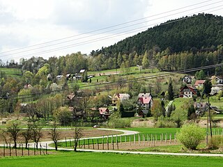
Będzieszyna is a village in the administrative district of Gmina Czchów, within Brzesko County, Lesser Poland Voivodeship, in southern Poland. It lies approximately 5 kilometres (3 mi) south-west of Czchów, 17 km (11 mi) south of Brzesko, and 58 km (36 mi) south-east of the regional capital Kraków.
Biskupice Melsztyńskie is a village in the administrative district of Gmina Czchów, within Brzesko County, Lesser Poland Voivodeship, in southern Poland. It lies approximately 4 kilometres (2 mi) north-east of Czchów, 14 km (9 mi) south-east of Brzesko, and 60 km (37 mi) east of the regional capital Kraków.
Domosławice is a village in the administrative district of Gmina Czchów, within Brzesko County, Lesser Poland Voivodeship, in southern Poland. It lies approximately 4 kilometres (2 mi) north-east of Czchów, 14 km (9 mi) south-east of Brzesko, and 61 km (38 mi) east of the regional capital Kraków.
Jurków is a village in the administrative district of Gmina Czchów, within Brzesko County, Lesser Poland Voivodeship, in southern Poland. It lies approximately 1 kilometre (1 mi) south-west of Czchów, 14 km (9 mi) south of Brzesko, and 59 km (37 mi) south-east of the regional capital Kraków.
Piaski-Drużków is a village in the administrative district of Gmina Czchów, within Brzesko County, Lesser Poland Voivodeship, in southern Poland. It lies approximately 4 kilometres (2 mi) south of Czchów, 18 km (11 mi) south of Brzesko, and 60 km (37 mi) south-east of the regional capital Kraków.
Tworkowa is a village in the administrative district of Gmina Czchów, within Brzesko County, Lesser Poland Voivodeship, in southern Poland. It lies approximately 3 kilometres (2 mi) north-west of Czchów, 12 km (7 mi) south of Brzesko, and 57 km (35 mi) south-east of the regional capital Kraków.
Tymowa is a village in the administrative district of Gmina Czchów, within Brzesko County, Lesser Poland Voivodeship, in southern Poland. It lies approximately 4 kilometres (2 mi) west of Czchów, 13 km (8 mi) south of Brzesko, and 56 km (35 mi) south-east of the regional capital Kraków.
Złota is a village in the administrative district of Gmina Czchów, within Brzesko County, Lesser Poland Voivodeship, in southern Poland. It lies approximately 4 kilometres (2 mi) north of Czchów, 12 km (7 mi) south-east of Brzesko, and 59 km (37 mi) east of the regional capital Kraków.
Lewniowa is a village in the administrative district of Gmina Gnojnik, within Brzesko County, Lesser Poland Voivodeship, in southern Poland. It lies approximately 3 kilometres (2 mi) east of Gnojnik, 10 km (6 mi) south of Brzesko, and 54 km (34 mi) east of the regional capital Kraków.

Iwkowa is a village in Brzesko County, Lesser Poland Voivodeship, in southern Poland. It is the seat of the gmina called Gmina Iwkowa. It lies approximately 18 kilometres (11 mi) south of Brzesko and 53 km (33 mi) south-east of the regional capital Kraków.
Wojakowa is a village in the administrative district of Gmina Iwkowa, within Brzesko County, Lesser Poland Voivodeship, in southern Poland. It lies approximately 1 kilometre (1 mi) south-west of Iwkowa, 18 km (11 mi) south of Brzesko, and 53 km (33 mi) south-east of the regional capital Kraków.
Kopacze Wielkie is a village in the administrative district of Gmina Szczurowa, within Brzesko County, Lesser Poland Voivodeship, in southern Poland. It lies approximately 6 kilometres (4 mi) north of Szczurowa, 23 km (14 mi) north of Brzesko, and 51 km (32 mi) east of the regional capital Kraków.

Rudy-Rysie is a village in the administrative district of Gmina Szczurowa, within Brzesko County, Lesser Poland Voivodeship, in southern Poland. It lies approximately 8 kilometres (5 mi) south of Szczurowa, 10 km (6 mi) north of Brzesko, and 50 km (31 mi) east of the regional capital Kraków.


