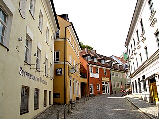
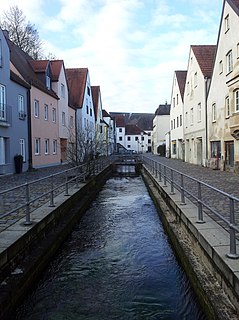
Dachau is a town in Upper Bavaria district of Bavaria, a state in the southern part of Germany. It is a major district town—a Große Kreisstadt—of the administrative region of Upper Bavaria, about 20 kilometres north-west of Munich. It is now a popular residential area for people working in Munich, with roughly 45,000 inhabitants. The historic centre of town with its 18th-century castle is situated on an elevation and visible over a great distance.
Bad Tölz-Wolfratshausen is a Landkreis (district) in Bavaria, Germany. It is bounded by Austria and the districts of Garmisch-Partenkirchen, Weilheim-Schongau, Starnberg, Munich and Miesbach.

The Isar is a river in Tyrol, Austria and Bavaria, Germany, which is not navigable for watercraft above raft size. Its source is in the Karwendel range of the Alps in Tyrol; it enters Germany near Mittenwald and flows through Bad Tölz, Munich, and Landshut before reaching the Danube near Deggendorf. At 295 km (183 mi) in length, it is the fourth largest river in Bavaria, after the Danube, Inn, and Main. It is Germany's second most important tributary of the Danube after the Inn.
Munich is a Landkreis (district) in Bavaria, Germany. It borders the districts of Dachau, Freising, Erding, Ebersberg, Rosenheim, Miesbach, Bad Tölz-Wolfratshausen, Starnberg, Fürstenfeldbruck, and almost encircles district-free city Munich itself, which is the district seat.

Ammersee is a Zungenbecken lake in Upper Bavaria, Germany, southwest of Munich between the towns of Herrsching and Dießen am Ammersee. With a surface area of approximately 47 square kilometres (18 sq mi), it is the sixth largest lake in Germany. The lake is at an elevation of 533 metres (1,749 ft), and has a maximum depth of 81 metres (266 ft). Like other Bavarian lakes, Ammersee developed as a result of the ice age glaciers melting. Ammersee is fed by the River Ammer, which flows as the Amper out of the lake. Like neighbouring Lake Starnberg - deeper, bigger in surface area, similar in shape - it is a popular location for watersports.
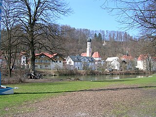
Wolfratshausen is a town of the district of Bad Tölz-Wolfratshausen, located in Bavaria, Germany. The town had a population of 19,033 as of 31 December 2019.

The Loisach is a river that flows through Tyrol, Austria and Bavaria, Germany. Its name might be Celtic in origin, from Proto-Celtic *lawo and *iskā, both of which mean "water". The Loisach goes through the great swamp Murnauer Moos.

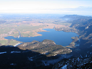
Lake Starnberg, or Starnberger See[ˈʃtaʁnbɛʁɡɐ ˌzeː](listen)) — called Lake Würm, or Würmsee[ˈvʏʁmˌzeː], until 1962 — is Germany's second-largest body of fresh water, having great depth, and fifth-largest lake by area. It and its surroundings lie in three different Bavarian districts, or Landkreise. The lake is property of the state and accordingly managed by the Bavarian Administration of State-Owned Palaces, Gardens and Lakes.

Gauting is a municipality in the district of Starnberg, in Bavaria, Germany with a population of approximately 20,000. It is situated on the river Würm, 17 kilometres (11 mi) southwest of Munich and is a part of the Munich metropolitan area.
Kochelsee or Lake Kochel is located 70 kilometres (43 mi) south of Munich on the edge of the Bavarian Alps. The western third of the lake lies within the borders of the town of Schlehdorf, while the rest belongs to Kochel am See. The southern edge of the lake lies up against the mountains and the northern shore is bordered by bog lands. The history of the settlement of Kochel begins with Birg bei Altjoch, a rock extrusion on the shore of the lake. The name Kochel is derived from the Latin cocula meaning head or cone.
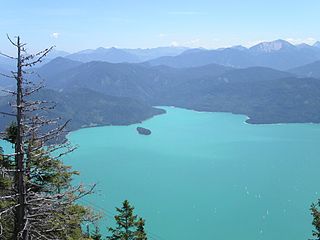
Walchensee or Lake Walchen is one of the deepest and largest alpine lakes in Germany, with a maximum depth of 192.3 metres (631 ft) and an area of 16.4 square kilometres (6.3 sq mi). The lake is 75 kilometres (47 mi) south of Munich in the middle of the Bavarian Alps. The entire lake, including the island of Sassau, is within the municipality of Kochel. Landowner of the lake and island area is the Bavarian State. To the east and the south, the lake borders the municipality of Jachenau.
The 1999 Pentecost flood was a 100-year flood around the Pentecost season in 1999 that mostly affected Bavaria, Vorarlberg and Tirol. It was caused by heavy rainfall coinciding with the regular Alpine meltwater.

The Munich–Garmisch-Partenkirchen railway is a single track, electrified main line railway in the southern part of the German state of Bavaria. It runs from Munich via Starnberg and Murnau to Garmisch-Partenkirchen. The first part of it was opened in 1854 and is one of the oldest lines in Germany.

The Leutascher Ache is a river of Tyrol, Austria and of Bavaria, Germany, a left tributary of the Isar.
Moosach is a 38-kilometre-long (24 mi) left tributary of the river Isar near Munich in Bavaria, Germany. It could also be described as a tributary of the river Amper, because of the stream Mühlbach that splits away carrying about 30% of the water just before the Moosach joins the Isar. After passing through Freising, the main flow enters the Isar near Oberhummel. The Mühlbach branch continues through Moosburg and enters the Amper close to its confluence with the Isar.
Lüßbach is a river of Bavaria, Germany. It flows into Lake Starnberg, which is drained by the Würm, near Starnberg.

The Maisinger Bach is a river in Bavaria, Germany. It flows into Lake Starnberg, which is drained by the Würm, in Starnberg.

The following outline is provided as an overview of and topical guide to Munich:

The Munich gravel plain is an outwash plain in Upper Bavaria, Germany, formed during Late Pleistocene glacial periods. Characterized by its very wide extension, it comprises sandur terraces and the floodplain of the Isar river. These most recent deposits overlie the Neogene Molasse basin of the Alpine Foreland, which in contrast comprises fine-grained fluviatile and lacustrine facies.
