Karmacs is a village in Zala County, Hungary.

Dębno is a village in the administrative district of Gmina Żmigród, within Trzebnica County, Lower Silesian Voivodeship, in south-western Poland. Prior to 1945 it was in Germany.

Siodłowice is a village in the administrative district of Gmina Ząbkowice Śląskie, within Ząbkowice Śląskie County, Lower Silesian Voivodeship, in south-western Poland. Prior to 1945 it was in Germany.

Nadolnik is a village in the administrative district of Gmina Tuchola, within Tuchola County, Kuyavian-Pomeranian Voivodeship, in north-central Poland. It lies approximately 10 kilometres (6 mi) north of Tuchola and 65 km (40 mi) north of Bydgoszcz.

Nowa Wieś Królewska is a village in the administrative district of Gmina Płużnica, within Wąbrzeźno County, Kuyavian-Pomeranian Voivodeship, in north-central Poland. It lies approximately 5 kilometres (3 mi) north-east of Płużnica, 9 km (6 mi) north-west of Wąbrzeźno, and 36 km (22 mi) north-east of Toruń.

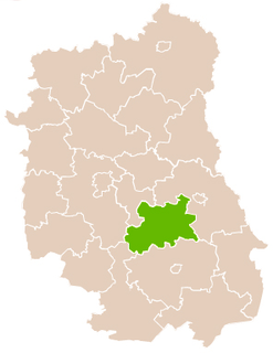
Stary Lipowiec is a village in the administrative district of Gmina Księżpol, within Biłgoraj County, Lublin Voivodeship, in eastern Poland. It lies approximately 8 kilometres (5 mi) north-east of Księżpol, 13 km (8 mi) south-east of Biłgoraj, and 91 km (57 mi) south of the regional capital Lublin.
Wola Studzieńska-Kolonia is a village in the administrative district of Gmina Batorz, within Janów Lubelski County, Lublin Voivodeship, in eastern Poland.

Rzeczków is a village in the administrative district of Gmina Biała Rawska, within Rawa County, Łódź Voivodeship, in central Poland. It lies approximately 5 kilometres (3 mi) north-east of Biała Rawska, 20 km (12 mi) north-east of Rawa Mazowiecka, and 73 km (45 mi) east of the regional capital Łódź.

Golanka is a village in the administrative district of Gmina Gromnik, within Tarnów County, Lesser Poland Voivodeship, in southern Poland. It lies approximately 22 kilometres (14 mi) south of Tarnów and 80 km (50 mi) east of the regional capital Kraków.

Zagórnik is a village in the administrative district of Gmina Andrychów, within Wadowice County, Lesser Poland Voivodeship, in southern Poland. It lies approximately 5 kilometres (3 mi) south-east of Andrychów, 11 km (7 mi) south-west of Wadowice, and 48 km (30 mi) south-west of the regional capital Kraków.

Rzegocin is a village in the administrative district of Gmina Nowy Korczyn, within Busko County, Świętokrzyskie Voivodeship, in south-central Poland. It lies approximately 6 kilometres (4 mi) north of Nowy Korczyn, 16 km (10 mi) south-east of Busko-Zdrój, and 62 km (39 mi) south of the regional capital Kielce.
Ignaców is a village in the administrative district of Gmina Przyłęk, within Zwoleń County, Masovian Voivodeship, in east-central Poland.

Krajewice is a village in the administrative district of Gmina Gostyń, within Gostyń County, Greater Poland Voivodeship, in west-central Poland. It lies approximately 5 kilometres (3 mi) south of Gostyń and 63 km (39 mi) south of the regional capital Poznań.
Janków is a village in the administrative district of Gmina Pleszew, within Pleszew County, Greater Poland Voivodeship, in west-central Poland.

Ludwikowo is a village in the administrative district of Gmina Wągrowiec, within Wągrowiec County, Greater Poland Voivodeship, in west-central Poland. It lies approximately 11 kilometres (7 mi) north-east of Wągrowiec and 57 km (35 mi) north-east of the regional capital Poznań.

Drvodelja is a village in the municipality of Leskovac, Serbia. According to the 2002 census, the village has a population of 245 people.

Negrišori is a village in the municipality of Lučani, Serbia. According to the 2011 census, the village has a population of 499 people.

Polje is a village in the municipality of Višegrad, Bosnia and Herzegovina.

Azghyr is a village in Atyrau Region, southwest Kazakhstan. It lies at an altitude of 4 m (13 ft).


