Yacamunda Station

Last updated

Yacamunda Station is a historic cattle station in North Queensland near Bowen. In 1935 it was one of the largest cattle stations in the state [1] and played a significant part in the growth and development of early Australia. [1] It was later sold in 2007 as a functioning cattle station. Historical references and photos are available for reference. [2] [3]

Contents

Yacamunda Station was also the name for a telegraph station on the Clermont—Charters Towers line as an important historical location featuring a public telephone. [1]

Location

The station is located on the Belyando River in the Bowen area. Yacamunda is 280 km west of Mackay. The original boundaries were described to the north as Rutherford and Natal Downs, on the west by Mt Hope and Mt Douglas, on the south by Stratford, Glen Avon, and Glen Eva, and on the east by Terang, Mt Lookout, Whynot, and Bungabine. [1] It was part of St Ann's holding and originally much larger than it is today. [4]

St Ann's was one of the oldest settled portions of the Queensland district and was shown on historic maps of Queensland. [1] Later however, St Ann's was superseded in importance by Yacamunda as an outstation of Yacamunda. [1]

Yacamunda was larger at the time it was under the Earl family’s management, but four selections were cut away from the original holding named Scartwater, Mt Hope, Bungabine, and Whynot. [1]

Origin of the name

Yacamunda is an Aboriginal word meaning "work for your tucker". [5] The name of the station could have its origins in this Aboriginal word as there were many Aboriginal people, especially stockmen, who were working at the station. [6]

History

The clan of Aboriginal people originally residing on the property were referred to as the Belyando tribe. [1]

James Earl, William Earl and Thomas Earl, three young Englishmen, were described as “path finders” and “trail breakers”, whose “names will go down in the history of this State”. At the time when they arrived to the recently established settlement of Bowen in 1860s, Bowen itself was described at that time as “a few tents and bark huts on the shore of Port Denison”. [4] They moved westward in search of pastoral land. They eventually took up a vast land area. They stocked the country and formed it into a station, calling it “Glen Lee”. [4] The station later became known as Yacamunda Station.

They took up Yacamunda Station which is located on the Belyando River in the Bowen area. They were described as "squatters".

They later took up Iffley Station in 1864 but floods carried off their entire stock. They subsequently returned to Yacamunda. [7]

The station was commonly referred to as “Yacamunda”. [7] In 1935 the station was referred to as St Ann's holding, including area of approximately 1200 square miles. [7] It was originally held by Earl and was larger than in 1935. [1] The Clermont—Charters Towers telephone line had a telegraph station at Yacamunda. [1] A public telephone was installed there at Yacamunda, [1] an important way of linking the station allowing communications with the rest of the local area.

Around 1935 the station held between 24,000 and 25,000 cattle and a few blood draught horses. [1] The station traded large numbers of bullocks around Queensland to Lakes Creek, Gladstone, Alligator Creek meatworks and other places were the cattle and bullocks were on-sold. [1]

There were up to sixteen permanent stockman camps on the property prior to World War II. [6] The majority of the stockmen working in the different sections were Aboriginal Australians. [6]

The property was acquired in 1914 by Winter lrvinrg and the Robinson brothers, who were well-known pastoralists in NSW and Victoria and would inspect the property yearly. [1] Mr Kermode became the manager of the station but died after fallling from a horse on the property. [1] In 1920 Mr G.H. Creaghe became the manager on site; he made improvements to the site and was well known and respected in the district at the time. [1]

The property was sold to the local Scott family in 2007, and included 38,500 hectares of grass pasture as well as 8000 cattle, a two-level, air-conditioned homestead, cottages, and a station plant. [8]

Climate and weather impact

Yacamunda is subject to the harsh Northern Queensland weather conditions. In the dry season of 1935 (Winter) it was reported that Yacamunda was impact by low rainfall. [1] This impacted livestock numbers and some cattle perished near dried-up waterholes, which were called "death traps" and fenced off. [1] To preserve cattle numbers, some were moved to other areas on the property or adjacent properties. [1]

See also

Related Research Articles
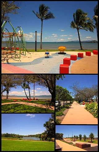
<span class="mw-page-title-main">Bowen, Queensland</span> Town in Queensland, Australia

Bowen is a coastal town and locality in the Whitsunday Region, Queensland, Australia. In the 2021 census, the locality of Bowen had a population of 11,205 people.
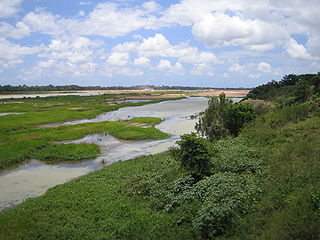
<span class="mw-page-title-main">Burdekin River</span> River in Queensland, Australia

The Burdekin River is a river in North and Far North Queensland, Australia. The river rises on the northern slopes of Boulder Mountain at Valley of Lagoons, part of the western slope of the Seaview Range, and flows into the Coral Sea at Upstart Bay over 200 kilometres (124 mi) to the southeast of the source, with a catchment area of approximately 130,000 square kilometres (50,000 sq mi). The Burdekin River is Australia's largest river by (peak) discharge volume.

<span class="mw-page-title-main">Ayr, Queensland</span> Town in Queensland, Australia

Ayr is a rural town and locality in the Shire of Burdekin, Queensland, Australia. It is the centre of a sugarcane-growing region and the administrative centre for the Burdekin Shire Council. In the 2021 census, the locality of Ayr had a population of 8,603 people.
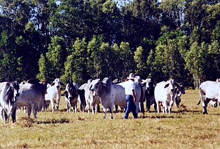
<span class="mw-page-title-main">Stockman (Australia)</span> Australian livestock herder

In Australia, a stockman is a person who looks after the livestock on a station, traditionally on horse. It has a similar meaning to "cowboy". A stockman may also be employed at an abattoir, feedlot, on a livestock export ship, or with a stock and station agency.

<span class="mw-page-title-main">Cattle station</span> Large Australian farm

In Australia and New Zealand, a cattle station is a large farm, the main activity of which is the rearing of cattle. The owner of a cattle station is called a grazier. The largest cattle station in the world is Anna Creek Station in South Australia, which covers an area of 23,677 square kilometres.

<span class="mw-page-title-main">Drover (Australian)</span> A person who moves livestock over long distances

A drover in Australia is a person, typically an experienced stockman, who moves livestock, usually sheep, cattle, and horses "on the hoof" over long distances. Reasons for droving may include: delivering animals to a new owner's property, taking animals to market, or moving animals during a drought in search of better feed and/or water or in search of a yard to work on the livestock. The drovers who covered very long distances to open up new country were known as "overlanders".

<span class="mw-page-title-main">Collinsville, Queensland</span> Town in Queensland, Australia

Collinsville is a rural town and locality in the Whitsunday Region, Queensland, Australia. In the 2021 census, the locality of Collinsville had a population of 1,496 people.

<span class="mw-page-title-main">Isaac Region</span> Local government area in Queensland, Australia

The Isaac Region is a local government area located in Central Queensland, Queensland, Australia created in March 2008 as a result of the report of the Local Government Reform Commission released in July 2007.
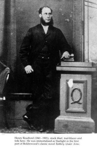
<span class="mw-page-title-main">Harry Readford</span> Australian bushranger

Henry Arthur Readford, was an Australian stockman, drover and cattle thief.
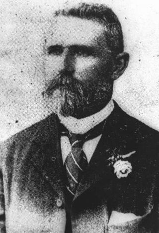
<span class="mw-page-title-main">William Aplin</span> Australian politician

William Aplin was an Australian pioneer, businessman and politician of Queensland, Australia in the 19th century.

<span class="mw-page-title-main">Belyando River</span> River in Queensland, Australia

The Belyando River, including the Belyando River (Western Branch), is a river system in Central Queensland, Australia. At 1,054 kilometres (655 mi) in length and with a catchment area of 35,000 square kilometres (14,000 sq mi), the Belyando River system is one of the longest rivers in Queensland.

The Suttor River is a river in Central Queensland, Australia. The Belyando River is its main tributary. The river has its origins in the Leichhardt Range, north west of Glenden. It flows into Lake Dalrymple, becoming a tributary of the Burdekin River.

Iffley Station is a pastoral lease that currently operates as a cattle station in Queensland.

<span class="mw-page-title-main">John Graham MacDonald</span>

John Graham MacDonald (1834–1918) was an explorer and pioneer in Queensland, Australia.

<span class="mw-page-title-main">Bowen Developmental Road</span> Road in Queensland, Australia

Bowen Developmental Road is a state-controlled district road rated as a local road of regional significance (LRRS). It is a rural strategic main road in Queensland, Australia. It is part of State Route 77, and functions as a highway. It has a length of 259 kilometres (161 mi) and extends in northeast-southwest direction from Bowen on the east coast of Australia to the Gregory Developmental Road in Belyando near Nairana National Park.

Belyando is a rural locality in the Isaac Region, Queensland, Australia. In the 2021 census, Belyando had a population of 307 people.

The Yangga, also spelt Jangga, are an Aboriginal Australian people of the state of Queensland. They are not to be confused with the Yanga people.

Keeroongooloo, previously known as Keerongooloo or Keerongoola is a pastoral lease that operates as a cattle station in the Channel Country of South West Queensland, Australia.

<span class="mw-page-title-main">James Earl (grazier)</span> Merchant, cartage and cattle breeder

James Earl (1835–1907) was a merchant in Far North Queensland of cartage and started cattle breeding.

<span class="mw-page-title-main">Alligator Creek meatworks</span>

Alligator Creek Meatworks is an important historical business in Queensland contributing to processing of food for the growing population and processing meet while the meat and cattle industry expanded the economy of the local area and of Australia with the introduction of meat exportation. Early meatworks included boiling down and preserving. Later meatworks used freezer technology and equipment. The meatworks is no longer in operation, but the photos and historical accounts provide an insight into rural life in early Australia and Queensland.

References

  1. 1 2 3 4 5 6 7 8 9 10 11 12 13 14 15 16 17 18 19 "YACAMUNDA STATION". Central Queensland Herald. 1935-08-01. Retrieved 2024-06-15.
  2. "Butcher's Hill farm to Yacamunda and Butcher's Hill Station : a chronological record of the early... - Catalogue | National Library of Australia". catalogue.nla.gov.au. Retrieved 2024-06-15.
  3. "Homestead at Yacamunda Station near Bowen. | State Library of Queensland". www.slq.qld.gov.au. Retrieved 2024-06-15.
  4. 1 2 3 "ON THE TOP RAIL". Townsville Daily Bulletin. 1946-06-04. Retrieved 2024-07-11.
  5. Thomas, Nick (Dec 8, 2022). Yaca-Munda: Aboriginal for Work for your Tucker. Nick Thomas. ISBN   9781471028533.
  6. 1 2 3 Hatte, E., Cook P., Northern Archaeology Consultancies. (2012, March). Non indigenous Historical Technical Report , p.14. https://eisdocs.dsdip.qld.gov.au/Byerwen%20Coal/EIS/Appendices/appendix-27-non-indigenous-history-technical-report.pdf
  7. 1 2 3 "Townsville "Bulletins."". Evening Telegraph. 1905-10-16. Retrieved 2024-06-15.
  8. "Qld station brings $38m". Australian Financial Review. 2007-02-13. Retrieved 2024-06-15.

21°22′35″S147°06′04″E / 21.37639°S 147.10111°E / -21.37639; 147.10111