Lakes Creek, Queensland

Last updated

Lakes Creek
Queensland
Australia Queensland location map.svg
Red pog.svg
Lakes Creek
Coordinates 23°22′27″S150°34′17″E / 23.3741°S 150.5713°E / -23.3741; 150.5713
Population633 (2021 census) [1]
 • Density58.6/km2 (151.8/sq mi)
Postcode(s) 4701
Area10.8 km2 (4.2 sq mi)
LGA(s)
State electorate(s)
Federal division(s) Capricornia
Suburbs around Lakes Creek:
Frenchville Mount Archer Nerimbera
Koongal Lakes Creek Nerimbera
Port Curtis Port Curtis Nerimbera

Lakes Creek is a suburb split between Rockhampton Region and Shire of Livingstone, Queensland, Australia. [2] [3] In the 2021 census, Lakes Creek had a population of 633 people. [1]

Contents

Geography

Lakes Creek is predominantly in Rockhampton Region with 10.4 square kilometres (4.0 sq mi) compared to Shire of Livingstone with 0.4 square kilometres (0.15 sq mi). The suburb is bordered to the south-west by the Fitzroy River. The developed land in the suburb is predominantly near the river approx 10 to 20 metres (33 to 66 ft) above sea level (and is entirely within the Rockhampton Region). The bulk of the land is mountainous and undeveloped rising to peaks such as:

Much of this undeveloped mountainous land in the north-east of the locality is within the Mount Archer National Park. [5]

The developed land use is a mix of residential and industrial. [5] Teys Australia operate a large abattoir and feedlot in Lakes Creek. In 2013 it was the largest employer in Rockhampton with a staff of over 1000 people. [6]

The Rockhampton–Emu Park Road runs through from west to south. [7]

History

On 14 September 1871, residents of the area who were mostly employees of the Central Queensland Meat Preserving Company held a meeting to establish a school in the area at which it was estimated that 25 children would attend the school if established. [8] Although the building was completed in January 1872, [9] Lakes Creek Provisional School did not open until 1 October 1872 but closed in 1874, reopening on 21 May 1877. [10] [11] In July 1894, the Queensland Government decided that the numbers of students in the area warranted a state school. [12] [13] In January 1895 Lakes Creek State School opened on the present site. [14]

Lakes Creek Baptist Church opened on Tuesday 3 March 1914. [15] [16]

Demographics

In the 2016 census Lakes Creek had a population of 552 people. [17]

In the 2021 census, Lakes Creek had a population of 633 people. [1]

Education

Lakes Creek State School is a government primary (Prep-6) school for boys and girls at 445 Paterson Street ( 23°22′33″S150°33′36″E / 23.3759°S 150.5600°E / -23.3759; 150.5600 (Lakes Creek State School) ). [18] [19] In 2016, the school had an enrolment of 127 students with 8 teachers (7 full-time equivalent) and 9 non-teaching staff (5 full-time equivalent). [20] In 2018, the school had an enrolment of 102 students with 8 teachers (7 full-time equivalent) and 12 non-teaching staff (7 full-time equivalent). [21]

Amenities

Rocky Wesleyan Church is at 446 Paterson Drive ( 23°22′34″S150°33′36″E / 23.3762°S 150.5600°E / -23.3762; 150.5600 (Rocky Wesleyan Church) ). [22] It is part of the Wesleyan Methodist Church. [23]

Related Research Articles

<span class="mw-page-title-main">Yeppoon</span> Town in Queensland, Australia

Yeppoon is a coastal town and locality in the Shire of Livingstone, Queensland, Australia. Yeppoon is renowned for its beaches, tropical climate, and the islands out on the bay. Located 41 kilometres (25 mi) from the city of Rockhampton, Yeppoon is the seat of the Shire of Livingstone and the principal town on the Capricorn Coast, a string of seaside communities stretching more than 150 kilometres (93 mi) from north to south. The beaches and shallow coves provide a destination both for tourists and retirees settling down in Central Queensland. Offshore, there are 27 islands including Great Keppel Island which is 20 kilometres (12 mi) from Yeppoon. In the 2021 census, the locality of Yeppoon had a population of 7,037 people; this does not include any neighbouring suburbs.
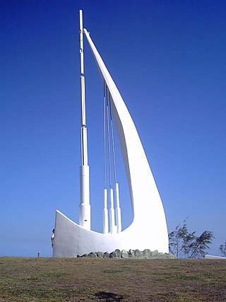
<span class="mw-page-title-main">Emu Park, Queensland</span> Town in Queensland, Australia

Emu Park is a coastal town and locality on the Capricorn Coast located 21 kilometres (13 mi) south of Yeppoon in Queensland, Australia. It is within the local government area of Shire of Livingstone. In the 2021 census, the locality of Emu Park had a population of 2,281 people.

<span class="mw-page-title-main">Frenchville, Queensland</span> Suburb of Rockhampton, Queensland, Australia

Frenchville is a suburb of Rockhampton in the Rockhampton Region, Queensland, Australia. In the 2021 census, Frenchville had a population of 8,982 people.

<span class="mw-page-title-main">Rockhampton City, Queensland</span> Suburb of Rockhampton, Queensland, Australia

Rockhampton City is the central suburb of the city of Rockhampton in the Rockhampton Region, Queensland, Australia. It is informally known as Rockhampton central business district (CBD). In the 2021 census, Rockhampton City had a population of 2,059 people.

<span class="mw-page-title-main">Wandal, Queensland</span> Suburb of Rockhampton, Queensland, Australia

Wandal is a suburb of Rockhampton in the Rockhampton Region, Queensland, Australia. In the 2021 census, Wandal had a population of 3,949 people.

<span class="mw-page-title-main">West Rockhampton, Queensland</span> Suburb of Rockhampton, Queensland, Australia

West Rockhampton is a suburb of Rockhampton in the Rockhampton Region, Queensland, Australia. In the 2021 census, West Rockhampton had a population of 1,848 people.

<span class="mw-page-title-main">Allenstown, Queensland</span> Suburb of Rockhampton, Queensland, Australia

Allenstown is an inner southern suburb of Rockhampton, Rockhampton Region, Queensland, Australia. It is situated 1.6 kilometres (0.99 mi) by road south-west of the Rockhampton CBD. In the 2021 census, Allenstown had a population of 2,762 people.

<span class="mw-page-title-main">Berserker, Queensland</span> Suburb of Rockhampton, Queensland, Australia

Berserker is a suburb of Rockhampton in the Rockhampton Region, Queensland, Australia. It is situated about six kilometres north east of the central business district.

The Common is a parkland suburb of Rockhampton in the Rockhampton Region, Queensland, Australia. In the 2021 census, The Common had "no people or a very low population".

<span class="mw-page-title-main">Byfield, Queensland</span> Town in Queensland, Australia

Byfield is a rural locality in the Shire of Livingstone, Queensland, Australia. In the 2021 census, the locality of Byfield had a population of 323 people.
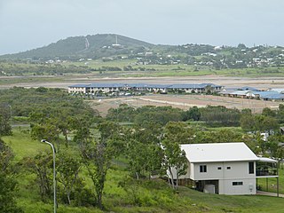
<span class="mw-page-title-main">Zilzie</span> Suburb of Shire of Livingstone, Queensland, Australia

Zilzie is a coastal locality in the Livingstone Shire, Queensland, Australia. In the 2021 census, Zilzie had a population of 2,846 people.

<span class="mw-page-title-main">Taranganba</span> Town in Queensland, Australia

Taranganba is a town and locality in the Livingstone Shire, Queensland, Australia. In the 2021 census, the locality of Taranganba had a population of 2,275 people.

<span class="mw-page-title-main">Koongal, Queensland</span> Suburb of Rockhampton Region, Queensland, Australia

Koongal is a suburb of Rockhampton in the Rockhampton Region, Queensland, Australia. In the 2021 census, Koongal had a population of 4,252 people.

<span class="mw-page-title-main">Morinish, Queensland</span> Suburb of Rockhampton Region, Queensland, Australia

Morinish is a rural locality in the Rockhampton Region, Queensland, Australia. In the 2021 census, Morinish had a population of 62 people.

<span class="mw-page-title-main">Lanefield, Queensland</span> Locality in Queensland australia

Lanefield is a rural locality in the City of Ipswich, Queensland, Australia. In the 2021 census, Lanefield had a population of 97 people.
<span class="mw-page-title-main">Yaamba</span> Town in Queensland, Australia

Yaamba is a rural town and locality in the Livingstone Shire, Queensland, Australia. In the 2021 census, the locality of Yaamba had a population of 51 people.

<span class="mw-page-title-main">Nerimbera, Queensland</span> Suburb of Shire of Livingstone, Queensland, Australia

Nerimbera is a rural locality in the Livingstone Shire, Queensland, Australia. In the 2021 census, Nerimbera had a population of 285 people.

<span class="mw-page-title-main">The Caves, Queensland</span> Town in Queensland, Australia

The Caves is a rural town and locality in the Livingstone Shire, Queensland, Australia. In the 2021 census, the locality of The Caves had a population of 680 people.

<span class="mw-page-title-main">Norman Gardens, Queensland</span> Suburb of Rockhampton, Queensland, Australia

Norman Gardens is a suburb in the Rockhampton Region, Queensland, Australia. In the 2021 census, Norman Gardens had a population of 10,534 people.

<span class="mw-page-title-main">Thompson Point, Queensland</span> Suburb of Livingstone Shire, Queensland, Australia

Thompson Point is a coastal locality in the Livingstone Shire, Queensland, Australia. It was the site of a short-lived town and port called Broadmount. In the 2021 census, Thompson Point had "no people or a very low population".

References

  1. 1 2 3 Australian Bureau of Statistics (28 June 2022). "Lakes Creek (SAL)". 2021 Census QuickStats. Retrieved 28 February 2023. OOjs UI icon edit-ltr-progressive.svg
  2. "Lakes Creek – suburb in Rockhampton Region (entry 48723)". Queensland Place Names. Queensland Government . Retrieved 8 November 2017.
  3. "Lakes Creek – suburb in Livingstone Shire (entry 48722)". Queensland Place Names. Queensland Government . Retrieved 20 November 2017.
  4. "Mount Birkbeck – mountain in Rockhampton Regional (entry 2736)". Queensland Place Names. Queensland Government . Retrieved 29 December 2020.
  5. 1 2 "Queensland Globe". State of Queensland . Retrieved 19 November 2017.
  6. "Lakes Creek plant earns Qld multi-cultural award". Beef Central. 10 September 2013. Archived from the original on 21 November 2017. Retrieved 22 November 2017.
  7. Google (6 August 2022). "Lakes Creek, Queensland" (Map). Google Maps . Google. Retrieved 6 August 2022.
  8. "LOCAL ITEMS". Rockhampton Bulletin And Central Queensland Advertiser . No. 1430. Queensland, Australia. 23 September 1871. p. 4. Archived from the original on 19 August 2021. Retrieved 22 November 2017 via National Library of Australia.
  9. "BRISBANE". Northern Argus . No. 1278. Queensland, Australia. 8 January 1872. p. 2. Archived from the original on 19 August 2021. Retrieved 22 November 2017 via National Library of Australia.
  10. Queensland Family History Society (2010), Queensland schools past and present (Version 1.01 ed.), Queensland Family History Society, ISBN   978-1-921171-26-0
  11. "Lake's Creek Meat-Preserving Establishment". Rockhampton Bulletin . Vol. XIX, no. 2852. Queensland, Australia. 28 May 1877. p. 2. Archived from the original on 19 August 2021. Retrieved 22 November 2017 via National Library of Australia.
  12. "School for Lake's Creek". The Telegraph . No. 6781. Queensland, Australia. 12 July 1894. p. 2. Archived from the original on 19 August 2021. Retrieved 22 November 2017 via National Library of Australia.
  13. "Official Notifications". The Queenslander . Queensland, Australia. 4 August 1894. p. 231. Archived from the original on 19 August 2021. Retrieved 22 November 2017 via National Library of Australia.
  14. "History". Lakes Creek State School. 3 October 2012. Archived from the original on 21 November 2017. Retrieved 22 November 2017.
  15. "Queensland Baptist churches by date of erection/opening". Baptist Church Archives Queensland. Retrieved 29 November 2021.
  16. "LAKE'S CREEK". Morning Bulletin . No. 15, 405. Queensland, Australia. 7 March 1914. p. 9. Retrieved 30 November 2021 via National Library of Australia.
  17. Australian Bureau of Statistics (27 June 2017). "Lakes Creek (SSC)". 2016 Census QuickStats. Retrieved 20 October 2018. OOjs UI icon edit-ltr-progressive.svg
  18. "State and non-state school details". Queensland Government. 9 July 2018. Archived from the original on 21 November 2018. Retrieved 21 November 2018.
  19. "Lakes Creek State School". Archived from the original on 30 March 2021. Retrieved 21 November 2018.
  20. "2016 Annual Report" (PDF). Lakes Creek State School. Archived (PDF) from the original on 21 November 2017. Retrieved 22 November 2017.
  21. "ACARA School Profile 2018". Australian Curriculum, Assessment and Reporting Authority. Archived from the original on 27 August 2020. Retrieved 28 January 2020.
  22. "Home". Rocky Wesleyan. Archived from the original on 20 March 2020. Retrieved 19 August 2021.
  23. "North Queensland". Wesleyan Methodist Church Australia. Archived from the original on 18 August 2021. Retrieved 18 August 2021.