Port Curtis, Queensland

Last updated

Map all coordinates using: OpenStreetMap
Port Curtis
Rockhampton,  Queensland
HastingsDeering1.jpg
Hastings Deering at Port Curtis, 2021
Australia Queensland location map.svg
Red pog.svg
Port Curtis
Coordinates 23°25′11″S150°32′26″E / 23.4197°S 150.5405°E / -23.4197; 150.5405 (Port Curtis (centre of suburb))
Population281 (2016 census) [1]
 • Density6.122/km2 (15.86/sq mi)
Postcode(s) 4700
Area45.9 km2 (17.7 sq mi)
Time zone AEST (UTC+10:00)
Location
LGA(s) Rockhampton Region
State electorate(s)
Federal division(s)
Suburbs around Port Curtis:
Depot Hill The Common Koongal
Fairy Bower
Allenstown
Port Curtis Lakes Creek
Bouldercombe
Gracemere
Midgee Nerimbera

Port Curtis is a suburb of Rockhampton in the Rockhampton Region, Queensland, Australia. [2] In the 2016 census, Port Curtis had a population of 281 people. [1]

Contents

Geography

The Fitzroy River bounds the suburb to the north-east. Gavial Creek, a tributary of the Fitzroy River, flows through the locality with their confluence at the north of the suburb. The land is flat and low-lying (less than 10 metres above sea level). [3]

The North Coast railway line passes along the western edge of the locality with the junction with the Central Western railway line at Rocklands railway station ( 23°26′11″S150°31′13″E / 23.4364°S 150.5203°E / -23.4364; 150.5203 (Rocklands railway station) ) within Port Curtis. [3] [4]

As at January 2021, very little of the land has been developed with only a few small pockets of residential and industrial use. [3]

History

Archer Hotel at Port Curtis, 2012 ArcherHotel2.jpg
Archer Hotel at Port Curtis, 2012

Port Curtis Road State School opened on 23 March 1875. [5]

In 1912, a Baptist church opened in Port Curtis Road close to the state school. [6] [7] It was a "rapid erection" with construction of pre-fabricated sections commencing at 3pm to be completed in time for an official opening service at around 6pm on Saturday 30 November 1912. [8] [9]

Apart from some land south of Baxter Street, Port Curtis was completely flooded by the Fitzroy River in early January 2011. [10]

In the 2016 census, Port Curtis had a population of 281 people. [1]

The Archer Hotel, formerly the Balmoral Hotel, was located at Port Curtis until a fire completely destroyed the pub on 1 January 2018. [11] [12] Built in the late 1800s, the hotel had been closed for four years before the fire. [13] [14] In 1983, a Ford Telstar sedan belonging to suspected murder victim Bradley Kerrisk was recovered from the Balmoral Hotel at Port Curtis after he went missing, having been last seen at Callaghan Park on 24 June 1983. [15] A $250,000 reward is still on offer for information leading to the conviction of those responsible for Kerrisk's disappearance and suspected murder. [16]

The Rockhampton site of mining and industrial equipment supplier Hastings Deering, one of Rockhampton's major employers, is located at Port Curtis. [17] [18]

Education

Port Curtis Road State School, 2021 PortCurtisSchool1.jpg
Port Curtis Road State School, 2021

Port Curtis Road State School is a government primary (Prep-6) school for boys and girls at Port Curtis Road ( 23°24′48″S150°30′50″E / 23.4134°S 150.5140°E / -23.4134; 150.5140 (Port Curtis Road State School) ). [19] [20]

In 2016, the school had an enrolment of 54 students with 5 teachers (4 full-time equivalent) and 6 non-teaching staff (4 full-time equivalent). [21] In 2018, the school had an enrolment of 67 students with 5 teachers (4 full-time equivalent) and 7 non-teaching staff (4 full-time equivalent). [22]

There are no secondary schools in Port Curtis. The nearest government secondary school is Rockhampton State High School in Wandal to the north.

Attractions

Billabong near the old Tropic of Capricorn marker, Port Curtis road, 2022 Billabong, old Tropic of Capricorn marker, Port Curtis road, Rockhampton, 2022.jpg
Billabong near the old Tropic of Capricorn marker, Port Curtis road, 2022

A pair of Tropic of Capricorn markers can be found beside the billabong on Port Curtis Road ( 23°26′17″S150°32′02″E / 23.4380°S 150.5338°E / -23.4380; 150.5338 (Tropic of Capricorn markers) ). [23]

Related Research Articles

<span class="mw-page-title-main">Rockhampton</span> City in Queensland, Australia

Rockhampton is a city in the Rockhampton Region of Central Queensland, Australia. The population of Rockhampton in June 2021 was 79,967, making it the fourth-largest city in the state outside of the cities of South East Queensland, and the 22nd-largest city in Australia. Today, Rockhampton is an industrial and agricultural centre of the north.

<span class="mw-page-title-main">Yeppoon</span> Town in Queensland, Australia

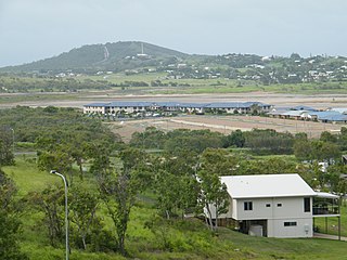
Yeppoon is a coastal town and locality in the Shire of Livingstone, Queensland, Australia. Yeppoon is renowned for its beaches, tropical climate, and the islands out on the bay. Located 41 kilometres (25 mi) from the city of Rockhampton, Yeppoon is the seat of the Shire of Livingstone and the principal town on the Capricorn Coast, a string of seaside communities stretching more than 150 kilometres (93 mi) from north to south. The beaches and shallow coves provide a destination both for tourists and retirees settling down in Central Queensland. Offshore, there are 27 islands including Great Keppel Island which is 20 kilometres (12 mi) from Yeppoon. In the 2021 census, the locality of Yeppoon had a population of 7,037 people; this does not include any neighbouring suburbs.

<span class="mw-page-title-main">Mount Morgan, Queensland</span> City in Queensland, Australia

Mount Morgan is a rural town and locality in the Rockhampton Region, Queensland, Australia. In the 2021 census the town of Mount Morgan had a population of 2,487 people.

<span class="mw-page-title-main">Emu Park, Queensland</span> Town in Queensland, Australia

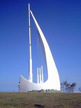
Emu Park is a coastal town and locality on the Capricorn Coast located 21 kilometres (13 mi) south of Yeppoon in Queensland, Australia. It is within the local government area of Shire of Livingstone. In the 2016 census the locality of Emu Park had a population of 2,130 people.

<span class="mw-page-title-main">Gracemere, Queensland</span> Town in Queensland, Australia

Gracemere is a rural town and locality in the Rockhampton Region, Queensland, Australia. In the 2016 census, the locality of Gracemere had a population of 11,315 people.

<span class="mw-page-title-main">Westwood, Queensland</span> Town in Queensland, Australia

Westwood is a town in the Rockhampton Region and a locality split between the Rockhampton Region and the Shire of Banana in Queensland, Australia. It was the first town that was gazetted by the Queensland Government. In the 2021 census, the locality of Westwood had a population of 199 people.

<span class="mw-page-title-main">Browne Park</span>

Browne Park is a rectangular football stadium located in the Rockhampton suburb of Wandal, Queensland, Australia. The venue has been the home of rugby football in Central Queensland since 1890 and today also hosts rugby union and soccer matches. It hosted a match of the 2008 Rugby League World Cup. The ground was named Browne Park in 1958 as a posthumous honour to long serving president of Rockhampton Rugby League, Jack Browne who died in office.

<span class="mw-page-title-main">Rockhampton City, Queensland</span> Suburb of Rockhampton, Queensland, Australia

Rockhampton City is the central suburb of the city of Rockhampton in the Rockhampton Region, Queensland, Australia. It is informally known as Rockhampton central business district (CBD). In the 2021 census, Rockhampton City had a population of 2,059 people.

<span class="mw-page-title-main">West Rockhampton, Queensland</span> Suburb of Rockhampton, Queensland, Australia

West Rockhampton is a suburb of Rockhampton in the Rockhampton Region, Queensland, Australia. In the 2016 census, West Rockhampton had a population of 1,825 people.

<span class="mw-page-title-main">Allenstown, Queensland</span> Suburb of Rockhampton, Queensland, Australia

Allenstown is a suburb of Rockhampton, Rockhampton Region, Queensland, Australia. It is situated 1.6 kilometres (0.99 mi) by road south-west of the Rockhampton CBD. In the 2016 census, Allenstown had a population of 2,790 people.

<span class="mw-page-title-main">Depot Hill, Queensland</span> Suburb of Rockhampton, Queensland, Australia

Depot Hill is a suburb of Rockhampton in the Rockhampton Region, Queensland, Australia. In the 2016 census, Depot Hill had a population of 1,032 people.

<span class="mw-page-title-main">Kawana, Queensland (Rockhampton)</span> Suburb of Rockhampton, Queensland, Australia

Kawana is a suburb of Rockhampton in the Rockhampton Region, Queensland, Australia. In the 2016 census, Kawana had a population of 4,426 people.

<span class="mw-page-title-main">Parkhurst, Queensland</span> Suburb of Rockhampton, Queensland, Australia

Parkhurst is a suburb of Rockhampton in the Rockhampton Region, Queensland, Australia. In the 2016 census, Parkhurst had a population of 2,476 people.

<span class="mw-page-title-main">Nerimbera, Queensland</span> Suburb of Shire of Livingstone, Queensland, Australia

Nerimbera is a rural locality in the Livingstone Shire, Queensland, Australia. In the 2016 census, Nerimbera had a population of 293 people.

Fairy Bower is a suburb in the Rockhampton Region, Queensland, Australia. In the 2016 census Fairy Bower had a population of 97 people.

<span class="mw-page-title-main">Norman Gardens, Queensland</span> Suburb of Rockhampton, Queensland, Australia

Norman Gardens is a suburb in the Rockhampton Region, Queensland, Australia. In the 2016 census Norman Gardens had a population of 9,944 people.

Lakes Creek is a suburb split between Rockhampton Region and Shire of Livingstone, Queensland, Australia. In the 2016 census Lakes Creek had a population of 552 people.

<span class="mw-page-title-main">Bushley, Queensland</span> Suburb of Rockhampton Region, Queensland, Australia

Bushley is a rural locality in the Rockhampton Region, Queensland, Australia. In the 2016 census, Bushley had a population of 30 people.

Callaghan Park is a horse and greyhound racing venue in Rockhampton, Queensland, Australia. It is located in the suburb of The Common.

<span class="mw-page-title-main">Curtis Island, Queensland</span> Suburb of Gladstone Region, Queensland, Australia

Curtis Island is a locality in the Gladstone Region, Queensland, Australia. In the 2016 census, Curtis Island had a population of 323 people.

References

  1. 1 2 3 Australian Bureau of Statistics (27 June 2017). "Port Curtis (SSC)". 2016 Census QuickStats. Retrieved 20 October 2018. OOjs UI icon edit-ltr-progressive.svg
  2. "Port Curtis – suburb in Rockhampton Region (entry 49353)". Queensland Place Names. Queensland Government . Retrieved 29 December 2020.
  3. 1 2 3 "Queensland Globe". State of Queensland . Retrieved 26 January 2021.
  4. "Rocklands – railway station in Rockhampton Region (entry 28655)". Queensland Place Names. Queensland Government . Retrieved 17 November 2017.
  5. Queensland Family History Society (2010), Queensland schools past and present (Version 1.01 ed.), Queensland Family History Society, ISBN   978-1-921171-26-0
  6. "Queensland Baptist churches by date of erection/opening". Baptist Church Archives Queensland. Retrieved 29 November 2021.
  7. "1912 Port Curtis Rd, Rockhampton". Baptist Church Archives Queensland. Retrieved 29 November 2021.
  8. "THE CHURCHES". Morning Bulletin . No. 15, 018. Queensland, Australia. 30 November 1912. p. 8. Retrieved 29 November 2021 via National Library of Australia.
  9. "NEW BAPTIST CHURCH". Morning Bulletin . No. 15, 019. Queensland, Australia. 2 December 1912. p. 6. Retrieved 29 November 2021 via National Library of Australia.
  10. "Port Curtis". Queensland Places. Centre for the Government of Queensland, University of Queensland. Archived from the original on 15 November 2017. Retrieved 16 November 2017.
  11. Hooker, Amber; Gately, Michelle (1 January 2018). "Dramatic photos as Rocky pub collapses in fire". The Morning Bulletin . News Corp Australia . Retrieved 9 October 2021.
  12. Gately, Michelle (1 January 2018). "'The whole sky was red': Fire rips through Rocky pub". The Morning Bulletin. News Corp Australia. Retrieved 9 October 2021.
  13. Bulloch, Shayla (2 January 2018). "Floods, fights and pints: Destroyed Rocky pub's history". The Morning Bulletin. News Corp Australia. Retrieved 9 October 2021.
  14. Jarrett, Vanessa (8 January 2021). "MEMORY LANE: 12 months since we lost an iconic building". The Morning Bulletin. Retrieved 9 October 2021.
  15. Gately, Michelle (2 May 2017). "Five shocking crimes that changed Rockhampton forever". The Morning Bulletin. News Corp Australia. Retrieved 9 October 2021.
  16. "Missing - Suspected Murder of Bradley Richard Kerrisk: $250,000 Reward" (PDF). Queensland Police Service . Queensland Government . Retrieved 9 October 2021.
  17. Evans, Jack (22 April 2020). "Key CQ employer faring well through COVID-19" . The Morning Bulletin. News Corp Australia. Retrieved 9 October 2021.
  18. Houley, Jann (13 October 2020). "PM begins Rockhampton visit at Port Curtis plant" . The Morning Bulletin. News Corp Australia. Retrieved 9 October 2021.
  19. "State and non-state school details". Queensland Government. 9 July 2018. Archived from the original on 21 November 2018. Retrieved 21 November 2018.
  20. "Port Curtis Road State School". Archived from the original on 25 April 2013. Retrieved 21 November 2018.
  21. "2015 Annual Report" (PDF). Port Curtis Road State School. Archived (PDF) from the original on 17 November 2017. Retrieved 17 November 2017.
  22. "ACARA School Profile 2018". Australian Curriculum, Assessment and Reporting Authority. Archived from the original on 27 August 2020. Retrieved 28 January 2020.
  23. Google (30 December 2022). "Old Tropic of Capricorn markers" (Map). Google Maps . Google. Retrieved 30 December 2022.

Further reading