The Common Rockhampton, Queensland | |||||||||||||||
---|---|---|---|---|---|---|---|---|---|---|---|---|---|---|---|
Coordinates | 23°22′57″S150°31′55″E / 23.3825°S 150.5319°E | ||||||||||||||
Population | 0 (2021 census) [1] | ||||||||||||||
• Density | 0.00/km2 (0.00/sq mi) | ||||||||||||||
Postcode(s) | 4701 | ||||||||||||||
Area | 5.4 km2 (2.1 sq mi) | ||||||||||||||
Time zone | AEST (UTC+10:00) | ||||||||||||||
Location |
| ||||||||||||||
LGA(s) | Rockhampton Region | ||||||||||||||
State electorate(s) | Rockhampton | ||||||||||||||
Federal division(s) | Capricornia | ||||||||||||||
|
The Common is a parkland suburb of Rockhampton in the Rockhampton Region, Queensland, Australia. [2] In the 2021 census, The Common had "no people or a very low population". [1]
The Common is on the north side of Rockhampton, to the east of the Rockhampton central business district but separated by the Fitzoy River. It is bounded to the north by the former North Rockhampton to Emu Park railway line and to the east, south and west by the River. [3] The Rockhampton–Emu Park Road also runs along the northern boundary. [4]
The Devils Elbow is a reach where the Fitzroy River has a sharp bend ( 23°22′38″S150°32′57″E / 23.3772°S 150.5491°E ) at the north-eastern corner of the suburb. [5] Fishing Point is the southernmost part of the suburb alongside the Fitzroy River ( 23°23′30″S150°32′05″E / 23.3916°S 150.5347°E ). [6] [7]
Kalka is a neighbourhood roughly within the centre of the suburb ( 23°23′00″S150°32′00″E / 23.3833°S 150.5333°E ). [8]
The land in the east of the suburb is somewhat marshy and undeveloped. The council landfill and sewage plant are in the northern part of the suburb with the recreational facilities in the west and south of the suburb. [3]
The North Rockhampton to Emu Park railway line was a branch line of the North Coast railway line. The railway allowed Rockhampton people easy access to seaside recreation at Emu Park. The railway line was officially opened on Saturday 22 December 1888 by Archibald Archer, the local Member of the Queensland Legislative Assembly for Rockhampton. [9]
The branch line's Rockhampton terminus was the North Rockhampton railway station ( 23°22′23″S150°31′24″E / 23.3730°S 150.5232°E ) on the north-western boundary of The Common. [10] The former Kalka railway station was another railway station on the line ( 23°22′25″S150°32′13″E / 23.3735°S 150.5369°E ). [10] The line was extended over the years, and then sections progressively closed. Since 2007 the line has terminated at Lakes Creek. [11]
The North Rockhampton Sewage Treatment Plant commenced operation in 1986. [12]
In the 2011 census, The Common had "no people or a very low population". [13]
In the 2016 census, The Common had "no people or a very low population". [14]
In the 2021 census, The Common had "no people or a very low population". [1]
There are no schools in The Common. The nearest government primary school is Berserker Street State School in neighbouring Berserker to the north. The nearest government secondary school is North Rockhampton State High School in Frenchville to the north. [3]
The North Rockhampton Sewage Treatment Plant is at 108 Lakes Creek Road ( 23°22′30″S150°31′40″E / 23.3749°S 150.5278°E ). [3] It processes the waste water from approximately 45,000 people in addition to commercial and industrial waste papers. The treated water is discharged into the Fitzroy River downstream of the Barrage (as drinking water is taken from upstream of the Barrage). [12] [15]
Lakes Creek Road Landfill is at 152 Lakes Creek Road ( 23°22′34″S150°32′09″E / 23.3760°S 150.5359°E ). [16]
The Common contains a number of recreational facilities:
There is a boat ramp and floating walkway at Robert Clark Drive ( 23°22′49″S150°31′13″E / 23.3803°S 150.5204°E ) for boating access to the Fitzroy River. It is managed by the Rockhampton Regional Council. [20]
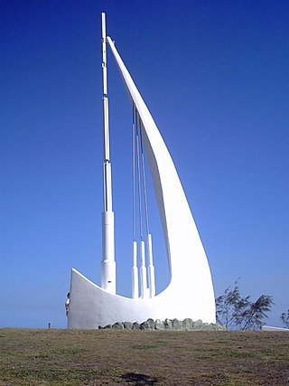
Emu Park is a coastal town and locality on the Capricorn Coast located 21 kilometres (13 mi) south of Yeppoon in Queensland, Australia. It is within the local government area of Shire of Livingstone. In the 2021 census, the locality of Emu Park had a population of 2,281 people.
Westwood is a town in the Rockhampton Region and a locality split between the Rockhampton Region and the Shire of Banana in Queensland, Australia. It was the first town that was gazetted by the Queensland Government. In the 2021 census, the locality of Westwood had a population of 199 people.
Frenchville is a suburb of Rockhampton in the Rockhampton Region, Queensland, Australia. In the 2021 census, Frenchville had a population of 8,982 people.
Rockhampton City is the central suburb of the city of Rockhampton in the Rockhampton Region, Queensland, Australia. It is informally known as Rockhampton central business district (CBD). In the 2021 census, Rockhampton City had a population of 2,059 people.
Depot Hill is a suburb of Rockhampton in the Rockhampton Region, Queensland, Australia. In the 2021 census, Depot Hill had a population of 995 people.
Kawana is a suburb of Rockhampton in the Rockhampton Region, Queensland, Australia. In the 2021 census, Kawana had a population of 4,434 people.
Port Alma is a coastal town, locality and port in the Rockhampton Region, Queensland, Australia. In the 2021 census, Port Alma had "no people or a very low population".
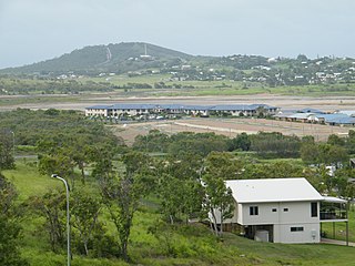
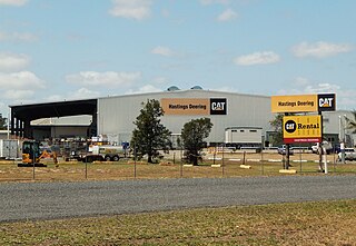
Zilzie is a coastal locality in the Livingstone Shire, Queensland, Australia. In the 2021 census, Zilzie had a population of 2,846 people.
Parkhurst is a suburb of Rockhampton in the Rockhampton Region, Queensland, Australia. In the 2021 census, Parkhurst had a population of 3,043 people.
Koongal is a suburb of Rockhampton in the Rockhampton Region, Queensland, Australia. In the 2021 census, Koongal had a population of 4,252 people.
Gogango is a rural town and locality in the Rockhampton Region, Queensland, Australia. In the 2021 census, the locality of Gogango had a population of 184 people.
Canoona is a rural locality in the Livingstone Shire, Queensland, Australia. It was the site of the first North Australian gold rush. In the 2021 census, Canoona had a population of 90 people.
Yaamba is a rural town and locality in the Livingstone Shire, Queensland, Australia. In the 2021 census, the locality of Yaamba had a population of 51 people.
North Rockhampton railway station was a railway station in The Common, Rockhampton, Queensland, Australia.
Park Avenue is a suburb of Rockhampton in the Rockhampton Region, Queensland, Australia. In the 2021 census, Park Avenue had a population of 5,292 people.
The Caves is a rural town and locality in the Livingstone Shire, Queensland, Australia. In the 2021 census, the locality of The Caves had a population of 680 people.
Port Curtis is a suburb of Rockhampton in the Rockhampton Region, Queensland, Australia. In the 2021 census, Port Curtis had a population of 309 people.
Nankin is a rural locality in the Livingstone Shire, Queensland, Australia. In the 2021 census, Nankin had a population of 176 people.
Thompson Point is a coastal locality in the Livingstone Shire, Queensland, Australia. It was the site of a short-lived town and port called Broadmount. In the 2021 census, Thompson Point had "no people or a very low population".
Rockhampton–Emu Park Road is a continuous 44.1 kilometres (27.4 mi) road route in the Rockhampton and Livingstone local government areas of Queensland, Australia. The route is designated as State Route 4 (Regional) and Tourist Drive 10. It is a state-controlled regional road.