Parkhurst, Queensland

Last updated

Parkhurst
Rockhampton,  Queensland
ParkhurstTownCentre4b.jpg
Parkhurst Town Centre shopping complex, 2020
Australia Queensland location map.svg
Red pog.svg
Parkhurst
Parkhurst, Queensland
Coordinates 23°18′27″S150°30′21″E / 23.3075°S 150.5058°E / -23.3075; 150.5058 (Parkhurst (centre of suburb))
Population3,043 (2021 census) [1]
 • Density147.7/km2 (382.6/sq mi)
Postcode(s) 4702
Area20.6 km2 (8.0 sq mi)
Time zone AEST (UTC+10:00)
Location
LGA(s) Rockhampton Region
State electorate(s)
Federal division(s) Capricornia
Suburbs around Parkhurst:
Glenlee Rockyview Limestone Creek
Glenlee Parkhurst Limestone Creek
Pink Lily Kawana Norman Gardens

Parkhurst is a suburb of Rockhampton in the Rockhampton Region, Queensland, Australia. [2] In the 2021 census, Parkhurst had a population of 3,043 people. [1]

Contents

Geography

Parkhurst is bounded to the north by Ramsay Creek and to the west by Ramsay Creek and then the Fitzroy River. To the south it is bounded by Limestone Creek (the creek, not the suburb) and by Rockhampton–Yeppoon Road. [3]

A section of the Bruce Highway passes through the centre of the suburb from south to north, while the North Coast railway line also passes through the suburb from south to north, to the west of the highway. [3] The proposed Rockhampton Ring Road will pass through Parkhurst on its way to join the Bruce Highway'

The Parkhurst Industrial Estate is in the south-west of the suburb, [4] while the residential land is in the west near the river and in the north-east of the suburb. Most of Parkhurst remains farmland, but Rockhampton's urban sprawl has led to further residential developments being established throughout Parkhurst including the Northridge, Rosedale, Paramount Park, Riverside and Edenbrook estates.[ citation needed ]

The increasing population at Parkhurst and in areas further north such as Rockyview and Glendale has led to the construction of the Parkhurst Town Centre, a new shopping centre anchored by a Woolworths supermarket. Construction of the centre commenced in August 2015. Woolworths was the first store in open in the centre on 15 November 2016. [3] [5] [6] [7]

The land near the river is prone to flooding. Rockhampton's water treatment facility is located near the river. [8]

Road infrastructure

The Rockhampton-Yeppoon Road (as Yeppoon Road) runs along the south-eastern boundary. [9]

History

The Glenmore Homestead is one of the earliest in the Rockhampton area, being established in the late 1850s. Land was opened up for settlement and small farms were established. [10]

Parkhurst Provisional School accepted its first enrolments on 11 June 1900. In 1909 it became Parkhurst State School. [11] [12]

Demographics

At the 2011 census, Parkhurst had a population of 1,385 people. [13]

In the 2016 census, Parkhurst had a population of 2,476 people. [14]

In the 2021 census, Parkhurst had a population of 3,043 people. [1]

Heritage listings

Glenmore Homestead, 2009 Glenmore Homestead (2009).jpg
Glenmore Homestead, 2009

Parkhurst has a number of heritage-listed sites, including:

Education

Parkhurst State School, 2021 ParkhurstSchool4.jpg
Parkhurst State School, 2021

Parkhurst State School is a government primary (Prep-6) school for boys and girls at 11 Mason Avenue ( 23°17′45″S150°30′49″E / 23.2958°S 150.5137°E / -23.2958; 150.5137 (Parkhurst State School) ). [16] [17] In 2014, the school had an enrolment of 308 students with 25 teachers (21 full-time equivalent). At that time, approximately half the children lived outside the suburb and came by school bus from the more rural areas to the north. [18] In 2018, the school had an enrolment of 404 students with 28 teachers (27 full-time equivalent) and 22 non-teaching staff (14 full-time equivalent). [19] It includes a special education program. [16]

There are no secondary schools in Parkhurst. The nearest government secondary school is Glenmore State High School in neighbouring Kawana to the south. [3]

Amenities

Parkhurst Tavern, 2020 ParkhurstTavern2.jpg
Parkhurst Tavern, 2020

Parkhurst Early Learning Centre is a child care centre and kindergarten in Bean Street established in 1995. [20] It also provides before-school care, after-school care, and vacation care. [21]

There are a number of parks in the area:

Attractions

Parkhurst is home to the Rockhampton Heritage Village. Located at 296 Boundary Road, this open air museum showcases a range of historic buildings with exhibitions of artefacts from Rockhampton's history. The museum is a venue for local markets and has a large function venue built in the style of a traditional woolshed. [23]

Limestone Creek Environmental Park offers a range of walking tracks in and around Limestone Creek through an open eucalypt forest where wildlife can be seen. It is popular with bird watchers and photographers. [24] [25]

Related Research Articles

<span class="mw-page-title-main">Yeppoon</span> Town in Queensland, Australia

Yeppoon is a coastal town and locality in the Shire of Livingstone, Queensland, Australia. Yeppoon is renowned for its beaches, tropical climate, and the islands out on the bay. Located 41 kilometres (25 mi) from the city of Rockhampton, Yeppoon is the seat of the Shire of Livingstone and the principal town on the Capricorn Coast, a string of seaside communities stretching more than 150 kilometres (93 mi) from north to south. The beaches and shallow coves provide a destination both for tourists and retirees settling down in Central Queensland. Offshore, there are 27 islands including Great Keppel Island which is 20 kilometres (12 mi) from Yeppoon. In the 2021 census, the locality of Yeppoon had a population of 7,037 people; this does not include any neighbouring suburbs.

<span class="mw-page-title-main">Capricorn Coast</span> Region in Queensland, Australia

The Capricorn Coast is a stretch of coastline in Central Queensland, Australia and is part of the Shire of Livingstone.

<span class="mw-page-title-main">Kinka Beach, Queensland</span> Suburb of Shire of Livingstone, Queensland, Australia

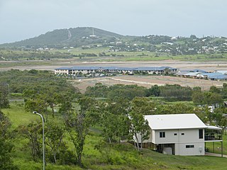
Kinka Beach is a coastal rural locality in the Livingstone Shire, Queensland, Australia. In the 2021 census, Kinka Beach had a population of 674 people.

<span class="mw-page-title-main">Kawana, Queensland (Rockhampton)</span> Suburb of Rockhampton, Queensland, Australia

Kawana is a suburb of Rockhampton in the Rockhampton Region, Queensland, Australia. In the 2021 census, Kawana had a population of 4,434 people.

The Common is a parkland suburb of Rockhampton in the Rockhampton Region, Queensland, Australia. In the 2021 census, The Common had "no people or a very low population".

<span class="mw-page-title-main">Zilzie</span> Suburb of Shire of Livingstone, Queensland, Australia

Zilzie is a coastal locality in the Livingstone Shire, Queensland, Australia. In the 2021 census, Zilzie had a population of 2,846 people.

<span class="mw-page-title-main">Cooee Bay</span> Suburb of Shire of Livingstone, Queensland, Australia

Cooee Bay is a coastal locality in the Livingstone Shire, Queensland, Australia. In the 2021 census, Cooee Bay had a population of 942 people.

<span class="mw-page-title-main">Taranganba</span> Town in Queensland, Australia

Taranganba is a town and locality in the Livingstone Shire, Queensland, Australia. In the 2021 census, the locality of Taranganba had a population of 2,275 people.

<span class="mw-page-title-main">Lammermoor, Queensland</span> Suburb of Shire of Livingstone, Queensland, Australia

Lammermoor is a coastal locality on the Capricorn Coast in the Livingstone Shire, Queensland, Australia. In the 2021 census, Lammermoor had a population of 2,551 people.

<span class="mw-page-title-main">Yaamba</span> Town in Queensland, Australia

Yaamba is a rural town and locality in the Livingstone Shire, Queensland, Australia. In the 2021 census, the locality of Yaamba had a population of 51 people.

<span class="mw-page-title-main">Cawarral</span> Town in Queensland, Australia

Cawarral is a rural town and locality in the Livingstone Shire, Queensland, Australia. In the 2021 census, the locality of Cawarral had a population of 831 people.

<span class="mw-page-title-main">Park Avenue, Queensland</span> Suburb of Rockhampton, Queensland, Australia

Park Avenue is a suburb of Rockhampton in the Rockhampton Region, Queensland, Australia. In the 2021 census, Park Avenue had a population of 5,292 people.

<span class="mw-page-title-main">The Caves, Queensland</span> Town in Queensland, Australia

The Caves is a rural town and locality in the Livingstone Shire, Queensland, Australia. In the 2021 census, the locality of The Caves had a population of 680 people.

Adelaide Park is a rural locality in the Livingstone Shire, Queensland, Australia. In the 2021 census, Adelaide Park had a population of 449 people.

<span class="mw-page-title-main">Norman Gardens, Queensland</span> Suburb of Rockhampton, Queensland, Australia

Norman Gardens is a suburb in the Rockhampton Region, Queensland, Australia. In the 2021 census, Norman Gardens had a population of 10,534 people.

Glenlee is a rural locality in the Livingstone Shire, Queensland, Australia. In the 2021 census, Glenlee had a population of 1,193 people.

<span class="mw-page-title-main">Canal Creek</span> Suburb of Livingstone Shire, Queensland, Australia

Canal Creek is a rural locality in the Livingstone Shire, Queensland, Australia. In the 2021 census, Canal Creek had "no people or a very low population".

<span class="mw-page-title-main">Coorooman, Queensland</span> Suburb of Livingstone Shire, Queensland, Australia

Coorooman is a rural coastal locality in the Livingstone Shire, Queensland, Australia. In the 2021 census, Coorooman had a population of 97 people.

Limestone Creek is a suburb in the Rockhampton Region, Queensland, Australia. In the 2021 census, Limestone Creek had a population of 179 people.

Rockhampton–Yeppoon Road is a non-continuous 39.8 kilometres (24.7 mi) road route in the Rockhampton and Livingstone local government areas of Queensland, Australia. Most of the route is designated as State Route 4 (Regional) and Tourist Drive 10. It is a state-controlled regional road.

References

  1. 1 2 3 Australian Bureau of Statistics (28 June 2022). "Parkhurst (SAL)". 2021 Census QuickStats. Retrieved 28 February 2023. OOjs UI icon edit-ltr-progressive.svg
  2. "Parkhurst – suburb in Rockhampton Region (entry 48829)". Queensland Place Names. Queensland Government . Retrieved 29 December 2020.
  3. 1 2 3 4 "Queensland Globe". State of Queensland . Retrieved 12 February 2022.
  4. "Parkhurst Industrial Estate | EDQ Industrial". industrial.edq.com.au. Archived from the original on 22 October 2015. Retrieved 5 August 2015.
  5. "Parkhurst Town Centre | AHC - Gold Coast Property Developers". www.ahc.com.au. Archived from the original on 29 February 2016. Retrieved 5 August 2015.
  6. "August start for construction of Parkhurst Town Centre". Archived from the original on 18 August 2015. Retrieved 5 August 2015.
  7. Parkhurst residents rejoice, it's finally here Archived 18 November 2016 at the Wayback Machine , Matty Holdsworth, The Morning Bulletin , 15 November 2016. Retrieved 17 November 2016.
  8. "Rockhampton City Plan: Parkhurst Rural Area" (PDF). Rockhampton Regional Council. 30 August 2005. Archived from the original (PDF) on 5 March 2016. Retrieved 6 August 2015.
  9. Google (23 April 2022). "Parkhurst, Queensland" (Map). Google Maps . Google. Retrieved 23 April 2022.
  10. "Parkhurst". Queensland Places. Centre for the Government of Queensland, University of Queensland. Archived from the original on 22 September 2020. Retrieved 18 July 2020.
  11. "Opening and closing dates of Queensland Schools". Queensland Government . Retrieved 18 April 2019.
  12. "Agency ID 5610, Parkhurst State School". Queensland State Archives . Retrieved 5 August 2015.
  13. Australian Bureau of Statistics (31 October 2012). "Parkhurst (State Suburb)". 2011 Census QuickStats. Retrieved 14 July 2013. OOjs UI icon edit-ltr-progressive.svg
  14. Australian Bureau of Statistics (27 June 2017). "Parkhurst (SSC)". 2016 Census QuickStats. Retrieved 20 October 2018. OOjs UI icon edit-ltr-progressive.svg
  15. "Glenmore Homestead (entry 600823)". Queensland Heritage Register . Queensland Heritage Council. Retrieved 12 July 2013.
  16. 1 2 "State and non-state school details". Queensland Government. 9 July 2018. Archived from the original on 21 November 2018. Retrieved 21 November 2018.
  17. "Parkhurst State School". Parkhurst State School. 14 February 2019. Archived from the original on 30 June 2021. Retrieved 12 February 2022.
  18. "2014 School Annual Report" (PDF). Parkhurst State School. Archived (PDF) from the original on 4 March 2016. Retrieved 5 August 2015.
  19. "ACARA School Profile 2018". Australian Curriculum, Assessment and Reporting Authority. Archived from the original on 27 August 2020. Retrieved 28 January 2020.
  20. Parkhurst Early Learning Centre celebrates 20 years Archived 18 February 2017 at the Wayback Machine , The Morning Bulletin , 28 October 2015. Retrieved 17 February 2017
  21. PELC: About Us Archived 18 February 2017 at the Wayback Machine , Parkhurst Early Learning Centre website. Retrieved 17 February 2017.
  22. 1 2 3 4 5 6 7 8 9 10 "Land for public recreation - Queensland". Queensland Open Data. Queensland Government. 20 November 2020. Archived from the original on 22 November 2020. Retrieved 22 November 2020.
  23. "Rockhampton Heritage Village". www.rockhamptonregion.qld.gov.au. Archived from the original on 11 August 2015. Retrieved 5 August 2015.
  24. "Rockhampton and Capricorn Coast: parks and forests" (PDF). Queensland Government. 2012. Retrieved 5 August 2015.
  25. Plant, Paul. "Limestone Creek Environmental Park" (PDF). Subtropical Gardening. Archived (PDF) from the original on 24 September 2015. Retrieved 5 August 2015.

Further reading

Commons-logo.svg Media related to Parkhurst, Queensland at Wikimedia Commons