
Yeppoon is a coastal town and locality in the Shire of Livingstone, Queensland, Australia. Yeppoon is renowned for its beaches, tropical climate, and the islands out on the bay. Located 41 kilometres (25 mi) from the city of Rockhampton, Yeppoon is the seat of the Shire of Livingstone and the principal town on the Capricorn Coast, a string of seaside communities stretching more than 150 kilometres (93 mi) from north to south. The beaches and shallow coves provide a destination both for tourists and retirees settling down in Central Queensland. Offshore, there are 27 islands including Great Keppel Island which is 20 kilometres (12 mi) from Yeppoon. In the 2021 census, the locality of Yeppoon had a population of 7,037 people; this does not include any neighbouring suburbs.

Kinka Beach is a coastal rural locality in the Livingstone Shire, Queensland, Australia. In the 2021 census, Kinka Beach had a population of 674 people.
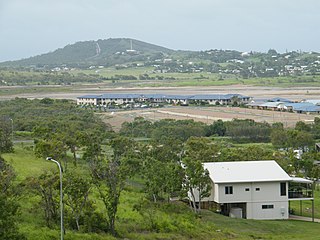
Zilzie is a coastal locality in the Livingstone Shire, Queensland, Australia. In the 2021 census, Zilzie had a population of 2,846 people.

Cooee Bay is a coastal locality in the Livingstone Shire, Queensland, Australia. In the 2021 census, Cooee Bay had a population of 942 people.

Taranganba is a town and locality in the Livingstone Shire, Queensland, Australia. In the 2021 census, the locality of Taranganba had a population of 2,275 people.

Parkhurst is a northern suburb of Rockhampton in the Rockhampton Region, Queensland, Australia. In the 2021 census, Parkhurst had a population of 3,043 people.

Mount Chalmers is a rural town and locality in the Livingstone Shire, Queensland, Australia. In the 2021 census, the locality of Mount Chalmers had a population of 226 people.
Adelaide Park is a rural locality in the Livingstone Shire, Queensland, Australia. In the 2021 census, Adelaide Park had a population of 449 people.
Ironpot is a rural locality in the Livingstone Shire, Queensland, Australia. In the 2021 census, Ironpot had a population of 184 people.
Nankin is a rural locality in the Livingstone Shire, Queensland, Australia. In the 2021 census, Nankin had a population of 176 people.
Glenlee is a rural locality in the Livingstone Shire, Queensland, Australia. In the 2021 census, Glenlee had a population of 1,193 people.

Canal Creek is a rural locality in the Livingstone Shire, Queensland, Australia. In the 2021 census, Canal Creek had "no people or a very low population".

Boulder Creek is a rural locality in the Rockhampton Region, Queensland, Australia. In the 2021 census, Boulder Creek had a population of 13 people.

Tanby is a rural locality in the Livingstone Shire, Queensland, Australia. In the 2021 census, Tanby had a population of 577 people.

Coorooman is a rural coastal locality in the Livingstone Shire, Queensland, Australia. In the 2021 census, Coorooman had a population of 97 people.
Cobraball is a rural locality in the Livingstone Shire, Queensland, Australia. In the 2021 census, Cobraball had a population of 81 people.
Lake Mary is a rural locality in the Livingstone Shire, Queensland, Australia. In the 2021 census, Lake Mary had a population of 96 people.
Greenlake is a rural locality in the Livingstone Shire, Queensland, Australia. In the 2021 census, Greenlake had "no people or a very low population".
Glendale is a rural locality in the Shire of Livingstone, Queensland, Australia. In the 2021 census, Glendale had a population of 600 people.
Rockhampton–Yeppoon Road is a non-continuous 39.8 kilometres (24.7 mi) road route in the Rockhampton and Livingstone local government areas of Queensland, Australia. Most of the route is designated as State Route 4 (Regional) and Tourist Drive 10. It is a state-controlled regional road.
