Kabra, Queensland

Last updated

Map all coordinates using: OpenStreetMap  
Download coordinates as: KML
Kabra
Queensland
Australia Queensland location map.svg
Red pog.svg
Kabra
Coordinates 23°28′18″S150°23′50″E / 23.4716°S 150.3972°E / -23.4716; 150.3972 (Kabra (town centre)) Coordinates: 23°28′18″S150°23′50″E / 23.4716°S 150.3972°E / -23.4716; 150.3972 (Kabra (town centre))
Population421 (2016 census locality) [1]
 • Density4.446/km2 (11.514/sq mi)
Postcode(s) 4702
Area94.7 km2 (36.6 sq mi)
Time zone AEST (UTC+10:00)
Location
LGA(s) Rockhampton Region
State electorate(s) Mirani
Federal division(s) Flynn
Suburbs around Kabra:
Stanwell Nine Mile Gracemere
Stanwell Kabra Gracemere
Stanwell Bouldercombe Bouldercombe

Kabra is a rural town and locality in the Rockhampton Region, Queensland, Australia. [2] [3] In the 2016 census the locality of Kabra had a population of 421 people. [1]

Contents

Boongary is a neighbourhood in the south-east of the locality ( 23°31′00″S150°25′00″E / 23.5166°S 150.4166°E / -23.5166; 150.4166 (Boongary (neighbourhood)) ). [4]

Geography

The town is in the north-east of the locality on the Capricorn Highway. Middle Creek passes through the town and Gracemere Creek passes through the rural part of the locality.

The Central Western railway line passes through the locality from Rockhampton to Winton with the following stations within the locality:

The Dawson Valley railway line commenced at Kabra railway station and went to Theodore with the following stations in the locality:

The Dawson Valley railway line is now closed and its stations abandoned. [5]

The locality of Kabra has the following mountains:

The land use is mixed. Housing is not limited to the town area with pockets of rural residential development mainly in the east of the locality. The agricultural use is predominantly grazing on native vegetation but also on modified pastures. There is also some cropping and a number of quarries. [9]

History

In the 1860s, Cargoogie Mountain (or Police Mountain) adjacent to Kabra was an outpost for the Native Police. It served as a depot for troopers and horses, and messages would be communicated from this outpost to the main barracks near Rockhampton via heliograph or smoke signals. [10] Skeletal remains, some in manacles, were occasionally unearthed when ploughing the fields around the outpost after it had ceased operations. [11]

A post office was opened on 7 September 1887; it closed on 31 October 1977. [12]

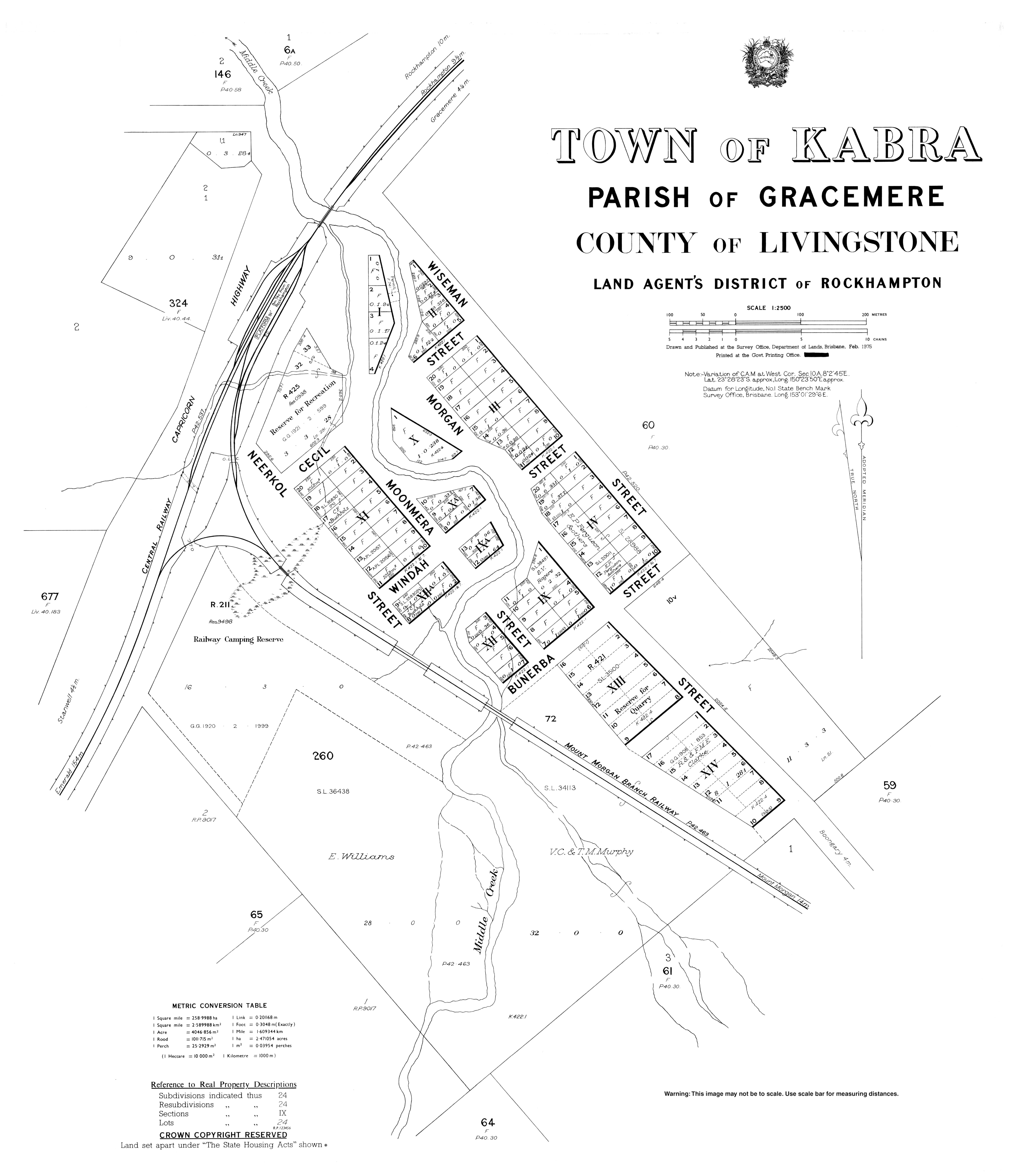
The first stage of the railway line to Mount Morgan (subsequently extended to Theodore) opened on 15 June 1898, branching at Kabra railway station. The Boongary railway station was named by the Queensland Railways Department and the name Boongarry is an Aboriginal word meaning tree kangaroo and that name also refers to the neighbourhood around the railway station. [4]

Land was reserved for a school in Kabra in July 1902 [13] and the Kabra Provisional School opened on 29 October 1902. On 1 January 1909 it became Kabra State School. Due to falling enrolment numbers, the school closed on 23 February 1941; the last teacher was Harry Adolph Barke. [14] [15]

On 29 September 1917, an honour board was unveiled at the Kabra railway station, listing men from the district who served in World War I. It was 5 feet (1.5 m) high and 4 feet (1.2 m) wide and made of polished silky oak. [16] When the railway station closed[ when? ], the honour board was relocated to the Kabra Hotel where it is now displayed in the dining room. [17]

In 2012, Kabra residents began raising concerns about potential health risks associated with an increasing number of flying foxes roosting in the town. [18] A colony of 15,000 flying foxes were living in the town's bloodwood trees. [18] Rockhampton Regional Council told residents the flying fox colony in the town would only be temporary as between 95% and 99% of the colony were identified as transient little red flying foxes which were expected to move on after a short period. [18] However, the flying foxes were still an issue for Kabra in 2014 when more than 40,000 bats were roosting in the town, prompting much discussion in the local media. [19] [20] [21] [22] [23] [24] In June 2014, the council received approval from the Department of Environment and Heritage Protection to modify local vegetation at Kabra, removing a number of trees and replacing them with native species which would be less appealing to flying foxes. [25]

In January 2013, Kabra was impacted by flash flooding caused by the torrential rain brought the region from ex-Cyclone Oswald. [26] Seven people were evacuated from Kabra by emergency services. [27] Kabra was also affected by the 2018 Central Queensland bushfires in November 2018 when a fast moving fire front travelled through the town as it headed towards Gracemere, completely destroying one home. [28]

In the 2011 census, Kabra had a population of 472 people. [29]

In the 2016 census the locality of Kabra had a population of 421 people. [1]

Education

There are no schools in Kabra. The nearest primary schools are Waraburra State School in neighbouring Gracemere to the east, Gracemere State School also in Gracemere, Bouldercombe State School in neighbouring Bouldercombe to the south, and Stanwell State School in neighbouring Stanwell to the west. The nearest government secondary schools are Rockhampton State High School in Wandal in Rockhampton to the north-east and Mount Morgan State High School in Mount Morgan to the south-west. [9]

Attractions

Kabra is a major waypoint on the National Bicentennial Trail. [30] [31]

The town is also known for its regular mud racing events. [32] [33] [34] [35]

Related Research Articles

<span class="mw-page-title-main">Rockhampton</span> City in Queensland, Australia

Rockhampton is a city in the Rockhampton Region of Central Queensland, Australia. The population of Rockhampton in June 2018 was 78,592, making it the fourth-largest city in the state outside of the cities of South East Queensland, and the 22nd-largest city in Australia. Today, Rockhampton is an industrial and agricultural centre of the north, and is the regional centre of Central Queensland.

Mount Morgan, Queensland City in Queensland, Australia

Mount Morgan is a rural town and locality in the Rockhampton Region, Queensland, Australia. In the 2016 census the locality of Mount Morgan had a population of 1,963 people.

Emu Park, Queensland Town in Queensland, Australia

Emu Park is a coastal town and locality on the Capricorn Coast located 21 kilometres (13 mi) south of Yeppoon in Queensland, Australia. It is within the local government area of Shire of Livingstone. In the 2016 census the locality of Emu Park had a population of 2,130 people.

<span class="mw-page-title-main">Gracemere, Queensland</span> Town in Queensland, Australia

Gracemere is a rural town and locality in the Rockhampton Region, Queensland, Australia. In the 2016 census, the locality of Gracemere had a population of 11,315 people.

Anakie Siding, Queensland Small town in central Queensland, Australia

Anakie Siding is a rural locality in the Central Highlands Region, Queensland, Australia. The town of Anakie is within the locality. It is a sapphire mining area.

Mount Larcom, Queensland Town in Queensland, Australia

Mount Larcom is the name of a mountain, a rural town and locality in the Gladstone Region, Queensland, Australia. In the 2016 census, the locality of Mount Larcom had a population of 361 people.

Shire of Fitzroy Local government area in Queensland, Australia

The Shire of Fitzroy was a local government area located in the Capricornia region of Central Queensland, Queensland, Australia, to the immediate west and south of the regional city of Rockhampton. The shire, administered from the town of Gracemere, covered an area of 5,898.7 square kilometres (2,277.5 sq mi), and existed as a local government entity from 1899 until 2008, when it amalgamated with several other councils to become the Rockhampton Region. It is named for the Fitzroy River, that passes along the northern boundary of the shire.

Wowan, Queensland Town in Queensland, Australia

Wowan is a rural town and locality in the Shire of Banana, Queensland, Australia. In the 2016 census, the locality of Wowan had a population of 216 people.

Jambin, Queensland Town in Queensland, Australia

Jambin is a rural town and locality in the Shire of Banana, Queensland, Australia.

Marmor, Queensland Town in Queensland, Australia

Marmor is a rural town and locality in the Rockhampton Region, Queensland, Australia. In the 2016 census, the locality of Marmor had a population of 212 people.

Raglan, Queensland Town in Queensland, Australia

Raglan is a rural town and locality in the Gladstone Region, Queensland, Australia. In the 2016 census, the locality of Raglan had a population of 146 people.

Bouldercombe Town in Queensland, Australia

Bouldercombe is a rural town and locality in the Rockhampton Region, Queensland, Australia. In the 2016 census, the locality of Bouldercombe had a population of 1,085 people.

Stanwell, Queensland Suburb of Rockhampton Region, Queensland, Australia

Stanwell is a rural town and locality in the Rockhampton Region, Queensland, Australia. In the 2016 census the locality of Stanwell had a population of 337 people.

<span class="mw-page-title-main">Bajool, Queensland</span> Suburb of Rockhampton Region, Queensland, Australia

Bajool is a rural town and locality in the Rockhampton Region, Queensland, Australia. In the 2016 census, the locality of Bajool had a population of 455 people.

Yaamba Suburb of Shire of Livingstone, Queensland, Australia

Yaamba is a rural town and locality in the Livingstone Shire, Queensland, Australia. In the 2016 census, the locality of Yaamba had a population of 62 people.

The Caves, Queensland Town in Queensland, Australia

The Caves is a rural town and locality in the Livingstone Shire, Queensland, Australia. In the 2016 census the locality of The Caves had a population of 718 people.

Port Curtis, Queensland Suburb of Rockhampton, Queensland, Australia

Port Curtis is a suburb in the Rockhampton Region, Queensland, Australia. In the 2016 census Port Curtis had a population of 281 people.

<span class="mw-page-title-main">Bushley, Queensland</span> Suburb of Rockhampton Region, Queensland, Australia

Bushley is a rural locality in the Rockhampton Region, Queensland, Australia. In the 2016 census, Bushley had a population of 30 people.

<span class="mw-page-title-main">Thompson Point, Queensland</span> Suburb of Livingstone Shire, Queensland, Australia

Thompson Point is a coastal locality in the Livingstone Shire, Queensland, Australia. In the 2016 census Thompson Point had a population of 10 people. It was the site of a short-lived town and port called Broadmount.

Kunwarara is a rural locality in the Livingstone Shire, Queensland, Australia. In the 2016 census Kunwarara had a population of 71 people.

References

  1. 1 2 3 Australian Bureau of Statistics (27 June 2017). "Kabra (SSC)". 2016 Census QuickStats. Retrieved 20 October 2018. OOjs UI icon edit-ltr-progressive.svg
  2. "Kabra – town in Rockhampton Region (entry 17527)". Queensland Place Names. Queensland Government . Retrieved 28 December 2020.
  3. "Kabra – locality in Rockhampton Region (entry 48688)". Queensland Place Names. Queensland Government . Retrieved 28 December 2020.
  4. 1 2 "Boongary – locality unbounded in Rockhampton Regional (entry 3767)". Queensland Place Names. Queensland Government . Retrieved 28 December 2020.
  5. 1 2 3 4 5 "Railway stations and sidings - Queensland". Queensland Open Data. Queensland Government. 2 October 2020. Archived from the original on 5 October 2020. Retrieved 5 October 2020.
  6. 1 2 "Mountain peaks and capes - Queensland". Queensland Open Data. Queensland Government. 12 November 2020. Archived from the original on 25 November 2020. Retrieved 25 November 2020.
  7. "Cargoogie Mountain – mountain in Rockhampton Region (entry 6236)". Queensland Place Names. Queensland Government . Retrieved 25 November 2020.
  8. "Table Mountain – mountain in Rockhampton Region (entry 33064)". Queensland Place Names. Queensland Government . Retrieved 25 November 2020.
  9. 1 2 "Queensland Globe". State of Queensland . Retrieved 20 February 2021.
  10. "Cargoogie Or Police Mountain". The Central Queensland Herald . Vol. 21, no. 1182. Queensland, Australia. 22 November 1951. p. 17. Retrieved 24 October 2020 via National Library of Australia.
  11. "ON THE TRACK". The Capricornian . Vol. XLVIII, no. 45. Queensland, Australia. 10 November 1923. p. 62. Retrieved 24 October 2020 via National Library of Australia.
  12. Premier Postal History. "Post Office List". Premier Postal Auctions. Retrieved 29 May 2014.
  13. "NEW RESERVES". The Queenslander . National Library of Australia. 26 July 1902. p. 223 Supplement: unknown. Retrieved 29 May 2014.
  14. "FAREWELL PARTIES". The Morning Bulletin . Rockhampton, Qld.: National Library of Australia. 4 March 1941. p. 8. Retrieved 29 May 2014.
  15. "Agency ID 9069, Kabra State School". Queensland State Archives . Retrieved 29 May 2014.
  16. "LOCAL AND GENERAL NEWS". The Capricornian . Rockhampton, Qld.: National Library of Australia. 29 September 1917. p. 7. Retrieved 29 May 2014.
  17. "Kabra 1914 - 1919 Honour Board". Queensland War Memorial Register. Queensland Government . Retrieved 8 September 2022.
  18. 1 2 3 Haydock, Amy (29 February 2012). "Growing bat numbers worry residents". The Morning Bulletin. Retrieved 15 June 2021.
  19. Rollo, William (12 February 2014). "'Stinky' flying foxes driving Kabra residents batty". ABC News. Retrieved 15 June 2021.
  20. King, Adrian (6 February 2014). "Kabra man kicks up a stink about smelly bats in backyard". The Morning Bulletin. Retrieved 15 June 2021.
  21. Laskus, Lyn (7 February 2014). "Letter to the Editor: Fearless bat protector jumps to defend red flying foxes". The Morning Bulletin. Retrieved 15 June 2021.
  22. King, Adrian (10 February 2014). "Entire street now full of flying foxes - Kabra resident says". The Morning Bulletin. Retrieved 15 June 2021.
  23. "'Common sense' call over flying fox roost from Mirani MP". The Morning Bulletin. 14 February 2014. Retrieved 15 June 2021.
  24. McKay, Pam (5 April 2014). "Residents batty over new influx a month later at Kabra". The Morning Bulletin. Retrieved 15 June 2021.
  25. "Council approved to remove trees to reduce Kabra bats". The Morning Bulletin. 3 June 2014. Retrieved 15 June 2021.
  26. "Flood ruins Jamie Miller's family home at Kabra property". The Morning Bulletin. 29 January 2013. Retrieved 15 June 2021.
  27. "As it happened: Flood chaos hits Queensland". ABC News. 25 January 2013. Retrieved 15 June 2021.
  28. Gately, Michelle (10 December 2018). "'Nothing left to salvage': Kabra couple loses everything" . The Morning Bulletin. Retrieved 15 June 2021.
  29. Australian Bureau of Statistics (31 October 2012). "Kabra (SSC)". 2011 Census QuickStats. Retrieved 29 May 2014. OOjs UI icon edit-ltr-progressive.svg
  30. "Section Three – Collinsville to Kabra". The Bicentennial National Trail. The Bicentennial National Trail Ltd. Retrieved 29 May 2014.
  31. "Section Four – Kabra to Biggenden". The Bicentennial National Trail. The Bicentennial National Trail Ltd. Retrieved 29 May 2014.
  32. McKay, Pam (17 November 2017). "Mud racers ready to turn it on at Kabra". The Morning Bulletin. Retrieved 15 June 2021.
  33. Terzon, Emilia (22 August 2018). "Mud racing event near Rockhampton unlikely victim of Queensland drought". ABC News. Retrieved 15 June 2021.
  34. McKay, Pam (12 November 2018). "Muddy good fun at twin track meet at Kabra". The Morning Bulletin. Retrieved 15 June 2021.
  35. McKay, Pam (5 March 2021). "'Keen as mustard' to get down and dirty" . The Morning Bulletin. Retrieved 15 June 2021.