Thompson Point, Queensland

Last updated

Map all coordinates using: OpenStreetMap  
Download coordinates as: KML
Thompson Point
Queensland
Houses on Thompson Point, near Rockhampton, Queensland, circa 1910.jpg
Houses on Thompson Point (probably the Broadmount area), circa 1910
Australia Queensland location map.svg
Red pog.svg
Thompson Point
Coordinates 23°28′29″S150°50′25″E / 23.4747°S 150.8402°E / -23.4747; 150.8402 (Thompson Point (centre of locality)) Coordinates: 23°28′29″S150°50′25″E / 23.4747°S 150.8402°E / -23.4747; 150.8402 (Thompson Point (centre of locality))
Population10 (2016 census) [1]
 • Density0.040/km2 (0.10/sq mi)
Postcode(s) 4702
Area251.2 km2 (97.0 sq mi)
Time zone AEST (UTC+10:00)
Location
LGA(s) Livingstone Shire
State electorate(s) Keppel
Federal division(s)
Suburbs around Thompson Point:
Joskeleigh Joskeleigh Coral Sea
Nankin Thompson Point Curtis Island
Nankin Port Alma The Narrows

Thompson Point is a coastal locality in the Livingstone Shire, Queensland, Australia. [2] In the 2016 census Thompson Point had a population of 10 people. [1] It was the site of a short-lived town and port called Broadmount.

Contents

Geography

The locality is bounded to the east by the Coral Sea and to the south by the Fitzroy River which enters the Coral Sea at the south-east of the locality. [3] [4]

There are also two neighbourhoods in the locality:

The undeveloped town of Broadmount is within the locality on the northern bank of the Fitzroy River ( 23°29′55″S150°47′41″E / 23.4986°S 150.7946°E / -23.4986; 150.7946 (Broadmount (town)) ). [7] [8]

The locality contains the following mountains (from west to east):

Thompson Point has the following ranges:

A number of creeks flow through the locality (from west to east by mouth):

Balnagowan Dam is a reservoir ( 23°26′52″S150°45′42″E / 23.4477°S 150.7616°E / -23.4477; 150.7616 (Balnagowan Dam) ), originally built to support the town of Broadmount and to provide water for the steam trains operating on the line. [17] [18] [19]

The locality has the following headlands (from west to east):

Rundle Beach is between Datum Point and Cattle Point ( 23°30′04″S150°51′33″E / 23.5012°S 150.8591°E / -23.5012; 150.8591 (Rundle Beach) ).

The mouth of the Fitzroy River contains three named islands (from west to east):

Rocky Point Reach is the reach of the Fitzroy River to the south of Egg and Mud Islands ( 23°31′45″S150°50′05″E / 23.5291°S 150.8347°E / -23.5291; 150.8347 (Rocky Point Reach) ). [30]

History

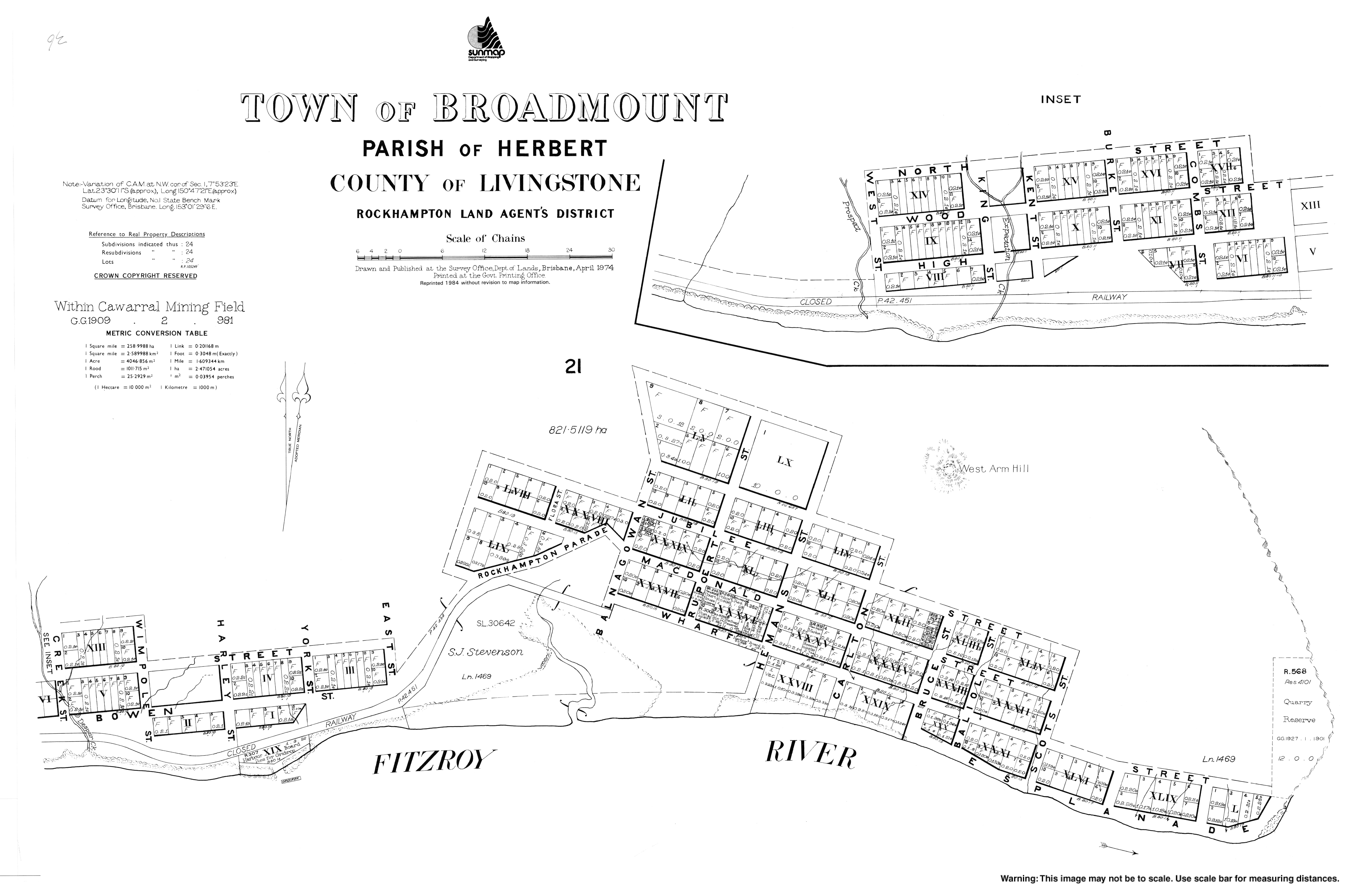
The town of Broadmount was originally named Herbert, but was renamed after the mountain Broadmount, which was named by Matthew Flinders on 10 August 1802 during his explorations on HM Sloop Investigator. [31]

On 30 January 1866 the Queensland Government began to sell town lots in the town of Herbert (as the town of Broadmount was then called). [32] In 1874 it was noted that none of the land sold at Herbert had been developed due to its inaccessibility overland to Rockhampton. [33]

Although Rockhampton (further upstream on the Fitzroy River) was a major port, as ships became larger, the river was not deep enough to accommodate them, resulting in Rockhampton being bypassed by ships or by the inefficient practice of ships being unloaded into small lighters in Keppel Bay for the remainder of the journey to Rockhampton. As the Fitzroy River at Broadmount had 4 fathoms (24 ft; 7.3 m) of water even at low tide, it was sufficient for even the largest ships of that time, but Broadmount was not accessible by rail. [34] However, the construction of North Rockhampton to Emu Park railway line in 1888 brought the railway closer to Broadmount. [35]

Broadmount Railway Station, circa 1910 Broadmount Railway Station, circa 1910.jpg
Broadmount Railway Station, circa 1910

On 26 September 1895 the Queensland Government announced that it would build a new section railway line to Herbert/Broadmount, branching off the Emu Park line at a new Nankin Junction railway station. [36] By November 1895 work had commenced on building a wharf at Broadmount and on the detailed survey of the railway route. [37] [38] In January 1896 a provisional hotel licence was issued to Joseph Cunningham who was constructing a hotel on the corner of Wharf and Carl Streets in Broadmount. [39] The railway was complete and able to be used by October 1897 but the wharf was not yet complete. The Balnagowan Dam was built on the Balnagowan pastoral run in 1898 to supply Broadmount and the railway with water. [17] [40] On 1 January 1898 railway services commenced on the new branch railway, which opened without any ceremony and despite the wharf still being 10 weeks from completion. The journey between North Rockhampton railway station and Broadmount railway station took one and a quarter hours. However, there were delays on completing the wharf and disagreements over the dredging of a channel to the wharf. [41] [42] [43] [44] [45] [46] [47] In February 1899 the coastal steamer Premier was forced to use Broadmount wharf during the flooding in Rockhampton, becoming a regular arrangement. [48] [49] In June 1899, the Alexandria Bridge rail bridge over the Fitzroy River in Rockhampton was opened, enabling cargo landed at the new port at Broadmount to travel throughout the Central Queensland railway network. [50]

The locality was served by two railway stations (from west to east): [51]

Broadmount Provisional School opened circa May 1901 and closed circa 1906 due to low student numbers. [52]

In 1905 August 1905 the Queensland Government agreed to the establishment of a provisional school near Thompson's Point (the headland) as there were 31 children living in the area. [53] [54] The opening of Thompson's Point Provisional School was celebrated with a concert and dance on Saturday 10 February 1906. [55] By that time there were over 60 children enrolled. [56] The school was built to be portable as it was believed that it might no longer be needed once all the harbour improvements were completed. [57] On 1 January 1909 it became Thompson's Point State School . It had some temporary closures due to low student numbers before it permanently closed in 1929. [52] It was located near the Thompson's Point railway station on Broadmount Road (approx 23°29′01″S150°44′16″E / 23.4836°S 150.7378°E / -23.4836; 150.7378 (Thompson's Point State School) ). [51]

Broadmount's role as a port was soon in doubt due to ongoing issues with dredging which prevented it from accommodating the largest ships. In December 1903 the North Coast railway line between Rockhampton and Gladstone was opened and Gladstone's excellent harbour become the preferred port for Central Queensland. Attempting to protect their investment in Broadmount, the government introduced a system of higher freight charges on that line to discourage its use in favour of using Broadmount port. In 1912 a railway line was built to Port Alma which had better deepwater facilities than Broadmount and the port at Broadmount became a "white elephant". The Broadmount railway line was closed on 19 August 1929, effectively closing the port. [58] In September 1930 the wharf at the port was damaged in a fire. [59]

In the 2016 census Thompson Point had a population of 10 people. [1]

Education

There are no schools in Thompson Point. The nearest government primary schools are Lakes Creek State School in Lakes Creek to the north-west and Keppel Sands State School in Keppel Sands to the north. The nearest government secondary schools are North Rockhampton State High School in Frenchville to the north-west and Yeppoon State High School in Yeppoon to the north. [3]

Amenities

There is a boat ramp and floating walkway at the southern end of Thompson Point Road ( 23°29′18″S150°44′10″E / 23.4884°S 150.7361°E / -23.4884; 150.7361 (Thompson Point boat ramp) ) providing access to the Fitzroy River. It is managed by the Livingstone Shire Council. [60]

Related Research Articles

Yeppoon Town in Queensland, Australia

Yeppoon is a coastal town and locality in the Shire of Livingstone, Queensland, Australia. Yeppoon is renowned for its beaches, tropical climate, and the islands out on the bay. Twenty-five minutes from the city of Rockhampton, Yeppoon is the principal town on the Capricorn Coast, a string of seaside communities stretching more than 150 kilometres (93 mi) from north to south. The beaches and shallow coves provide a destination both for tourists and retirees settling down in Central Queensland. Offshore, there are 27 islands including Great Keppel Island which is 20 kilometres (12 mi) from Yeppoon.

Capricorn Coast Region in Queensland, Australia

The Capricorn Coast is a stretch of coastline in Central Queensland, Australia and is part of the Shire of Livingstone.

Shire of Livingstone Local government area in Queensland, Australia

The Shire of Livingstone is a local government area located in the Capricornia region of Central Queensland, Queensland, Australia, to the immediate north and east of the regional city of Rockhampton. The shire, administered from the coastal town of Yeppoon, covers an area of 11,758 square kilometres (4,539.8 sq mi), and existed as a local government entity from 1879 until 2008, when it amalgamated with several other councils to become the Rockhampton Region. The Shire was re-established on 1 January 2014 following a successful de-amalgamation referendum in 2013.

Keppel Bay Body of water

Keppel Bay is a bay in Central Queensland, Australia at the mouth of the Fitzroy River on the coast of the Coral Sea.

Rockhampton Region Local government area in Queensland, Australia

The Rockhampton Region is a local government area (LGA) in Central Queensland, Australia, located on the Tropic of Capricorn about 600 kilometres (370 mi) north of Brisbane. Rockhampton is the region's major city; the region also includes the Fitzroy River, Mount Archer National Park and Berserker Range.

The Common is a parkland suburb of Rockhampton in the Rockhampton Region, Queensland, Australia. In the 2016 census The Common had a population of 0 people.

Port Alma, Queensland Town in Queensland, Australia

Port Alma is a coastal town, locality and port in the Rockhampton Region, Queensland, Australia. In the 2016 census, Port Alma had a population of 0 people.

Zilzie Suburb of Shire of Livingstone, Queensland, Australia

Zilzie is a coastal locality in the Livingstone Shire, Queensland, Australia. In the 2016 census, Zilzie had a population of 2,713 people.

Cooee Bay Suburb of Shire of Livingstone, Queensland, Australia

Cooee Bay is a coastal locality in the Livingstone Shire, Queensland, Australia. In the 2016 census Cooee Bay had a population of 913 people.

Morinish, Queensland Suburb of Rockhampton Region, Queensland, Australia

Morinish is a rural locality in the Rockhampton Region, Queensland, Australia. In the 2016 census Morinish had a population of 89 people.

Bajool, Queensland Suburb of Rockhampton Region, Queensland, Australia

Bajool is a rural town and locality in the Rockhampton Region, Queensland, Australia. In the 2016 census, the locality of Bajool had a population of 455 people.

Canoona Suburb of Shire of Livingstone, Queensland, Australia

Canoona is a rural locality in the Livingstone Shire, Queensland, Australia. In the 2016 census, Canoona had a population of 81 people. It was the site of the first North Australian gold rush.

Yaamba is a town and locality in the Shire of Livingstone, Queensland, Australia.

Nerimbera, Queensland Suburb of Shire of Livingstone, Queensland, Australia

Nerimbera is a rural locality in the Livingstone Shire, Queensland, Australia. In the 2016 census, Nerimbera had a population of 293 people.

Mount Chalmers, Queensland Town in Queensland, Australia

Mount Chalmers is a rural town and locality in the Livingstone Shire, Queensland, Australia. In the 2016 census, the locality of Mount Chalmers had a population of 235 people.

The Caves, Queensland Town in Queensland, Australia

The Caves is a rural town and locality in the Livingstone Shire, Queensland, Australia. In the 2016 census the locality of The Caves had a population of 718 people.

Lakes Creek is a suburb split between Rockhampton Region and Shire of Livingstone, Queensland, Australia. In the 2016 census Lakes Creek had a population of 552 people.

Glenlee is a rural locality in the Livingstone Shire, Queensland, Australia. In the 2016 census, Glenlee had a population of 1,236 people.

Kunwarara is a rural locality in the Livingstone Shire, Queensland, Australia. In the 2016 census Kunwarara had a population of 71 people.

Broadmount, Queensland Town in Queensland, Australia

Broadmount is an abandoned riverside town in the Livingstone Shire, Queensland, Australia. It is within the locality of Thompson Point. From 1899 to 1929 it operated as a port serving Central Queensland.

References

  1. 1 2 3 Australian Bureau of Statistics (27 June 2017). "Thompson Point (SSC)". 2016 Census QuickStats. Retrieved 20 October 2018. OOjs UI icon edit-ltr-progressive.svg
  2. "Thompson Point – locality in Livingstone Shire (entry 49119)". Queensland Place Names. Queensland Government . Retrieved 20 July 2021.
  3. 1 2 "Queensland Globe". State of Queensland . Retrieved 20 November 2021.
  4. "Fitzroy River – watercourse in Livingstone Shire (entry 12565)". Queensland Place Names. Queensland Government . Retrieved 20 July 2021.
  5. "Gridiron – locality unbounded in Livingstone Shire (entry 14884)". Queensland Place Names. Queensland Government . Retrieved 20 July 2021.
  6. "Eureka Flat – locality unbounded in Livingstone Shire (entry 11974)". Queensland Place Names. Queensland Government . Retrieved 20 July 2021.
  7. "Broadmount – population centre in the Shire of Livingstone (entry 4606)". Queensland Place Names. Queensland Government . Retrieved 22 November 2021.
  8. "Map of the town of Broadmount". Queensland Government . 1974. Archived from the original on 12 January 2020. Retrieved 12 January 2020.
  9. 1 2 3 4 5 6 7 8 9 10 "Mountain peaks and capes - Queensland". Queensland Open Data. Queensland Government. 12 November 2020. Archived from the original on 25 November 2020. Retrieved 25 November 2020.
  10. "Mount Kilner – mountain in Livingstone Shire (entry 18142)". Queensland Place Names. Queensland Government . Retrieved 25 November 2020.
  11. "Broadmount – mountain in Livingstone Shire (entry 4605)". Queensland Place Names. Queensland Government . Retrieved 25 November 2020.
  12. "West Arm Hill – mountain in Livingstone Shire (entry 37022)". Queensland Place Names. Queensland Government . Retrieved 25 November 2020.
  13. "Red Hill – mountain in Livingstone Shire (entry 28151)". Queensland Place Names. Queensland Government . Retrieved 25 November 2020.
  14. 1 2 "Mountain ranges beaches and sea passages - Queensland". Queensland Open Data. Queensland Government. 12 November 2020. Archived from the original on 25 November 2020. Retrieved 25 November 2020.
  15. "Back Creek – watercourse in Livingstone Shire (entry 1146)". Queensland Place Names. Queensland Government . Retrieved 20 July 2021.
  16. "Barramundi Creek – watercourse in Livingstone Shire (entry 1721)". Queensland Place Names. Queensland Government . Retrieved 20 July 2021.
  17. 1 2 "VISIT OF THE PREMIER". Morning Bulletin . Vol. LXI, no. 10, 567. Queensland, Australia. 30 May 1898. p. 6. Archived from the original on 31 January 2022. Retrieved 22 November 2021 via National Library of Australia.
  18. "THE TRIP TO BROADMOUNT". Morning Bulletin . Vol. LXI, no. 10, 567. Queensland, Australia. 30 May 1898. p. 6. Archived from the original on 31 January 2022. Retrieved 22 November 2021 via National Library of Australia.
  19. "Balnagowan Dam – reservoir in Livingstone Shire (entry 1432)". Queensland Place Names. Queensland Government . Retrieved 20 July 2021.
  20. "Thompson Point – mountain in Livingstone Shire (entry 34282)". Queensland Place Names. Queensland Government . Retrieved 25 November 2020.
  21. "Botany Point – mountain in Livingstone Shire (entry 3925)". Queensland Place Names. Queensland Government . Retrieved 25 November 2020.
  22. "Ledge Point – mountain in Livingstone Shire (entry 19117)". Queensland Place Names. Queensland Government . Retrieved 25 November 2020.
  23. "West Arm Point – mountain in Livingstone Shire (entry 37023)". Queensland Place Names. Queensland Government . Retrieved 25 November 2020.
  24. "Datum Point – mountain in Livingstone Shire (entry 9403)". Queensland Place Names. Queensland Government . Retrieved 25 November 2020.
  25. "Cattle Point – mountain in Livingstone Shire (entry 6651)". Queensland Place Names. Queensland Government . Retrieved 25 November 2020.
  26. 1 2 3 "Marine islands - Queensland". Queensland Open Data. Queensland Government. 12 November 2020. Archived from the original on 25 November 2020. Retrieved 25 November 2020.
  27. "Egg Island – island (entry 11267)". Queensland Place Names. Queensland Government . Retrieved 25 November 2020.
  28. "Mud Island – island (entry 23270)". Queensland Place Names. Queensland Government . Retrieved 25 November 2020.
  29. "Mackenzie Island – island (entry 20452)". Queensland Place Names. Queensland Government . Retrieved 25 November 2020.
  30. "Rocky Point Reach – reach in Livingstone Shire (entry 28878)". Queensland Place Names. Queensland Government . Retrieved 20 July 2021.
  31. "Broadmount – population centre in Livingstone Shire (entry 4606)". Queensland Place Names. Queensland Government . Retrieved 20 July 2021.
  32. "LAND SALES". The Brisbane Courier . Queensland, Australia. 23 December 1865. p. 4. Archived from the original on 31 January 2022. Retrieved 12 January 2020 via Trove.
  33. "Untitled". Rockhampton Bulletin . Queensland, Australia. 10 October 1874. p. 2 (DAILY.). Archived from the original on 31 January 2022. Retrieved 12 January 2020 via Trove.
  34. "The Rockhampton Bulletin AND CENTRAL QUEENSLAND ADVERTISER". Rockhampton Bulletin And Central Queensland Advertiser . Queensland, Australia. 2 December 1865. p. 2. Archived from the original on 31 January 2022. Retrieved 12 January 2020 via Trove.
  35. "Mayoral Picnic". The Daily Northern Argus . Queensland, Australia. 15 July 1895. p. 3 (SECOND EDITION). Archived from the original on 31 January 2022. Retrieved 12 January 2020 via Trove.
  36. "RAILWAY EXTENSION". The Brisbane Courier . Queensland, Australia. 26 September 1895. p. 5. Archived from the original on 31 January 2022. Retrieved 12 January 2020 via Trove.
  37. "The Brisbane Courier". The Brisbane Courier . Queensland, Australia. 23 November 1895. p. 4. Archived from the original on 31 January 2022. Retrieved 12 January 2020 via Trove.
  38. "LATEST BY TELEGRAPH". The Queenslander . Queensland, Australia. 30 November 1895. p. 1015. Archived from the original on 31 January 2022. Retrieved 12 January 2020 via Trove.
  39. "LICENSING MATTERS". The Daily Northern Argus . Queensland, Australia. 2 January 1896. p. 3 (SECOND EDITION). Archived from the original on 31 January 2022. Retrieved 12 January 2020 via Trove.
  40. "VISIT TO BROADMOUNT". The Queenslander . Vol. LIII, no. 1179. Queensland, Australia. 4 June 1898. p. 1097 (Unknown). Archived from the original on 31 January 2022. Retrieved 22 November 2021 via National Library of Australia.
  41. "Broadmount Railway". The Telegraph . Queensland, Australia. 4 January 1898. p. 2. Archived from the original on 31 January 2022. Retrieved 13 January 2020 via Trove.
  42. "Rockhampton's Ports" (PDF). Archer Park Rail Museum . Archived (PDF) from the original on 12 January 2020. Retrieved 12 January 2020.
  43. "Broadmount Railway Wharf". The Telegraph . Queensland, Australia. 9 August 1898. p. 2. Archived from the original on 31 January 2022. Retrieved 13 January 2020 via Trove.
  44. "THE RIVER CHANNELS". The Capricornian . Queensland, Australia. 20 August 1898. p. 36. Archived from the original on 31 January 2022. Retrieved 13 January 2020 via Trove.
  45. "THE BROADMOUNT MUDDLE". The Capricornian . Queensland, Australia. 15 October 1898. p. 18. Archived from the original on 31 January 2022. Retrieved 13 January 2020 via Trove.
  46. "Untitled". Morning Bulletin . Queensland, Australia. 26 October 1898. p. 5. Retrieved 13 January 2020 via Trove.
  47. "RAILWAY WORKS". The Telegraph . Queensland, Australia. 4 February 1899. p. 2. Retrieved 13 January 2020 via Trove.
  48. "THE ROCKHAMPTON DISTRICT". Maryborough Chronicle, Wide Bay and Burnett Advertiser . Queensland, Australia. 9 February 1899. p. 2. Retrieved 13 January 2020 via Trove.
  49. "THE GLADSTONE-ROCKHAMPTON SERVICE". Morning Bulletin . Queensland, Australia. 1 March 1899. p. 6. Retrieved 13 January 2020 via Trove.
  50. "THE NEW RAILWAY BRIDGE. THE OFFICIAL OPENING. NAMING THE BRIDGE". Morning Bulletin . Queensland, Australia. 7 November 1899. p. 6. Retrieved 13 January 2020 via Trove.
  51. 1 2 "County of Livingstone sheet 1" (Map). Queensland Government. 1921. Archived from the original on 22 November 2021. Retrieved 22 November 2021.
  52. 1 2 Queensland Family History Society (2010), Queensland schools past and present (Version 1.01 ed.), Queensland Family History Society, ISBN   978-1-921171-26-0
  53. "Rockhampton Harbour". The Telegraph . No. 10218. Queensland, Australia. 17 August 1905. p. 4 (SECOND EDITION). Retrieved 22 November 2021 via National Library of Australia.
  54. "HARBOUR BOARD". Morning Bulletin . Vol. LXVII, no. 12, 374. Queensland, Australia. 17 August 1905. p. 6. Retrieved 22 November 2021 via National Library of Australia.
  55. "THOMPSON'S POINT PROVISIONAL SCHOOL". Morning Bulletin . Vol. LXVII, no. 12, 521. Queensland, Australia. 8 February 1906. p. 4. Retrieved 22 November 2021 via National Library of Australia.
  56. "THOMPSON'S POINT PROVISIONAL SCHOOL". The Capricornian . Vol. 32, no. 7. Queensland, Australia. 17 February 1906. p. 41. Retrieved 22 November 2021 via National Library of Australia.
  57. "PORTABLE PROVISIONAL SCHOOL". Morning Bulletin . Vol. LXVII, no. 12, 531. Queensland, Australia. 20 February 1906. p. 4. Retrieved 22 November 2021 via National Library of Australia.
  58. Kerr, John (1990). Triumph of narrow gauge : a history of Queensland Railways. Boolarong Publications. pp. 88–89. ISBN   978-0-86439-102-5.
  59. "BROADMOUNT WHARF". Morning Bulletin . Queensland, Australia. 9 September 1930. p. 6. Retrieved 13 January 2020 via Trove.
  60. "Recreational Boating Facilities Queensland". Queensland Open Data. Queensland Government. 12 November 2020. Archived from the original on 22 November 2020. Retrieved 22 November 2020.