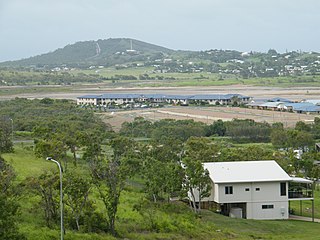
Bondoola, Queensland

Last updated

Bondoola
Queensland
Australia Queensland location map.svg
Red pog.svg
Bondoola
Coordinates 23°11′10″S150°41′08″E / 23.1861°S 150.6855°E / -23.1861; 150.6855 (Bondoola (centre of locality))
Population551 (2021 census) [1]
 • Density14.165/km2 (36.69/sq mi)
Postcode(s) 4703
Area38.9 km2 (15.0 sq mi)
Time zone AEST (UTC+10:00)
Location
LGA(s) Livingstone Shire
State electorate(s) Keppel
Federal division(s) Capricornia
Suburbs around Bondoola:
Lake Mary Barmaryee Barmaryee
Cobraball Bondoola Hidden Valley
Mulara Cawarral Tanby

Bondoola is a rural locality in the Livingstone Shire, Queensland, Australia. [2] In the 2021 census, Bondoola had a population of 551 people. [1]

Contents

Geography

The Rockhampton-Yeppoon Road (as Yeppoon Road) runs through from south-west to north-east. [3]

Bondoola railway station is an abandoned railway station on the now-dismantled North Rockhampton to Emu Park railway line ( 23°10′27″S150°41′20″E / 23.1741°S 150.6890°E / -23.1741; 150.6890 (Bondoola railway station) ). [4]

History

Kington Provisional School opened on 21 February 1887 under teacher Mr Redstone with nine students. [5] It closed on 31 March 1893. It reopened on 6 July 1896 and renamed Bondoola Provisional School in 1897. In 1910, it became Bondoola State School. [6] [7] As at 1921, it was north of Cobraball Road (approx 23°10′29″S150°41′17″E / 23.1746°S 150.6880°E / -23.1746; 150.6880 (Bondoola State School (original site)) ). [8] It relocated to a new site in 1933. [9] The school celebrated its golden jubilee (50th anniversary) in November 1937. [10] [5] As at 1942, it was located immediately south of the railway station at 54 Bondoola Road ( 23°10′29″S150°41′17″E / 23.17460°S 150.68795°E / -23.17460; 150.68795 (Bondoola State School (former)) ). [11] It closed in 1945. [12] [13] [14]

Demographics

In the 2016 census, Bondoola had a population of 530 people. [15]

In the 2021 census, Bondoola had a population of 551 people. [1]

Education

There are no schools in Bondoola. The nearest government primary schools are Yeppoon State School in Yeppoon to the north-east and Cawarral State School in neighbouring Cawarral to the south. The nearest government secondary school is Yeppoon State High School in Yeppoon. [16]

Related Research Articles

<span class="mw-page-title-main">Yeppoon</span> Town in Queensland, Australia

Yeppoon is a coastal town and locality in the Shire of Livingstone, Queensland, Australia. Yeppoon is renowned for its beaches, tropical climate, and the islands out on the bay. Located 41 kilometres (25 mi) from the city of Rockhampton, Yeppoon is the seat of the Shire of Livingstone and the principal town on the Capricorn Coast, a string of seaside communities stretching more than 150 kilometres (93 mi) from north to south. The beaches and shallow coves provide a destination both for tourists and retirees settling down in Central Queensland. Offshore, there are 27 islands including Great Keppel Island which is 20 kilometres (12 mi) from Yeppoon. In the 2021 census, the locality of Yeppoon had a population of 7,037 people; this does not include any neighbouring suburbs.

<span class="mw-page-title-main">Capricorn Coast</span> Region in Queensland, Australia

The Capricorn Coast is a stretch of coastline in Central Queensland, Australia and is part of the Shire of Livingstone.

<span class="mw-page-title-main">Kinka Beach, Queensland</span> Suburb of Shire of Livingstone, Queensland, Australia

Kinka Beach is a coastal rural locality in the Livingstone Shire, Queensland, Australia. In the 2021 census, Kinka Beach had a population of 674 people.

<span class="mw-page-title-main">Zilzie</span> Suburb of Shire of Livingstone, Queensland, Australia

Zilzie is a coastal locality in the Livingstone Shire, Queensland, Australia. In the 2021 census, Zilzie had a population of 2,846 people.

<span class="mw-page-title-main">Taranganba</span> Town in Queensland, Australia

Taranganba is a town and locality in the Livingstone Shire, Queensland, Australia. In the 2021 census, the locality of Taranganba had a population of 2,275 people.

<span class="mw-page-title-main">Lammermoor, Queensland</span> Suburb of Shire of Livingstone, Queensland, Australia

Lammermoor is a coastal locality on the Capricorn Coast in the Livingstone Shire, Queensland, Australia. In the 2021 census, Lammermoor had a population of 2,551 people.

<span class="mw-page-title-main">Witta, Queensland</span> Town in Queensland, Australia

Witta is a rural town and locality in the Sunshine Coast Region, Queensland, Australia. In the 2021 census, the locality of Witta had a population of 1,296 people.

<span class="mw-page-title-main">Mount Chalmers, Queensland</span> Town in Queensland, Australia

Mount Chalmers is a rural town and locality in the Livingstone Shire, Queensland, Australia. In the 2021 census, the locality of Mount Chalmers had a population of 226 people.

<span class="mw-page-title-main">Cawarral</span> Town in Queensland, Australia

Cawarral is a rural town and locality in the Livingstone Shire, Queensland, Australia. In the 2021 census, the locality of Cawarral had a population of 831 people.

Adelaide Park is a rural locality in the Livingstone Shire, Queensland, Australia. In the 2021 census, Adelaide Park had a population of 449 people.

Barlows Hill is a rural locality in the Livingstone Shire, Queensland, Australia. In the 2021 census, Barlows Hill had a population of 834 people.

Barmaryee is a rural locality in the Livingstone Shire, Queensland, Australia. In the 2021 census, Barmaryee had a population of 925 people.

Farnborough is a coastal rural locality in the Livingstone Shire, Queensland, Australia. In the 2021 census, Farnborough had a population of 469 people.

Bungundarra is a rural locality in the Livingstone Shire, Queensland, Australia. In the 2021 census, Bungundarra had a population of 667 people.

Pacific Heights is a semi-rural locality in the Livingstone Shire, Queensland, Australia. In the 2021 census, Pacific Heights had a population of 1,111 people.

<span class="mw-page-title-main">Thompson Point, Queensland</span> Suburb of Livingstone Shire, Queensland, Australia

Thompson Point is a coastal locality in the Livingstone Shire, Queensland, Australia. It was the site of a short-lived town and port called Broadmount. In the 2021 census, Thompson Point had "no people or a very low population".

<span class="mw-page-title-main">Hidden Valley, Queensland</span> Suburb of Livingstone Shire, Queensland, Australia

Hidden Valley is a mixed-use locality in the Livingstone Shire, Queensland, Australia. In the 2021 census, Hidden Valley had a population of 879 people.

<span class="mw-page-title-main">Coorooman, Queensland</span> Suburb of Livingstone Shire, Queensland, Australia

Coorooman is a rural coastal locality in the Livingstone Shire, Queensland, Australia. In the 2021 census, Coorooman had a population of 97 people.

Lake Mary is a rural locality in the Livingstone Shire, Queensland, Australia. In the 2021 census, Lake Mary had a population of 96 people.

Greenlake is a rural locality in the Livingstone Shire, Queensland, Australia. In the 2021 census, Greenlake had "no people or a very low population".

References

  1. 1 2 3 Australian Bureau of Statistics (28 June 2022). "Bondoola (SAL)". 2021 Census QuickStats. Retrieved 28 February 2023. OOjs UI icon edit-ltr-progressive.svg
  2. "Bondoola – locality in Livingstone Shire (entry 49343)". Queensland Place Names. Queensland Government . Retrieved 26 October 2019.
  3. Google (23 April 2022). "Bondoola, Queensland" (Map). Google Maps . Google. Retrieved 23 April 2022.
  4. "Railway stations and sidings - Queensland". Queensland Open Data. Queensland Government. 2 October 2020. Archived from the original on 5 October 2020. Retrieved 5 October 2020.
  5. 1 2 "BONDOOLA". Morning Bulletin . No. 22254. Queensland, Australia. 23 November 1937. p. 3. Archived from the original on 27 June 2024. Retrieved 27 June 2024 via National Library of Australia.
  6. "THE BONDOOLA STATE SCHOOL". Morning Bulletin . No. 14165. Queensland, Australia. 19 March 1910. p. 6. Archived from the original on 27 June 2024. Retrieved 27 June 2024 via National Library of Australia.
  7. "STATE SCHOOL TEACHERS". The Brisbane Courier . No. 16, 280. Queensland, Australia. 17 March 1910. p. 2. Archived from the original on 27 June 2024. Retrieved 27 June 2024 via National Library of Australia.
  8. "County of Livingstone" (Map). Queensland Government. 1921. Archived from the original on 13 August 2023. Retrieved 27 June 2024.
  9. "BONDOOLA STATE SCHOOL". Morning Bulletin . No. 20, 990. Queensland, Australia. 30 October 1933. p. 6. Archived from the original on 27 June 2024. Retrieved 27 June 2024 via National Library of Australia.
  10. "Advertising". Morning Bulletin . No. 22, 234. Queensland, Australia. 30 October 1937. p. 2. Archived from the original on 27 June 2024. Retrieved 27 June 2024 via National Library of Australia.
  11. "Yeppoon" (Map). Queensland Government. 1942. Archived from the original on 27 June 2024. Retrieved 27 June 2024.
  12. "Agency ID 8891, Bondoola State School: Description". Queensland State Archives . Retrieved 27 June 2024.
  13. "BONDOOLA". The Central Queensland Herald . Vol. 17, no. 911. Queensland, Australia. 29 August 1946. p. 25. Archived from the original on 27 June 2024. Retrieved 27 June 2024 via National Library of Australia.
  14. Queensland Family History Society (2010), Queensland schools past and present (Version 1.01 ed.), Queensland Family History Society, ISBN   978-1-921171-26-0
  15. Australian Bureau of Statistics (27 June 2017). "Bondoola (SSC)". 2016 Census QuickStats. Retrieved 20 October 2018. OOjs UI icon edit-ltr-progressive.svg
  16. "Layers: Locality; Schools and school catchments". Queensland Globe. Queensland Government. Archived from the original on 19 December 2017. Retrieved 26 June 2024.

Further reading