The Caves, Queensland

Last updated

Map all coordinates using: OpenStreetMap
The Caves
Queensland
Capricornia Caves2.jpg
Capricornia Caves
Australia Queensland location map.svg
Red pog.svg
The Caves
Coordinates 23°10′36″S150°27′35″E / 23.1766°S 150.4597°E / -23.1766; 150.4597 (The Caves (town centre))
Population718 (2016 census) [1]
 • Density15.956/km2 (41.32/sq mi)
Postcode(s) 4702
Area45.0 km2 (17.4 sq mi)
Time zone AEST (UTC+10:00)
Location
LGA(s) Shire of Livingstone
State electorate(s)
Federal division(s) Capricornia
Localities around The Caves:
Milman Wattlebank Barmoya
Yaamba The Caves Sandringham
Etna Creek Etna Creek Sandringham

The Caves is a rural town and locality in the Livingstone Shire, Queensland, Australia. [2] [3] In the 2016 census the locality of The Caves had a population of 718 people. [1]

Contents

Geography

The locality is in Central Queensland region. Alligator Creek, a tributary of the Fitzroy River forms the western boundary of the locality. The town is in the centre of the locality. [4] [5]

Cammoo is a neighbourhood within the north of the locality ( 23°10′00″S150°27′00″E / 23.1666°S 150.45°E / -23.1666; 150.45 (Cammoo (neighbourhood)) ). [6]

The Bruce Highway (locally also known as Yaamba Road) and the North Coast railway line traverse the locality from south (Etna Creek) to north-west (Milman), passing through the town, which is served by The Caves railway station ( 23°10′51″S150°27′41″E / 23.1807°S 150.4614°E / -23.1807; 150.4614 (The Caves railway station) ) while Cammoo railway station further north in the locality ( 23°10′01″S150°27′07″E / 23.1669°S 150.4519°E / -23.1669; 150.4519 (Cammoo railway station (former)) ) is now abandoned. [5] [7]

The Mount Etna Caves National Park ( 23°09′27″S150°28′56″E / 23.1575°S 150.4822°E / -23.1575; 150.4822 (Mount Etna Caves National Park) ) protects the limestone caves area in the north of the locality and its colonies of ghost bats: [8] [5]

Olsens Caves in the east of the locality ( 23°09′54″S150°29′26″E / 23.1650°S 150.4905°E / -23.1650; 150.4905 (Olsens Caves) ) is outside the national park. [9]

The locality has a number of mountains, including:

History

Group from Rockhampton, just before returning from a day trip to Mount Etna Caves, 1921 Group from Rockhampton, just before returning from a day trip to Mount Etna Caves, 1921.jpg
Group from Rockhampton, just before returning from a day trip to Mount Etna Caves, 1921

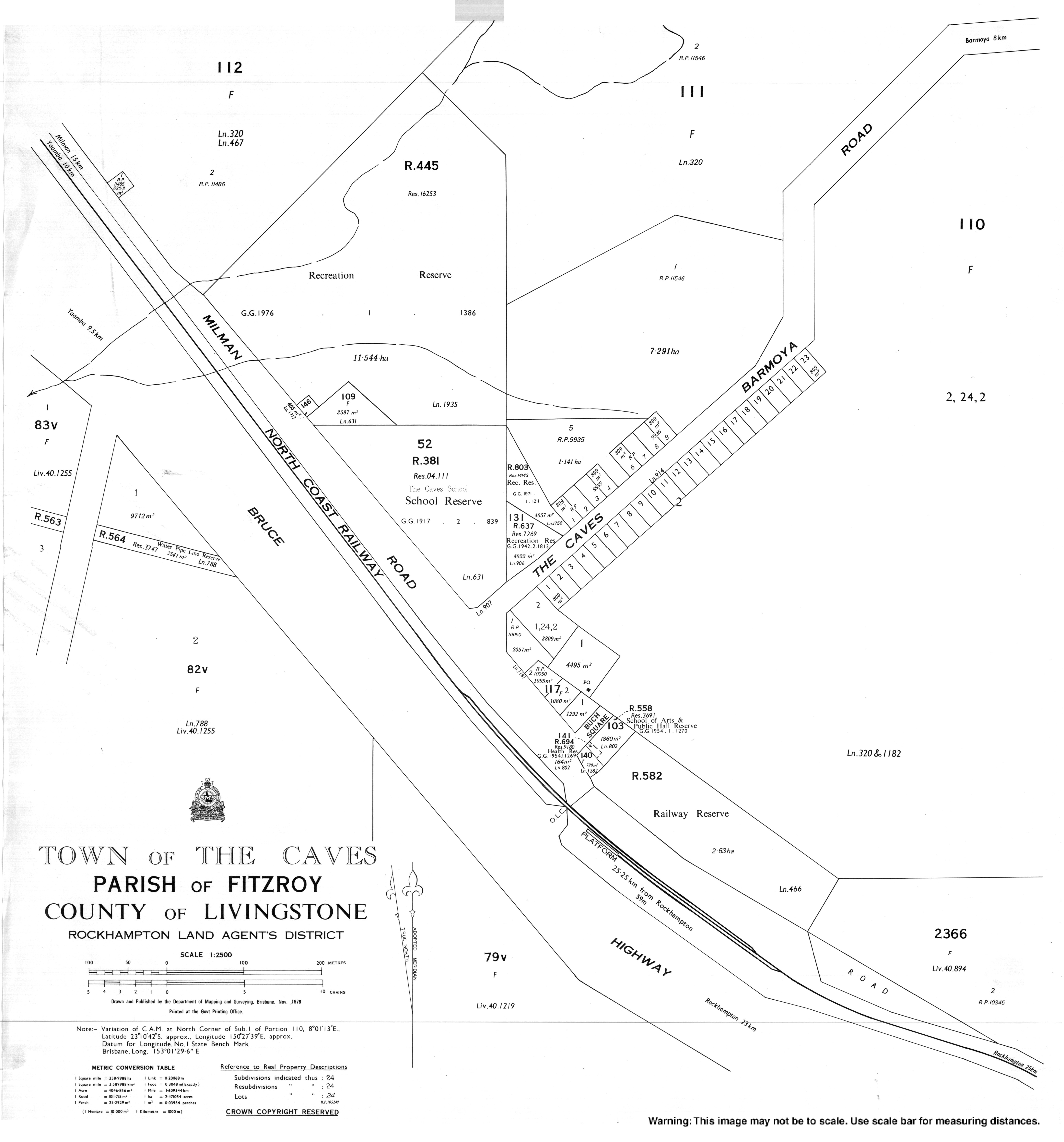
The town takes its name from The Caves railway station, which in turn was originally called Etna railway station but was renamed by the Queensland Railways Department on 23 July 1914, because of the limestone caves in the area. [2] [15]

Mount Etna Provisional School opened on 7 November 1904 but was renamed The Caves Provisional School in 1905. It became The Caves State School on 1 January 1909. [16]

The Fitzroy Caves National Park was gazetted in 1973 with a focus on the protection of the bats rather than the caves. In 1990 it was renamed Mount Etna Caves National Park. In 1999 the park was extended to provide more protection to the caves. [17]

The Caves Progress & Agricultural Society was established in 1975 to provide a venue to hold agricultural shows, campdrafts, rodeos, and other sporting events. [18]

The Caves War Memorial was unveiled on Thursday 25 April 1985 (Anzac Day in Queensland) by Lindsay Hartwig, Member of the Queensland Legislative Assembly for Callide and chairman of the Livingstone Shire Council. [19] [20]

At the 2011 census The Caves recorded a population of 708 people. [21]

In the 2016 census the locality of The Caves had a population of 718 people. [1]

Education

The Caves State School is a government primary (Prep-6) school for boys and girls at 1 Barmoya Road ( 23°10′36″S150°27′33″E / 23.1767°S 150.4593°E / -23.1767; 150.4593 (The Caves State School) ). [22] [23] In 2016, the school had an enrolment of 87 students with 6 teachers (5 full-time equivalent) and 8 non-teaching staff (5 full-time equivalent). [24] In 2018, the school had an enrolment of 89 students with 5 teachers (4 full-time equivalent) and 10 non-teaching staff (5 full-time equivalent). [25]

There is no secondary school in The Caves. The nearest government secondary school is Glenmore State High School in Kawana, Rockhampton, to the south. [5]

Amenities

North Rockhampton Uniting Church (based in Frenchville, Rockhampton) holds quarterly services at the CWA Hall. [26]

The Caves Lions Bicentennial Park is at 5-11 Barmoya Street ( 23°10′34″S150°27′36″E / 23.1761°S 150.4599°E / -23.1761; 150.4599 (Caves Lions Bicentennial Park) ). [27]

The Caves Showgrounds are on Rossmoya Road ( 23°10′22″S150°27′30″E / 23.1727°S 150.4583°E / -23.1727; 150.4583 (The Caves Showground) ). The venue has an arena with supporting infrastructure such as kitchen, bar, pavilion, and announcer's box. It has powered and unpowered camp sites and toilet facilities. It also has paddocks, holding yards, and shutes to support the events involving animals. [5] [28]

The Caves War Memorial is in Buch Square off Rossmoya Road ( 23°10′42″S150°27′37″E / 23.1782°S 150.4603°E / -23.1782; 150.4603 (The Caves War Memorial) ) [19] [20]

The Caves Post Office is at 7-9 Buch Square ( 23°10′41″S150°27′38″E / 23.1781°S 150.4606°E / -23.1781; 150.4606 (The Caves Post Office) ). [29]

Events

The Caves Show is an agricultural show held in April annually, but was cancelled in 2020 due to the COVID-19 pandemic. [30]

The Caves Rodeo is held annually in September. It was also cancelled in 2020 due to the pandemic. [31]

Attractions

Cathedral Cave, Capricorn Caves, 2013 Cathedral Cave, Capricorn Caves.jpg
Cathedral Cave, Capricorn Caves, 2013

The Caves is home to two cave based tourist attractions. They are:

Related Research Articles

<span class="mw-page-title-main">Yeppoon</span> Town in Queensland, Australia

Yeppoon is a coastal town and locality in the Shire of Livingstone, Queensland, Australia. Yeppoon is renowned for its beaches, tropical climate, and the islands out on the bay. Located 41 kilometres (25 mi) from the city of Rockhampton, Yeppoon is the seat of the Shire of Livingstone and the principal town on the Capricorn Coast, a string of seaside communities stretching more than 150 kilometres (93 mi) from north to south. The beaches and shallow coves provide a destination both for tourists and retirees settling down in Central Queensland. Offshore, there are 27 islands including Great Keppel Island which is 20 kilometres (12 mi) from Yeppoon. In the 2021 census, the locality of Yeppoon had a population of 7,037 people; this does not include any neighbouring suburbs.

<span class="mw-page-title-main">Mount Morgan, Queensland</span> City in Queensland, Australia

Mount Morgan is a rural town and locality in the Rockhampton Region, Queensland, Australia. In the 2021 census the town of Mount Morgan had a population of 2,487 people.

<span class="mw-page-title-main">Emu Park, Queensland</span> Town in Queensland, Australia

Emu Park is a coastal town and locality on the Capricorn Coast located 21 kilometres (13 mi) south of Yeppoon in Queensland, Australia. It is within the local government area of Shire of Livingstone. In the 2016 census the locality of Emu Park had a population of 2,130 people.

<span class="mw-page-title-main">Kinka Beach, Queensland</span> Suburb of Shire of Livingstone, Queensland, Australia

Kinka Beach is a coastal rural locality in the Livingstone Shire, Queensland, Australia. In the 2016 census, Kinka Beach had a population of 621 people.

<span class="mw-page-title-main">Zilzie</span> Suburb of Shire of Livingstone, Queensland, Australia

Zilzie is a coastal locality in the Livingstone Shire, Queensland, Australia. In the 2021 census, Zilzie had a population of 2,846 people.

<span class="mw-page-title-main">Cooee Bay</span> Suburb of Shire of Livingstone, Queensland, Australia

Cooee Bay is a coastal locality in the Livingstone Shire, Queensland, Australia. In the 2016 census Cooee Bay had a population of 913 people.

<span class="mw-page-title-main">Taranganba</span> Town in Queensland, Australia

Taranganba is a town and locality in the Livingstone Shire, Queensland, Australia. In the 2016 census, the locality of Taranganba had a population of 2,276 people.

<span class="mw-page-title-main">Yaamba</span> Suburb of Shire of Livingstone, Queensland, Australia

Yaamba is a rural town and locality in the Livingstone Shire, Queensland, Australia. In the 2016 census, the locality of Yaamba had a population of 62 people.

<span class="mw-page-title-main">Nerimbera, Queensland</span> Suburb of Shire of Livingstone, Queensland, Australia

Nerimbera is a rural locality in the Livingstone Shire, Queensland, Australia. In the 2016 census, Nerimbera had a population of 293 people.

<span class="mw-page-title-main">Mount Chalmers, Queensland</span> Town in Queensland, Australia

Mount Chalmers is a rural town and locality in the Livingstone Shire, Queensland, Australia. In the 2016 census, the locality of Mount Chalmers had a population of 235 people.

<span class="mw-page-title-main">Cawarral</span> Town in Queensland, Australia

Cawarral is a rural town and locality in the Livingstone Shire, Queensland, Australia. In the 2016 census the locality of Cawarral had a population of 831 people.

Adelaide Park is a rural locality in the Livingstone Shire, Queensland, Australia. In the 2016 census, Adelaide Park had a population of 424 people.

Barmaryee is a rural locality in the Livingstone Shire, Queensland, Australia. In the 2016 census, Barmaryee had a population of 878 people.

Lakes Creek is a suburb split between Rockhampton Region and Shire of Livingstone, Queensland, Australia. In the 2016 census Lakes Creek had a population of 552 people.

Etna Creek is a rural locality in the Livingstone Shire, Queensland, Australia. In the 2016 census Etna Creek had a population of 792 people.

Nankin is a rural locality in the Livingstone Shire, Queensland, Australia. In the 2016 census Nankin had a population of 170 people.

<span class="mw-page-title-main">Thompson Point, Queensland</span> Suburb of Livingstone Shire, Queensland, Australia

Thompson Point is a coastal locality in the Livingstone Shire, Queensland, Australia. It was the site of a short-lived town and port called Broadmount. In the 2021 census, Thompson Point had a population of 4 people.

Greenlake is a rural locality in the Livingstone Shire, Queensland, Australia. In the 2021 census, Greenlake had a population of 3 people.

Kunwarara is a rural locality in the Livingstone Shire, Queensland, Australia. In the 2016 census Kunwarara had a population of 71 people.

South Yaamba is a rural locality in the Rockhampton Region, Queensland, Australia. In the 2021 census, South Yaamba had a population of 79 people.

References

  1. 1 2 3 Australian Bureau of Statistics (27 June 2017). "The Caves (SSC)". 2016 Census QuickStats. Retrieved 20 October 2018. OOjs UI icon edit-ltr-progressive.svg
  2. 1 2 "The Caves – town in Livingstone Shire (entry 33898)". Queensland Place Names. Queensland Government . Retrieved 27 December 2020.
  3. "The Caves – locality in Livingstone Shire (entry 48893)". Queensland Place Names. Queensland Government . Retrieved 27 December 2020.
  4. "Alligator Creek – watercourse in the Shire of Livingstone (entry 389)". Queensland Place Names. Queensland Government . Retrieved 19 March 2021.
  5. 1 2 3 4 5 "Queensland Globe". State of Queensland . Retrieved 19 March 2021.
  6. "Cammoo – locality unbounded in Livingstone Shire (entry 5876)". Queensland Place Names. Queensland Government . Retrieved 27 December 2020.
  7. "Railway stations and sidings - Queensland". Queensland Open Data. Queensland Government. 2 October 2020. Archived from the original on 5 October 2020. Retrieved 5 October 2020.
  8. "Mount Etna Caves National Park – national park in Shire of Livingstone (entry 50959)". Queensland Place Names. Queensland Government . Retrieved 18 March 2021.
  9. 1 2 3 4 5 6 7 8 9 "Mountain peaks and capes - Queensland". Queensland Open Data. Queensland Government. 12 November 2020. Archived from the original on 25 November 2020. Retrieved 25 November 2020.
  10. "Limestone Peak – mountain in Livingstone Shire (entry 19428)". Queensland Place Names. Queensland Government . Retrieved 25 November 2020.
  11. "Mount Charlton – mountain in Livingstone Shire (entry 6932)". Queensland Place Names. Queensland Government . Retrieved 25 November 2020.
  12. "Mount Etna – mountain in Livingstone Shire (entry 11895)". Queensland Place Names. Queensland Government . Retrieved 25 November 2020.
  13. "Scrubby Hill – mountain in Livingstone Shire (entry 30286)". Queensland Place Names. Queensland Government . Retrieved 25 November 2020.
  14. "Spinifex Hill – mountain in Livingstone Shire (entry 31658)". Queensland Place Names. Queensland Government . Retrieved 25 November 2020.
  15. "The Caves – railway station in Shire of Livingstone (entry 33899)". Queensland Place Names. Queensland Government . Retrieved 5 October 2017.
  16. Queensland Family History Society (2010), Queensland schools past and present (Version 1.01 ed.), Queensland Family History Society, ISBN   978-1-921171-26-0
  17. Berrill, Peter; Vavryn, Dianne. "An overview of the Mount Etna campaign" (PDF). p. 4. Archived (PDF) from the original on 19 March 2021. Retrieved 19 March 2021.
  18. "Our Venue". The Caves Progress & Agricultural Society Inc. Retrieved 19 March 2021.
  19. 1 2 "The Caves War Memorial". Queensland War Memorials Register. 23 June 2014. Archived from the original on 9 March 2020. Retrieved 19 March 2021.
  20. 1 2 "The Caves War Memorial". Monument Australia. Retrieved 19 March 2021.
  21. Australian Bureau of Statistics (31 October 2012). "The Caves (State Suburb)". 2011 Census QuickStats. Retrieved 18 April 2017. OOjs UI icon edit-ltr-progressive.svg
  22. "State and non-state school details". Queensland Government. 9 July 2018. Archived from the original on 21 November 2018. Retrieved 21 November 2018.
  23. "The Caves State School" . Retrieved 19 March 2021.
  24. "Annual Report 2016" (PDF). The Caves State School. Archived (PDF) from the original on 5 October 2017. Retrieved 5 October 2017.
  25. "ACARA School Profile 2018". Australian Curriculum, Assessment and Reporting Authority. Archived from the original on 27 August 2020. Retrieved 28 January 2020.
  26. "North Rockhampton Uniting Church". www.northrockyuc.org.au. Archived from the original on 2 December 2020. Retrieved 2 December 2020.
  27. "Land for public recreation - Queensland". Queensland Open Data. Queensland Government. 20 November 2020. Archived from the original on 22 November 2020. Retrieved 22 November 2020.
  28. "Home". The Caves Progress & Agricultural Society Inc. Archived from the original on 19 March 2021. Retrieved 19 March 2021.
  29. "The Caves CPA". Australia Post . Retrieved 19 March 2021.
  30. "The Caves Show". The Caves Progress & Agricultural Society Inc. Archived from the original on 19 March 2021. Retrieved 19 March 2021.
  31. "The Caves Rodeo". National Rodeo Association. Archived from the original on 19 March 2021. Retrieved 19 March 2021.

Further reading