Bangalee, Queensland (Livingstone Shire)

Last updated

Bangalee
Queensland
Postcode(s) 4703
Area2.7 km2 (1.0 sq mi)
LGA(s) Shire of Livingstone

Bangalee is a coastal locality within the local government area of Shire of Livingstone, Queensland, Australia. [1] Between 2008 and 2013 it was within Rockhampton Region. At the 2006 census, Bangalee had a population of 469. [2]

Suburbs and localities are the names of geographic subdivisions in Australia, used mainly for address purposes. The term locality is used in rural areas, while the term suburb is used in urban areas. Australian postcodes closely align with the boundaries of localities and suburbs.

Local government in Australia is the third tier of government in Australia administered by the states and territories, which in turn are beneath the federal tier. Local government is not mentioned in the Constitution of Australia and two referenda in the 1970s and 1980s to alter the Constitution relating to local government were unsuccessful. Every state government recognises local government in their respective constitutions. Unlike Canada or the United States, there is only one level of local government in each state, with no distinction such as cities and counties.

Shire of Livingstone Local government area in Queensland, Australia

The Shire of Livingstone is a local government area located in the Capricornia region of Central Queensland, Queensland, Australia, to the immediate north and east of the regional city of Rockhampton. The shire, administered from the coastal town of Yeppoon, covers an area of 11,776.3 square kilometres (4,546.9 sq mi), and existed as a local government entity from 1879 until 2008, when it amalgamated with several other councils to become the Rockhampton Region. The Shire was re-established on 1 January 2014 following a successful de-amalgamation referendum in 2013.

Geography

Bangalee is a tiny strip of coastline on the Capricorn Coast comprising two streets of residential housing beside the beach. It is surrounded by the locality of Farnborough. [3]

Capricorn Coast Region in Queensland, Australia

The Capricorn Coast is a stretch of coastline in Central Queensland, Australia and is part of the Shire of Livingstone. The region straddles the Tropic of Capricorn, after which it is named.

Farnborough, Queensland Suburb of Shire of Livingstone, Queensland, Australia

Farnborough is a coastal locality on the Capricorn Coast in the Shire of Livingstone, Queensland, Australia.

Related Research Articles

Marlborough, Queensland Town in Queensland, Australia

Marlborough is a small town and locality in the Shire of Livingstone, Queensland, Australia. At the 2006 census, Marlborough and the surrounding area had a population of 355.

Banana, Queensland Town in Queensland, Australia

Banana is a small town and rural locality in the Shire of Banana, Central Queensland, Australia. In the 2011 census, Banana had a population of 377 people.

Kinka Beach, Queensland Town in Queensland, Australia

Kinka Beach is a small coastal locality on the Capricorn Coast in the Australian state of Queensland. It is situated on the banks of Kinka Creek, about six kilometres north of Emu Park and seventeen kilometres south of Yeppoon. It is within the local government area of Shire of Livingstone. At the 2006 census, Kinka Beach had a population of 621.

Shire of Fitzroy Local government area in Queensland, Australia

The Shire of Fitzroy was a local government area located in the Capricornia region of Central Queensland, Queensland, Australia, to the immediate west and south of the regional city of Rockhampton. The shire, administered from the town of Gracemere, covered an area of 5,898.7 square kilometres (2,277.5 sq mi), and existed as a local government entity from 1899 until 2008, when it amalgamated with several other councils to become the Rockhampton Region. It is named for the Fitzroy River, that passes along the northern boundary of the shire.

Shire of Mount Morgan Local government area in Queensland, Australia

The Shire of Mount Morgan was a local government area located in the Capricornia region of Central Queensland, Queensland, Australia, about 20 kilometres (12 mi) south of the regional city of Rockhampton. The shire, roughly the region surrounding the former gold mining town of Mount Morgan, covered an area of 492.0 square kilometres (190.0 sq mi), and existed as a local government entity from 1890 until 2008, when it amalgamated with several other councils to become the Rockhampton Region.

Byfield, Queensland Town in Queensland, Australia

Byfield is a locality in Shire of Livingstone, Queensland, Australia. In the 2011 census, Byfield had a population of 261 people.

Zilzie Town in Queensland, Australia

Zilzie is a coastal locality on the Capricorn Coast in Queensland, Australia. Contiguous with Emu Park, the town is located on the Pacific Ocean coast, 685 kilometres (426 mi) north west of the state capital, Brisbane and 46 kilometres (29 mi) east of the city of Rockhampton. It is within the local government area of Shire of Livingstone. At the 2006 census, Zilzie had a population of 1,153.

Cooee Bay Town in Queensland, Australia

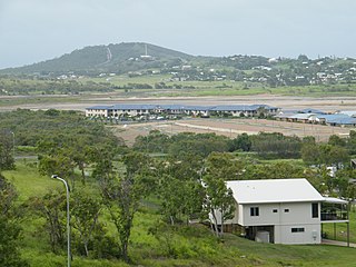
Cooee Bay is a coastal locality on the Capricorn Coast in Queensland, Australia. It is within the local government area of Shire of Livingstone.

Taranganba Town in Queensland, Australia

Taranganba is a town and locality on the tropical Central Queensland coast in Australia. It is within the local government area of Shire of Livingstone. In the 2011 census, Taranganba had a population of 2,430 people.

Lammermoor, Queensland Queensland, Australia

Lammermoor is a coastal locality on the Capricorn Coast in the Shire of Livingstone, Queensland, Australia. Between 2008 and 2013, it was within the Rockhampton Region.

Cockatoo, Queensland Suburb of Shire of Banana, Queensland, Australia

Cockatoo is a locality in the Shire of Banana, Queensland, Australia. In the 2011 census, the population of Cockatoo was not separately reported but was included within neighbouring Taroom which had a combined population of 873 people.

Mount Chalmers, Queensland Town in Queensland, Australia

Mount Chalmers is a town and locality in the Shire of Livingstone, Queensland, Australia. In the 2011 census, Mount Chalmers had a population of 216 people.

Cawarral Town in Queensland, Australia

Cawarral is a town and locality in the Shire of Livingstone, Queensland, Australia. In the 2011 census, Cawarral had a population of 726 people.

Bangalee, Queensland may refer to:

The Caves, Queensland Town in Queensland, Australia

The Caves is a small community and a locality in the Livingstone Shire, Queensland, Australia.

Barmaryee, Queensland Suburb of Shire of Livingstone, Queensland, Australia

Barmaryee is a locality in the Shire of Livingstone, Queensland, Australia.

Pacific Heights, Queensland Suburb of Livingstone Shire, Queensland, Australia

Pacific Heights is a locality in the Livingstone Shire, Queensland, Australia.

Lakes Creek, Queensland Suburb of Rockhampton Region, Queensland, Australia

Lakes Creek is a suburb split between Rockhampton Region and Shire of Livingstone, Queensland, Australia.

References

  1. "Bangalee - locality in Shire of Livingstone (entry 48507)". Queensland Place Names. Queensland Government . Retrieved 24 June 2017.
  2. Australian Bureau of Statistics (25 October 2007). "Bangalee (Livingstone Shire) (State Suburb)". 2006 Census QuickStats. Retrieved 6 April 2010.
  3. "Queensland Globe". State of Queensland . Retrieved 9 July 2017.

Coordinates: 23°04′36″S150°47′05″E / 23.0766°S 150.7847°E / -23.0766; 150.7847

Geographic coordinate system Coordinate system

A geographic coordinate system is a coordinate system that enables every location on Earth to be specified by a set of numbers, letters or symbols. The coordinates are often chosen such that one of the numbers represents a vertical position and two or three of the numbers represent a horizontal position; alternatively, a geographic position may be expressed in a combined three-dimensional Cartesian vector. A common choice of coordinates is latitude, longitude and elevation. To specify a location on a plane requires a map projection.