Causeway Lake, Queensland

Last updated

Causeway Lake
Queensland
Causeway2014i.jpg
Causeway Lake crossing, 2014
Australia Queensland location map.svg
Red pog.svg
Causeway Lake
Coordinates 23°11′58″S150°47′46″E / 23.1994°S 150.7961°E / -23.1994; 150.7961 (Causeway Lake (centre of locality)) Coordinates: 23°11′58″S150°47′46″E / 23.1994°S 150.7961°E / -23.1994; 150.7961 (Causeway Lake (centre of locality))
Population121 (2016 census) [1]
 • Density11.86/km2 (30.72/sq mi)
Postcode(s) 4703
Area10.2 km2 (3.9 sq mi)
Time zone AEST (UTC+10:00)
Location
LGA(s) Shire of Livingstone
State electorate(s) Keppel
Federal division(s) Capricornia
Suburbs around Causeway Lake:
Taroomball Rosslyn Mulambin
Tanby Causeway Lake Coral Sea
Tanby Tanby Kinka Beach

Causeway Lake is a coastal locality on the Capricorn Coast in the Livingstone Shire, Queensland, Australia. [2] In the 2016 census, Causeway Lake had a population of 121 people. [1]

Contents

Geography

Looking along Mulambin Beach with Causeway lake in the background, 2009 Mulambin Beach with Causeway Lake in the background, 2009.jpg
Looking along Mulambin Beach with Causeway lake in the background, 2009

The locality takes its name from the lake of the same name which lies within the locality, both of which take their name from the causeway (and smallbridge) which allows the Scenic Highway to cross the lake's narrow entrance to the Coral Sea. [3]

There is very little development within the locality except for a small residential area on the north-eastern shore of the lake where there is also public parkland access to the lake for recreation. Apart from that, most of the locality is undeveloped being taken up with the lakes and the associated palustrine wetland surrounding the numerous creeks which flow into the lake. [3]

The northern mouth of the lake is part of the Capricorn Coast National Park. The southern part of the locality is within the Causeway Lake Conservation Park. [3]

History

The Scenic Highway crossing over Causeway Lake was constructed in 1939, allowing motorists to travel between Yeppoon and Emu Park. [4]

After a near-drowning of an 8-year-old girl at Causeway Lake in June 1951, Livingstone Shire Council erected warning signs the following month advising of the potential dangers associated with the lake. [5] [6]

A 15-year-old boy drowned in the lake in January 1952 after his clothes became entangled in the propeller shaft of the outboard motor aboard his boat. [7]

A five-year-old boy drowned in the lake in February 1954. [8] After noticing him disappear, a 15-year-old girl retrieved him from the water prior to an honorary ambulance officer attempting resuscitation without success. [8]

Despite it having been a much-discussed topic in the local community, the issue of potentially dredging Causeway Lake remains an ongoing concern for local residents, recreational users of the lake and environmental agencies. [9] [10] [11]

Causeway Lake Shop (formerly Causeway Lake Kiosk), 2022 Causeway2022j.jpg
Causeway Lake Shop (formerly Causeway Lake Kiosk), 2022

A local fish and chip shop which fronts the lake, the Causeway Lake Kiosk, received some publicity in 2017 following a visit by One Nation leader Pauline Hanson who worked in the shop for a day, in an attempt to bring attention to the issue of high electricity prices. [12] [13] Hanson denied it was a ploy to win votes prior to the state election. [13]

A house fire which occurred in August 2018 caused structural damage to the neighbouring Causeway Lake Kiosk. [14] However, the business re-opened the following day and began accepting donations for the family whose home was destroyed by the fire. [14]

In the 2016 census, Causeway Lake had a population of 121 people. [1]

Education

There are no schools in Causeway Lake. The nearest government primary school is Taranganba State School in Taranganba to the north. The nearest government secondary school is Yeppoon State High School in Yeppoon to the north. [3]

Amenities

Watersports on the lake, 2009 Causeway Lake with a jetski towing a wakeboarder, 2009.jpg
Watersports on the lake, 2009

The lake is popular for fishing and watersports. There are picnic and barbeque facilities, as well as a shop. [15]

Related Research Articles

<span class="mw-page-title-main">Yeppoon</span> Town in Queensland, Australia

Yeppoon is a coastal town and locality in the Shire of Livingstone, Queensland, Australia. Yeppoon is renowned for its beaches, tropical climate, and the islands out on the bay. Located 41 kilometres (25 mi) from the city of Rockhampton, Yeppoon is the seat of the Shire of Livingstone and the principal town on the Capricorn Coast, a string of seaside communities stretching more than 150 kilometres (93 mi) from north to south. The beaches and shallow coves provide a destination both for tourists and retirees settling down in Central Queensland. Offshore, there are 27 islands including Great Keppel Island which is 20 kilometres (12 mi) from Yeppoon. In the 2021 census, the locality of Yeppoon had a population of 7,037 people; this does not include any neighbouring suburbs.

<span class="mw-page-title-main">Capricorn Coast</span> Region in Queensland, Australia

The Capricorn Coast is a stretch of coastline in Central Queensland, Australia and is part of the Shire of Livingstone.
<span class="mw-page-title-main">Emu Park, Queensland</span> Town in Queensland, Australia

Emu Park is a coastal town and locality on the Capricorn Coast located 21 kilometres (13 mi) south of Yeppoon in Queensland, Australia. It is within the local government area of Shire of Livingstone. In the 2016 census the locality of Emu Park had a population of 2,130 people.

<span class="mw-page-title-main">Shire of Livingstone</span> Local government area in Queensland, Australia

The Shire of Livingstone is a local government area located in the Capricornia region of Central Queensland, Queensland, Australia, to the immediate north and east of the regional city of Rockhampton. The shire, administered from the coastal town of Yeppoon, covers an area of 11,758 square kilometres (4,539.8 sq mi), and existed as a local government entity from 1879 until 2008, when it amalgamated with several other councils to become the Rockhampton Region. The Shire was re-established on 1 January 2014 following a successful de-amalgamation referendum in 2013.

<span class="mw-page-title-main">Kinka Beach, Queensland</span> Suburb of Shire of Livingstone, Queensland, Australia

Kinka Beach is a coastal rural locality in the Livingstone Shire, Queensland, Australia. In the 2016 census, Kinka Beach had a population of 621 people.

<span class="mw-page-title-main">Keppel Sands, Queensland</span> Town in Queensland, Australia

Keppel Sands is a coastal rural town and locality in the Livingstone Shire, Queensland, Australia. In the 2016 census, the locality of Keppel Sands had a population of 360 people.
<span class="mw-page-title-main">Zilzie</span> Suburb of Shire of Livingstone, Queensland, Australia

Zilzie is a coastal locality in the Livingstone Shire, Queensland, Australia. In the 2016 census, Zilzie had a population of 2,713 people.

<span class="mw-page-title-main">Cooee Bay</span> Suburb of Shire of Livingstone, Queensland, Australia

Cooee Bay is a coastal locality in the Livingstone Shire, Queensland, Australia. In the 2016 census Cooee Bay had a population of 913 people.

<span class="mw-page-title-main">Taranganba</span> Town in Queensland, Australia

Taranganba is a town and locality in the Livingstone Shire, Queensland, Australia. In the 2016 census, the locality of Taranganba had a population of 2,276 people.

Coowonga is a rural locality in the Shire of Livingstone, Central Queensland, Australia. In the 2021 census, Coowonga had a population of 255 people.

<span class="mw-page-title-main">Lammermoor, Queensland</span> Suburb of Shire of Livingstone, Queensland, Australia

Lammermoor is a coastal locality on the Capricorn Coast in the Livingstone Shire, Queensland, Australia. In the 2016 census, Lammermoor had a population of 2,167 people.

<span class="mw-page-title-main">Mount Chalmers, Queensland</span> Town in Queensland, Australia

Mount Chalmers is a rural town and locality in the Livingstone Shire, Queensland, Australia. In the 2016 census, the locality of Mount Chalmers had a population of 235 people.

Adelaide Park is a rural locality in the Livingstone Shire, Queensland, Australia. In the 2016 census, Adelaide Park had a population of 424 people.

Farnborough is a coastal rural locality in the Livingstone Shire, Queensland, Australia. In the 2016 census Farnborough had a population of 476 people.

<span class="mw-page-title-main">Scenic Highway (Queensland)</span>

The Scenic Highway is a coastal highway from Yeppoon to Emu Park, both on the Capricorn Coast in the Shire of Livingstone, Queensland, Australia.

Pacific Heights is a semi-rural locality in the Livingstone Shire, Queensland, Australia. In the 2016 census, Pacific Heights had a population of 926 people.

<span class="mw-page-title-main">Thompson Point, Queensland</span> Suburb of Livingstone Shire, Queensland, Australia

Thompson Point is a coastal locality in the Livingstone Shire, Queensland, Australia. In the 2016 census Thompson Point had a population of 10 people. It was the site of a short-lived town and port called Broadmount.

Mulara is a rural locality in the Livingstone Shire, Queensland, Australia. In the 2016 census, Mulara had a population of 89 people.

Rockhampton–Emu Park Road is a continuous 44.1 kilometres (27.4 mi) road route in the Rockhampton and Livingstone local government areas of Queensland, Australia. The route is designated as State Route 4 (Regional) and Tourist Drive 10. It is a state-controlled regional road.

<span class="mw-page-title-main">Singing Ship</span> Australian monument to James Cook

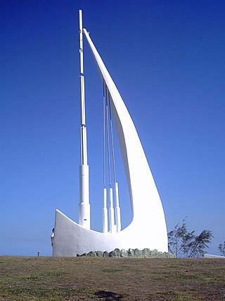
The Singing Ship is a 12-metre tall concrete and steel monument located in Emu Park, Shire of Livingstone, Queensland, Australia.

References

  1. 1 2 3 Australian Bureau of Statistics (27 June 2017). "Causeway Lake (SSC)". 2016 Census QuickStats. Retrieved 20 October 2018. OOjs UI icon edit-ltr-progressive.svg
  2. "Causeway Lake – locality in Livingstone Shire (entry 48566)". Queensland Place Names. Queensland Government . Retrieved 27 December 2020.
  3. 1 2 3 4 "Queensland Globe". State of Queensland . Retrieved 5 August 2022.
  4. "Yeppoon, Emu Park linked by coastal road: causeway now across Shoal Creek". The Morning Bulletin . 21 November 1939. Archived from the original on 27 July 2022. Retrieved 27 July 2022.
  5. "Timely rescue of girl". The Morning Bulletin. 13 June 1951. Archived from the original on 27 July 2022. Retrieved 27 July 2022.
  6. "Warning notice at Causeway". The Morning Bulletin. 4 July 1951. Archived from the original on 27 July 2022. Retrieved 27 July 2022.
  7. "Youth drowned near causeway". The Morning Bulletin. 14 January 1952. Archived from the original on 27 July 2022. Retrieved 27 July 2022.
  8. 1 2 "Boy drowned at causeway". The Morning Bulletin. 15 February 1954. Archived from the original on 27 July 2022. Retrieved 27 July 2022.
  9. Watts, Nikita (30 June 2010). "Causeway is on verge of disaster". The Morning Bulletin. Retrieved 27 July 2022.
  10. "Major Causeway Lake dredging given green light". The Morning Bulletin. 21 July 2017. Retrieved 27 July 2022.
  11. Jarrett, Vanessa (13 April 2021). "Livingstone Shire Council announces $300,000 study for dredging Causeway Lake". The Morning Bulletin. Retrieved 27 July 2022.
  12. Gately, Michelle (2 July 2017). "Pauline Hanson helps business owner struggling with power bills". The Sunday Mail . Retrieved 27 July 2022.
  13. 1 2 "Bigger fish to fry? Hanson takes time out to lend a hand to struggling Queensland takeaway shop". A Current Affair . 3 July 2017. Archived from the original on 5 August 2022. Retrieved 27 July 2022.
  14. 1 2 McCosker, Maddelin (21 August 2018). "Business as usual for fire damaged business". The Morning Bulletin. Retrieved 27 July 2022.
  15. "Causeway Lake". Yeppoon, Capricorn Coast. Archived from the original on 6 March 2022. Retrieved 5 August 2022.

Commons-logo.svg Media related to Causeway Lake, Queensland at Wikimedia Commons