Lammermoor, Queensland

Last updated

Map all coordinates using: OpenStreetMap  
Download coordinates as: KML
Lammermoor
Queensland
Lammermoor Beach 2011-02.jpg
Lammermoor Beach, looking south from Wreck Point, 2011
Australia Queensland location map.svg
Red pog.svg
Lammermoor
Coordinates 23°09′22″S150°46′21″E / 23.1561°S 150.7725°E / -23.1561; 150.7725 (Lammermoor (centre of locality)) Coordinates: 23°09′22″S150°46′21″E / 23.1561°S 150.7725°E / -23.1561; 150.7725 (Lammermoor (centre of locality))
Population2,167 (2016 census) [1]
 • Density202.5/km2 (524.5/sq mi)
Postcode(s) 4703
Area10.7 km2 (4.1 sq mi)
Time zone AEST (UTC+10:00)
Location
LGA(s) Shire of Livingstone
Region Central Queensland
State electorate(s) Keppel
Federal division(s) Capricornia
Suburbs around Lammermoor:
Taranganba Cooee Bay Coral Sea
Taroomball Lammermoor Rosslyn
Taroomball Taroomball Causeway Lake

Lammermoor is a coastal locality on the Capricorn Coast in the Livingstone Shire, Queensland, Australia. [2] In the 2016 census, Lammermoor had a population of 2,167 people. [1]

Contents

Geography

Lammermoor is beside the Coral Sea overlooking Keppel Bay, and is centrally located on the Capricorn Coast, 6.5 kilometres (4.0 mi) by road south-east of Yeppoon and 17.2 kilometres (10.7 mi) by road north-north-west of Emu Park. Unusually, the suburb is not bounded by the coastline but extends over 5 kilometres (3.1 mi) offshore; this is also the case for a number of other coastal suburbs. [3]

Lammermoor Beach is a long sandy beach ( 23°09′21″S150°46′04″E / 23.1559°S 150.7677°E / -23.1559; 150.7677 (Lammermoor Beach) ). [4] [5]

Statue Rock ( 23°09′51″S150°46′40″E / 23.1641°S 150.7777°E / -23.1641; 150.7777 (Statue Rock) ) [6] and Statue Bay ( 23°09′53″S150°46′53″E / 23.1646°S 150.7813°E / -23.1646; 150.7813 (Statue Bay) ) [7] are offshore at the southern end of the beach. [3]

The Scenic Highway is the main drive for locals and tourists which passes by the beach of Lammermoor.

Lammermoor is a steadily growing community. Several major land developments in Tarranganba and the neighbouring localities of Lammermoor and Taroombal are filling quickly with demand from the mining boom.[ citation needed ]

Many residents of Lammermoor work in Rockhampton City and live on the coast.[ citation needed ]

History

Lammermoor is part of the traditional lands of the Yirandhali peoples and takes its name from a pastoral station, established in 1863 by Robert Christison.[ citation needed ]

Sacred Heart Catholic Primary School opened in 1958. [8]

Prior to Local Government Amalgamations in 2008, the Capricorn Coast was administered by Livingstone Shire Council. From 2008 to 2013, it was part of Rockhampton Region. In 2014, the Shire of Livingstone was re-established and now administers Lammermoor.[ citation needed ]

In the 2011 census, Lammermoor had a population of 1,316 people.[ citation needed ]

In the 2016 census, Lammermoor had a population of 2,167 people. [1]

Education

Sacred Heart Catholic Primary School is a Catholic primary (Prep-6) school for boys and girls at 14 Barracuda Crescent ( 23°09′30″S150°45′58″E / 23.1584°S 150.7662°E / -23.1584; 150.7662 (Sacred Heart Catholic Primary School) ). [9] [10] In 2018, the school had an enrolment of 388 students with 29 teachers (24 full-time equivalent) and 17 non-teaching staff (8 full-time equivalent). [11]

There are no government schools in Lammermoor. The nearest government primary school is Taranganba State School in neighbouring Taranganba to the north-west. The nearest government secondary school is Yeppoon State High School in Yeppoon to the north-west. [3]

Related Research Articles

Yeppoon Town in Queensland, Australia

Yeppoon is a coastal town and locality in the Shire of Livingstone, Queensland, Australia. Yeppoon is renowned for its beaches, tropical climate, and the islands out on the bay. Twenty-five minutes from the city of Rockhampton, Yeppoon is the principal town on the Capricorn Coast, a string of seaside communities stretching more than 150 kilometres (93 mi) from north to south. The beaches and shallow coves provide a destination both for tourists and retirees settling down in Central Queensland. Offshore, there are 27 islands including Great Keppel Island which is 20 kilometres (12 mi) from Yeppoon.

Capricorn Coast Region in Queensland, Australia

The Capricorn Coast is a stretch of coastline in Central Queensland, Australia and is part of the Shire of Livingstone.

Emu Park, Queensland Town in Queensland, Australia

Emu Park is a coastal town and locality on the Capricorn Coast located 21 kilometres (13 mi) south of Yeppoon in Queensland, Australia. It is within the local government area of Shire of Livingstone. In the 2016 census the locality of Emu Park had a population of 2,130 people.

Shire of Livingstone Local government area in Queensland, Australia

The Shire of Livingstone is a local government area located in the Capricornia region of Central Queensland, Queensland, Australia, to the immediate north and east of the regional city of Rockhampton. The shire, administered from the coastal town of Yeppoon, covers an area of 11,758 square kilometres (4,539.8 sq mi), and existed as a local government entity from 1879 until 2008, when it amalgamated with several other councils to become the Rockhampton Region. The Shire was re-established on 1 January 2014 following a successful de-amalgamation referendum in 2013.

Kinka Beach, Queensland Town in Queensland, Australia

Kinka Beach is a coastal rural locality in the Livingstone Shire, Queensland, Australia. In the 2016 census, Kinka Beach had a population of 621 people.

Keppel Sands, Queensland Town in Queensland, Australia

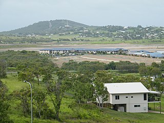
Keppel Sands is a coastal rural town and locality in the Livingstone Shire, Queensland, Australia. In the 2016 census, Keppel Sands had a population of 360 people.

Zilzie Suburb of Shire of Livingstone, Queensland, Australia

Zilzie is a coastal locality in the Livingstone Shire, Queensland, Australia. In the 2016 census, Zilzie had a population of 2,713 people.

Cooee Bay Suburb of Shire of Livingstone, Queensland, Australia

Cooee Bay is a coastal locality in the Livingstone Shire, Queensland, Australia. In the 2016 census Cooee Bay had a population of 913 people.

Ross Creek (Central Queensland) Region in Queensland, Australia

Ross Creek is the main ocean tributary of Yeppoon, Queensland, on the Capricorn Coast. Beak Bridge crosses Ross Creek, connecting Yeppoon with Cooee Bay and other southern towns along Scenic Highway 10.

Taranganba is a town and locality on the tropical Central Queensland coast in Australia. It is within the local government area of Shire of Livingstone.

Mount Chalmers, Queensland Town in Queensland, Australia

Mount Chalmers is a rural town and locality in the Livingstone Shire, Queensland, Australia. In the 2016 census, the locality of Mount Chalmers had a population of 235 people.

Cawarral Town in Queensland, Australia

Cawarral is a rural town and locality in the Livingstone Shire, Queensland, Australia. In the 2016 census the locality of Cawarral had a population of 831 people.

Adelaide Park is a rural locality in the Livingstone Shire, Queensland, Australia. In the 2016 census, Adelaide Park had a population of 424 people.

Barmaryee is a rural locality in the Livingstone Shire, Queensland, Australia. In the 2016 census Barmaryee had a population of 878 people.

Rosslyn, Queensland Town in Queensland, Australia

Rosslyn is a coastal town and locality in the Livingstone Shire, Queensland, Australia. In the 2016 census, the locality of Rosslyn had a population of 574 people.

Farnborough is a coastal rural locality in the Livingstone Shire, Queensland, Australia. In the 2016 census Farnborough had a population of 476 people.

The Scenic Highway is a coastal highway from Yeppoon to Emu Park, both on the Capricorn Coast in the Shire of Livingstone, Queensland, Australia.

Pacific Heights is a semi-rural locality in the Livingstone Shire, Queensland, Australia. In the 2016 census, Pacific Heights had a population of 926 people.

Norman Gardens, Queensland Suburb of Rockhampton, Queensland, Australia

Norman Gardens is a suburb in the Rockhampton Region, Queensland, Australia. In the 2016 census Norman Gardens had a population of 9,944 people.

Thompson Point, Queensland Suburb of Livingstone Shire, Queensland, Australia

Thompson Point is a coastal locality in the Livingstone Shire, Queensland, Australia. In the 2016 census Thompson Point had a population of 10 people. It was the site of a short-lived town and port called Broadmount.

References

  1. 1 2 3 Australian Bureau of Statistics (27 June 2017). "Lammermoor (SSC)". 2016 Census QuickStats. Retrieved 20 October 2018. OOjs UI icon edit-ltr-progressive.svg
  2. "Lammermoor – locality in Livingstone Shire (entry 48725)". Queensland Place Names. Queensland Government . Retrieved 20 July 2021.
  3. 1 2 3 "Queensland Globe". State of Queensland . Retrieved 22 December 2021.
  4. "Mountain ranges beaches and sea passages - Queensland". Queensland Open Data. Queensland Government. 12 November 2020. Archived from the original on 25 November 2020. Retrieved 25 November 2020.
  5. "Lammermoor Beach – beach in Livingstone Shire (entry 18890)". Queensland Place Names. Queensland Government . Retrieved 20 July 2021.
  6. "Statue Rock – rock in Livingstone Shire (entry 32301)". Queensland Place Names. Queensland Government . Retrieved 20 July 2021.
  7. "Bays - Queensland". Queensland Open Data. Queensland Government. 12 November 2020. Archived from the original on 25 November 2020. Retrieved 25 November 2020.
  8. Queensland Family History Society (2010), Queensland schools past and present (Version 1.01 ed.), Queensland Family History Society, ISBN   978-1-921171-26-0
  9. "State and non-state school details". Queensland Government. 9 July 2018. Archived from the original on 21 November 2018. Retrieved 21 November 2018.
  10. "Sacred Heart Catholic Primary School". Archived from the original on 31 October 2018. Retrieved 21 November 2018.
  11. "ACARA School Profile 2018". Australian Curriculum, Assessment and Reporting Authority. Archived from the original on 27 August 2020. Retrieved 28 January 2020.