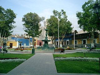
The General Sánchez Cerro Province is the smallest of three provinces in the Moquegua Region of Peru. The capital of the province is Omate. The province was named after the former Peruvian army officer and president Luis Miguel Sánchez Cerro.

The Mariscal Nieto Province is the largest of three provinces that make up the Moquegua Region of Peru. The capital of the province is the city of Moquegua.

Chuquiananta is a mountain in the Andes of southern Peru, about 5,300 metres (17,388 ft) high. It is situated in the Moquegua Region, Mariscal Nieto Province, Torata District, and in the Tacna Region, Candarave Province, Camilaca District. Chuquiananta lies south-west of Tutupaca volcano, south-east of Pomani.

Pomani is a mountain in the Andes of southern Peru, about 5,300 metres (17,388 ft) high. It is situated in the Moquegua Region, Mariscal Nieto Province, Torata District. Pomani lies south-west of the volcano Tutupaca and north-west of the mountain Chuquiananta. The Asana River originates near the mountain.

Humajalso is a mountain in the Andes of southern Peru, about 5,000 m (16,000 ft) high. It is located in the Moquegua Region, Mariscal Nieto Province, Carumas District.

Millu is a mountain in the Andes of southern Peru, about 5,000 metres (16,404 ft) high. It is situated in the Moquegua Region, Mariscal Nieto Province, Carumas District. Millu lies south of the mountain Uma Jalsu.

Wawa Chaki is a mountain in the Andes of southern Peru, about 5,000 metres (16,404 ft) high. It is situated in the Moquegua Region, Mariscal Nieto Province, Carumas District. Wawa Chaki lies southwest of the mountains Uma Jalsu and Millu.

Arichua is a mountain in the Andes of southern Peru, about 4,800 metres (15,748 ft) high. It is situated in the Moquegua Region, Mariscal Nieto Province, Carumas District, and in the Tacna Region, Candarave Province, Candarave District. Arichua lies southwest of the mountain Huarintapaña.

Titini is a mountain in the Andes of southern Peru, about 4,800 metres (15,748 ft) high. It is located in the Moquegua Region, Mariscal Nieto Province, Carumas District, and in the Tacna Region, Candarave Province, Candarave District. Titini is situated south of the mountains Warintapani, Arichuwa, Puma and Misa Qalani which all lie on the border of the two regions.

Huañuma is a mountain in the Andes of southern Peru, about 5,200 metres (17,060 ft) high. It is located in the Moquegua Region, Mariscal Nieto Province, Torata District, and in the Tacna Region, Candarave Province, Camilaca District. Huañuma lies south of Limani, Apacheta Limani and Tutupaca, west of the Tutupaca volcano, north of Chuquiananta and northeast of Pomani.

Tutupaca is a mountain in the Andes of southern Peru, about 5,200 metres (17,060 ft) high. It is located in the Moquegua Region, Mariscal Nieto Province, Torata District, and in the Tacna Region, Candarave Province, Camilaca District. Tutupaca is situated southeast of the mountains Limani and Apachita Limani, west of Tutupaca volcano, north of Chuqi Ananta and Wañuma, and northeast of Pumani. The Asana River originates near Tutupaca. It flows to the southwest.

Pinkilluni is a mountain in the Peruvian Andes, about 5,000 metres (16,404 ft) high. It is located in the Moquegua Region, Mariscal Nieto Province, Carumas District, and in the Puno Region, Puno Province, Pichacani District. Pinkilluni lies northwest of the mountain Q'iwiri.

Arichuwa is a mountain in the Andes of southern Peru, about 5,000 metres (16,404 ft) high. It is situated in the Moquegua Region, Mariscal Nieto Province, Carumas District. Arichuwa lies north of the lake Aqhuyach'alla, southwest of the mountains Wilaquta, Qurini and Qhini Jamach'ini, and west of Qina Mich'ini.

Kunturini is a mountain in the Peruvian Andes, about 4,600 metres (15,092 ft) high. Kunturini is located in the Moquegua Region, on the border of the General Sánchez Cerro Province, Chojata District, and the Mariscal Nieto Province, Carumas District, and in the Puno Region, Puno Province, Pichacani District. It lies southwest of the lake Pharaquta.

Achucallani is a mountain in the Andes of southern Peru, about 5,000 metres (16,404 ft) high. It is situated in the Moquegua Region, Mariscal Nieto Province, Torata District. Achucallani lies southwest of Humajalso, Iruma and Surehuayco.

Chinchillani is a mountain in the Andes of southern Peru, about 4,800 m (15,700 ft) high. It is situated in the Moquegua Region, Mariscal Nieto Province, Torata District, and in the Tacna Region, Candarave Province, Camilaca District. Chinchillani lies southwest of Chuquiananta.

Jach'a Sirka is a mountain in the Andes of southern Peru, about 5,000 metres (16,404 ft) high. It is located in the Moquegua Region, Mariscal Nieto Province, Carumas District. Jach'a Sirka lies northeast of Chiñi Lakha and southeast of Tixani.

Chiñi Lakha is a mountain in the Andes of southern Peru, about 5,000 metres (16,404 ft) high. It is located in the Moquegua Region, Mariscal Nieto Province, Carumas District. Chiñi Lakha lies southwest of Jach'a Sirka and southeast of Tixani.

Sirka Sirka is a mountain in the Peruvian Andes, about 5,200 m (17,100 ft) high. It is located in the Moquegua Region, Mariscal Nieto Province, Carumas District, and in the Puno Region, Puno Province, Acora District. It lies southeast of Q'iwiri.


