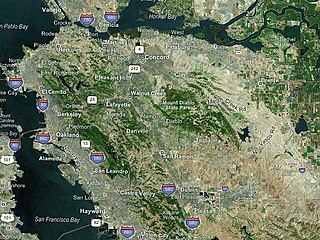
Contra Costa County is a county located in the U.S. state of California, in the East Bay of the San Francisco Bay Area. As of the 2020 United States Census, the population was 1,165,927. The county seat is Martinez. It occupies the northern portion of the East Bay region of the San Francisco Bay Area and is primarily suburban. The county's name refers to its position on the other side of the bay from San Francisco. Contra Costa County is included in the San Francisco–Oakland–Berkeley, CA Metropolitan Statistical Area.

Concord is the most populous city in Contra Costa County, California, United States. According to an estimate completed by the United States Census Bureau, the city had a population of 129,295 in 2019, making it the eighth largest city in the San Francisco Bay Area. Founded in 1869 as Todos Santos by don Salvio Pacheco II, a noted Californio ranchero, the name was later changed to Concord. The city is a major regional suburban East Bay center within the San Francisco Bay Area, and is 29 miles east of San Francisco.

Walnut Creek is a city in Contra Costa County, California, United States, located in the East Bay region of the San Francisco Bay Area, about 16 miles east of the city of Oakland. Walnut Creek has a total population of 70,127 per the 2020 census, is located at the junction of the highways from Sacramento and San Jose (I-680) and San Francisco/Oakland (SR-24), and is accessible by BART. The city shares its borders with Clayton, Lafayette, Alamo, Pleasant Hill, and Concord.

Interstate 680 (I-680) is a north–south auxiliary Interstate Highway in Northern California. It curves around the eastern cities of the San Francisco Bay Area from San Jose to I-80 at Fairfield, bypassing cities along the eastern shore of San Francisco Bay such as Oakland and Richmond while serving others more inland such as Pleasanton and Concord.

State Route 24 is a heavily traveled east–west state highway in the U.S. state of California that serves the eastern side of the San Francisco Bay Area. A freeway throughout its entire length, it runs from the Interstate 580/Interstate 980 interchange in Oakland, and through the Caldecott Tunnel under the Berkeley Hills, to the Interstate 680 junction in Walnut Creek. It lies in Alameda County, where it is highly urban, and Contra Costa County, where it passes through wooded hillsides and suburbs. SR 24 is a major connection between the San Francisco–Oakland Bay Bridge/MacArthur Maze complex and the inland cities of the East Bay.

U.S. Route 72 (US 72) is an east–west United States highway that travels for 317.811 miles (511.467 km) from southwestern Tennessee, throughout North Mississippi, North Alabama, and southeastern Tennessee. The highway's western terminus is in Memphis, Tennessee and its eastern terminus is in Chattanooga. It is the only U.S. Highway to begin and end in the same state, yet pass through other states in between. Prior to the U.S. Highway system signage being posted in 1926, the entire route was part of the Lee Highway.
The State Scenic Highway System in the U.S. state of California is a list of highways, mainly state highways, that have been designated by the California Department of Transportation (Caltrans) as scenic highways. They are marked by the state flower, a California poppy, inside either a rectangle for state-maintained highways or a pentagon for county highways.
Lamorinda is an area within Contra Costa County, California in the United States. The name is a portmanteau from the names of the three cities that make up the region: Lafayette, Moraga and Orinda.

State Route 4 is a state highway in the U.S. state of California, routed from Interstate 80 in the San Francisco Bay Area to State Route 89 in the Sierra Nevada. It roughly parallels the Sacramento-San Joaquin River Delta, a popular area for boating and fishing, with a number of accesses to marinas and other attractions. After crossing the Central Valley, the highway ascends up the Sierra foothills. It passes through Ebbetts Pass and contains the Ebbetts Pass Scenic Byway, a National Scenic Byway.

State Route 242 is a three-mile (5 km) state highway in the U.S. state of California that links Interstate 680 north of Pleasant Hill to State Route 4 in Concord in Contra Costa County. Along with Interstate 580, State Route 24, Interstate 680 and State Route 4, it serves as the most direct route between the San Francisco Bay Area and the Sacramento–San Joaquin River Delta region.

U.S. Route 460 (US 460) in Virginia runs west-east through the southern part of the Commonwealth. The road has two separate pieces in Virginia, joined by a relatively short section in West Virginia. Most of US 460 is a four-lane divided highway and is a major artery in the southern third of the state. From Petersburg to Suffolk, US 460 is a four-lane non-divided highway. It is a popular alternative to Interstate 64 (I-64) when going from Richmond and other points in central Virginia to the Currituck Sound and Outer Banks of North Carolina, avoiding the congestion and tunnels of the more northerly I-64 corridor. The road passes through several small towns that built up at stops along the railroad line.
Mount Diablo Unified School District (MDUSD) is a public school district in Contra Costa County, California. It currently operates 29 elementary schools, 9 middle schools, and 5 high schools, with 7 alternative school programs and an adult education program. MDUSD is one of the largest school districts in the state of California, with over 56 school sites and a budget of approximately $270,000,000. The district has over 36,000 K-12 students, over 20,000 adult education students, and over 3,500 employees, including over 2,000 certificated educators. The district covers 150 square miles (390 km2), including the cities of Concord and Clayton; as well as most of Pleasant Hill and portions of Walnut Creek, Pittsburg, Lafayette, and Martinez; and unincorporated areas, including Pacheco, Clyde, and Bay Point.

State Route 96 (SR 96) is a 94.9-mile-long (152.7 km) state highway that travels west-to-east through portions of Talbot, Taylor, Crawford, Peach, Houston, Twiggs, and Wilkinson counties in the west-central and central parts of the U.S. state of Georgia. The highway travels from its western terminus at US 80/SR 22/SR 41/SR 540 in Geneva to its eastern terminus at US 441/SR 29 south-southeast of Irwinton.

U.S. Highway 23 (US 23) in the U.S. state of Georgia is a north–south United States Numbered Highway that travels from the St. Marys River south-southeast of Folkston to the North Carolina state line, in the northern part of Dillard. At nearly 392 miles (631 km) in length, it is the longest U.S. Highway in Georgia.
There are 45 routes assigned to the "J" zone of the California Route Marker Program, which designates county routes in California. The "J" zone includes county highways in Alameda, Calaveras, Contra Costa, Fresno, Kern, Inyo, Mariposa, Merced, Sacramento, San Benito, San Joaquin, Stanislaus, and Tulare counties.

The Walnut Creek mainstem is a 12.3-mile-long (19.8-kilometer) northward-flowing stream in northern California. The Walnut Creek watershed lies in central Contra Costa County, California and drains the west side of Mount Diablo and the east side of the East Bay Hills. The Walnut Creek mainstem is now mostly a concrete or earthen flood control channel until it reaches Pacheco Creek on its way to Suisun Bay. Walnut Creek was named for the abundant native Northern California walnut trees which lined its banks historically. The city of Walnut Creek, California was named for the creek when its post office was established in the 1860s.


