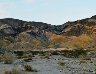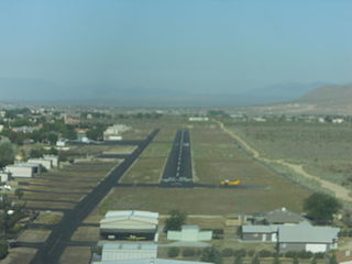
Seeley is a census-designated place (CDP) in Imperial County, California. Seeley is located 7.5 miles (12 km) west of El Centro. The population was 1,823 at the 2010 census, up from 1,624 in 2000. It is part of the El Centro Metropolitan Area.

Antelope Valley California Poppy Reserve is a state-protected reserve of California, United States, harboring the most consistent blooms of California poppies, the state flower. The reserve is located in the rural west side of Antelope Valley in northern Los Angeles County, 15 miles (24 km) west of Lancaster. To the north is Kern County. The reserve is at an elevation ranging from 2,600 to 3,000 feet above sea level, in the Mojave Desert climate zone. The reserve is administered by the California Department of Parks and Recreation. Other wildflowers within the reserve include the Owl's Clover, Lupine, Goldfields, Cream Cups and Coreopsis.

The Pit River is a major river draining from northeastern California into the state's Central Valley. The Pit, the Klamath and the Columbia are the only three rivers in the U.S. that cross the Cascade Range.

Tehachapi Pass is a mountain pass crossing the Tehachapi Mountains in Kern County, California. Traditionally, the pass marks the northeast end of the Tehachapis and the south end of the Sierra Nevada range.

The Jacumba Mountains are a mountain range of the Peninsular Ranges system, located in eastern San Diego County, Southern California, near the U.S. border with Mexico.

The Vallecito Mountains are located in the Colorado Desert, in eastern San Diego County, Southern California. They are about 28 miles (45 km) north of the U.S. border with Mexico.

Telescope Peak is the highest point within Death Valley National Park, in the U.S. state of California. It is also the highest point of the Panamint Range, and lies in Inyo County. From atop this desert mountain one can see for over one hundred miles in many directions, including west to Mount Whitney, and east to Charleston Peak. The mountain was named for the great distance visible from the summit.

The Twin Buttes are two volcanic cinder cones located in the Cascade Mountain Range in Shasta County, California. They are part of the Bidwell Spring chain and lie within a region that was active in the Quaternary. Formed during the Pleistocene between 25,000 and 15,000 years ago, the volcanoes erupted lava flows that coursed toward the Burney Mountain lava dome. These lava flows cover an area of 3.9 square miles (10.1 km2) and are made of basalt and dacite. The volcanoes also erupted cinder and volcanic ash that reached eastward.

Snake River Valley is Idaho's first American Viticultural Area (AVA) that encompasses an area in southwestern Idaho and two counties in eastern Oregon. The area was established on April 9, 2007 by the Alcohol and Tobacco Tax and Trade Bureau (TTB), Treasury after reviewing the petition submitted by Idahoan vintners of the Snake River Valley, the Idaho Grape Growers and Wine Producers Commission, and the Idaho Department of Commerce and Labor, collectively acting as “petitioner” to establish the 8,263 square miles viticultural area named "Snake River Valley." For wines to bear the "Snake River Valley" label, at least 85% of the grapes used for production must be grown in the designated area, which includes the southwestern Idaho counties of Ada, Adams, Boise, Canyon, Elmore, Gem, Gooding, Jerome, Owyhee, Payette, Twin Falls, and Washington, and the Eastern Oregon counties of Malheur and Baker. The appellation, when established, was resident to 15 wineries and 46 vineyards with 1,800 acres (728 ha) under vine.

The Snow Mountain Wilderness is a 60,076-acre (243.12 km2) federally designated wilderness area located 65 miles (105 km) north of Santa Rosa, California, USA in the Mendocino National Forest. The U.S. Congress passed the California Wilderness Act of 1984 which created 23 new wilderness areas including Snow Mountain. It lies within the North Coast Range of mountains.

South Lake is an unincorporated community in the Kern River Valley, in Kern County, California. It is located 4.5 miles (7.2 km) west-southwest of Weldon, at an elevation of 2,887 feet (880 m).
The Piper Mountain Wilderness is a federally designated wilderness area located in the White Mountains 20 miles (32 km) northeast of Big Pine, California in Inyo County, California.

The Coyote Mountains are a small mountain range in San Diego and Imperial Counties in southern California. The Coyotes form a narrow ESE trending 2 mi (3.2 km) wide range with a length of about 12 mi (19 km). The southeast end turns and forms a 2 mi (3.2 km) north trending "hook". The highest point is Carrizo Mountain on the northeast end with an elevation of 2,408 feet (734 m). Mine Peak at the northwest end of the range has an elevation of 1,850 ft (560 m). Coyote Wash along I-8 along the southeast margin of the range is 100 to 300 feet in elevation. Plaster City lies in the Yuha Desert about 5.5 mi (8.9 km) east of the east end of the range.

Coyote Wells is an unincorporated community in Imperial County, California. It is located on the San Diego and Arizona Eastern Railway 24 miles (39 km) west of El Centro, at an elevation of 299 feet.

The Puerco River or Rio Puerco is a tributary of the Little Colorado River in northwestern New Mexico and northeastern Arizona. It flows through arid terrain, including the Painted Desert.

Rosamond Skypark is a residential airpark and public-use airport located three nautical miles (6 km) west of the central business district of Rosamond, in Kern County, California, United States. It is privately owned by the Rosamond Skypark Association.
Roy Williams Airport is a privately owned public-use airport located three nautical miles (6 km) northeast of the central business district of Joshua Tree, in San Bernardino County, California, United States.
The Dry River is an intermittent tributary, 88 miles (142 km) long, of the Crooked River in the U.S. state of Oregon. The stream arises near Hampton Buttes north of Hampton and U.S. Route 20 between Brothers and Riley in the Oregon High Desert. Beginning in eastern Deschutes County near its border with Crook County, it flows generally northwest along the Deschutes–Crook county line, crossing briefly into Crook County before turning slightly south and returning to Deschutes County. Along these upper reaches, it flows roughly parallel to the highway, under which it passes several times before turning sharply north near the Horse Ridge Research Natural Area, 19 miles (31 km) southeast of Bend. Continuing north and re-entering Crook County, it passes under Powell Butte Highway, Oregon Route 126, and Oregon Route 370 before entering the Crooked River 34 miles (55 km) from the larger stream's confluence with the Deschutes River.

Missouri Buttes or Little Missouri Buttes are located in Crook County in northeast Wyoming on the northwest flank of the Black Hills Uplift. The buttes are 3.5 miles (5.6 km) northwest (N60°W) of Devils Tower between the Little Missouri and the Belle Fourche rivers.
Lanfair Buttes, also known as Eagle Mountain, Indian Hill, Eagle Hill, Graveyard Hills is a summit in the Mojave National Preserve in the Mojave Desert in San Bernardino County, California. The Lanfair Buttes lie 3 miles (4.8 km) east-southeast of the Grotto Hills and 8 miles (13 km) north-northeast of Hackberry Mountain in Lanfair Valley. The tallest and northernmost elevation in the Lanfair Buttes is Eagle Mountain at 1338 feet. The southernmost elevation is Indian Hill, at 35°08′36.71″N115°09′15.34″W at an elevation of 1281 feet. Indian Well, an old well is found west of the Buttes at 35°08′43″N115°09′32″W, and petroglyphs are found nearby on the slope of the Buttes to the east. Indian Well petroglyphs indicate it was a Native American water source and camping site in previous centuries. Indian Well was also located along the route of the Mohave Trail.


