
State Route 86 is a north–south state highway in the U.S. State of California that connects the Imperial and Coachella valleys in the southeastern desert region of the state. It runs from State Route 111 near the Mexican border crossing at Calexico north through the Imperial Valley via El Centro and Brawley, and around the west side of the Salton Sea into the Coachella Valley. It then goes through Coachella before terminating at Interstate 10 in Indio.
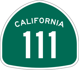
State Route 111 is a state highway in the southeastern part of U.S. state of California. It is a north-south route serving the Imperial Valley, the eastern shore of the Salton Sea, and the Coachella Valley. Its southern terminus is at Imperial Avenue and 1st Street in Calexico, at the former entrance to the Calexico West Port of Entry. SR 111's northern terminus is at Interstate 10 at the northwestern corner of the Palm Springs city limits, near the unincorporated community of Whitewater.

State Route 118 is a state highway in the U.S. state of California that runs west to east through Ventura and Los Angeles counties. It travels from State Route 126 at the eastern edge of Ventura immediately northwest of Saticoy, then through Saticoy, in Ventura County east to Interstate 210 near Lake View Terrace in Los Angeles. SR 118 crosses the Santa Susana Pass and the northern rim of the San Fernando Valley along its route.
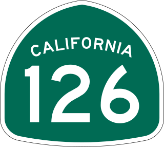
State Route 126 is a state highway in the U.S. state of California that serves Ventura and Los Angeles counties. The route runs from U.S. Route 101 in Ventura to Interstate 5 at the Castaic Junction-Santa Clarita border through the Santa Clara River Valley. The highway is an important connector highway in Ventura County, and serves as an alternate route into the Santa Clarita Valley, and the San Fernando Valley area of Los Angeles and the High Desert of Antelope Valley.

State Route 23 is a state highway in the U.S. state of California that connects the Pacific coast and the Santa Monica Mountains to the Conejo and Santa Clara River valleys. It runs from Pacific Coast Highway in Malibu in Los Angeles County to Ventura Street in Fillmore in Ventura County.
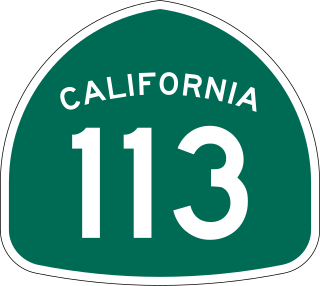
State Route 113 is a north–south state highway in the U.S. state of California that runs from around 10 miles (16 km) in the Sacramento Valley west of Rio Vista at State Route 12 to State Route 99 in Tudor. It serves as one of two important connecting routes between Interstate 80 and Interstate 5, bypassing Sacramento to the east; the other being Interstate 505 to the west. Past the southern terminus are Collinsville and Birds Landing around the Suisun Bay marshes. Cities along the route include Dixon, Davis, and Woodland. It also shares a stretch of Interstate 80 between just outside UC Davis and Dixon. The section running from Dixon to Woodland is a controlled-access freeway; the remainder is a standard road of two to four lanes. The freeway section spanning from the I-80 interchange in Davis to Woodland is called the Vic Fazio Highway, after the former U.S. House representative of the Davis area, who is credited with obtaining the funding for the freeway upgrade of that section.

State Route 35, generally known as Skyline Boulevard for most of its length, is a mostly two-lane state highway in the U.S. state of California. It runs along the ridge of the Santa Cruz Mountains from the high point of State Route 17 near Lexington Reservoir in Santa Clara County to State Route 1 just south of Daly City in San Mateo County, where it crosses SR 1 and loops around Lake Merced to become Sloat Boulevard in San Francisco. SR 35 then continues along Sloat Boulevard until it reaches its terminus when it meets SR 1 again at 19th Avenue.

State Route 3 is a state highway in the U.S. state of California that serves Trinity and Siskiyou counties. It runs from SR 36 north along the shore of Trinity Lake, Fort Jones and Etna. The route then approaches Yreka, intersecting with Interstate 5 (I-5), and turns east to Montague. The road was numbered SR 3 in 1964, and most of it has been part of the state highway system since 1933.

State Route 299 is an east–west state highway in the U.S. state of California that runs across the northern part of the state. At 305.777 miles (492.100 km), it is the third longest California state route, after Route 1 and Route 99, and the longest east-west route. Route 299's western terminus is at US 101 at the northern edge of Arcata, and its eastern terminus is at the Nevada state line at a point east of Cedarville. Between Arcata and Redding, Route 299 intersects with State Route 96, and is briefly co-signed with State Route 3. In Redding, it intersects with State Route 273, State Route 44, and Interstate 5. East of Redding, it intersects with State Route 89, and a section is co-signed with State Route 139 before reaching Alturas. It is then co-signed with U.S. Route 395 northeast of Alturas, and then runs east through Cedarville and to the border with Nevada. A ghost town, Vya, Nevada, can be reached via this route, which after the border becomes a dirt road, which was formerly Nevada State Route 8A. The segment of SR 299 between Arcata and Redding is the Trinity Scenic Byway, a National Forest Scenic Byway.

State Route 173 is a state highway in the U.S. state of California that runs entirely in San Bernardino County, mostly in the San Bernardino National Forest. Its west end is at State Route 138 near the west end of Silverwood Lake in the Summit Valley south of Hesperia. Its east end is at State Route 18 south of Lake Arrowhead. The route starts at the Mojave River Forks, skims the easterly and southerly sides of Lake Arrowhead and meets State Route 189, Lake's Edge Road, at the south entrance to the Lake Arrowhead Village.

State Route 66 is a state highway in the U.S. state of California that runs along a section of old U.S. Route 66 in Los Angeles and San Bernardino counties. It goes from State Route 210 in La Verne east to Interstate 215 in San Bernardino, passing through Claremont, Upland, Rancho Cucamonga, Fontana and Rialto along Foothill Boulevard. In San Bernardino, it is the part of Fifth Street west of H Street.

State Route 7 is a state highway in the U.S. state of California, running from the Calexico East Port of Entry on the U.S.-Mexico border east of Calexico north to its terminus at Interstate 8 (I-8), where Orchard Road continues the route north towards Holtville. The route provides convenient access to the country of Mexico from I-8. The southern portion of the route opened in 1996, and the rest of the route connecting to I-8 opened in 2005.

State Route 36 is an east–west state highway in the U.S. state of California that is routed from U.S. Route 101 in Humboldt County to U.S. Route 395 just east of Susanville in Lassen County. The highway passes through Red Bluff, the county seat of Tehama County, on the northern edge of the Sacramento Valley. The portion of SR 36 travelling past Lassen Volcanic National Park and Lake Almanor is part of the Volcanic Legacy Scenic Byway, a National Scenic Byway. Also, Route 36 between Alton and Susanville is a designated Blue Star Memorial Highway.

State Route 132 is a state highway in the U.S. state of California that connects the Central Valley with the Sierra Nevada foothills and the California Gold Country. Its western segment also connects the city of Modesto with the San Francisco Bay Area via I-580, although this route is discouraged due to it being a two-lane road between Modesto and Interstate 5. East of Modesto, the road climbs the foothills and eventually ends at SR 49 at Coulterville.

State Route 177 is a state highway in the U.S. state of California in Riverside County. The route runs along Rice Road, linking Interstate 10 (I-10) midway between the Coachella Valley and Blythe on the California–Arizona border, to SR 62 near Rice. SR 177 travels along the eastern portion of the Joshua Tree National Park; like the eastern 100 miles (160 km) of SR 62, it passes through some of the most desolate areas of the Mojave Desert.

State Route 63 is a north–south state highway in the U.S. state of California in the Central Valley. It begins from near Tulare at Route 137, runs north through the city of Visalia and the towns of Cutler and Orosi, before ending 8 miles (13 km) north of Orange Cove, where it reaches its northern terminus at Route 180, roughly 2 and 1/2 miles southwest of the town of Yokuts Valley. State Route 63 runs concurrent with Route 198 within Visalia.

State Route 195 was a state highway in the U.S. state of California, branching westward from SR 111 to SR 86 near the town of Mecca and the Salton Sea. The route formerly extended east to Interstate 10 (I-10) near Joshua Tree National Park as a longer route extending to Blythe and points further east. After the main route was shifted north, the older route remained as an alternate known as Box Canyon Road. The route was designated in the 1964 state highway renumbering, although the Box Canyon Road portion was removed as a state highway in 1972. Following the construction of the SR 86 expressway, SR 195 was curtailed in 2009, and removed entirely in 2014.

State Route 115 is a state highway in the U.S. state of California. It runs in Imperial County from Interstate 8 (I-8) southeast of Holtville to SR 111 in Calipatria. The routing was added to the state highway system in 1933, and was constructed by 1934; SR 115 was officially designated in the 1964 state highway renumbering.

State Route 128 is a state highway in the U.S. state of California, connecting the Mendocino coast to the Sacramento Valley, through the state's Wine Country. It runs from State Route 1 near Albion to Interstate 505 in Winters.
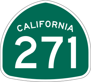
State Route 271 is a state highway in the U.S. state of California that runs along a former routing of U.S. Route 101 in Mendocino and Humboldt counties. It also connects with State Route 1 just before that route's terminus with US 101 in Leggett. After US 101 was realigned, SR 271 was reduced to being a frontage road in discontinuous segments. While US 101 stays mostly in second growth redwoods, SR 271 is used as a scenic alternate through several old growth redwood groves.

